Category:English-language SVG maps of Asia
Jump to navigation
Jump to search
Subcategories
This category has only the following subcategory.
E
Media in category "English-language SVG maps of Asia"
The following 120 files are in this category, out of 120 total.
-
2019 Lok Sabha Election Schedule.svg 1,350 × 1,545; 8.16 MB
-
9호선.svg 1,500 × 1,100; 296 KB
-
Abundance of Hilsa Fish in Bangladesh.svg 1,050 × 1,200; 1.76 MB
-
Afghanistan - Location Map (2013) - AFG - UNOCHA.svg 254 × 254; 656 KB
-
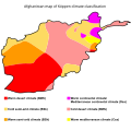
Afghanistan map of Köppen climate classification.svg 1,900 × 1,900; 155 KB
-
Al Anbar-English.svg 656 × 552; 18 KB
-
Allon Plan.svg 732 × 1,051; 209 KB
-
Armenia map of Köppen climate classification.svg 1,900 × 1,900; 89 KB
-
Asia (2020 update).svg 506 × 670; 758 KB
-
Asia.svg 506 × 670; 679 KB
-
Assyrian genocide map.svg 1,062 × 806; 83 KB
-
Assyrian population 1914.svg 1,062 × 806; 42 KB
-
Atomic bomb 1945 mission map.svg 1,919 × 2,525; 392 KB
-
Attack on Ayutthaya (1549).svg 1,107 × 883; 224 KB
-
Austroasiatic-en.svg 540 × 615; 314 KB
-
Austroasiatickhmermap2.svg 540 × 615; 322 KB
-
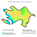
Azerbaijan map of Köppen climate classification.svg 1,900 × 1,900; 115 KB
-
Azerbaijan map Sumqayit-en.svg 577 × 389; 57 KB
-
Bangladesh map of Köppen climate classification.svg 1,900 × 1,900; 123 KB
-
Bangladeshi Muslims map.svg 755 × 927; 4.51 MB
-
Banlamgu.svg 1,550 × 1,800; 32 KB
-
Bhutan map of Köppen climate classification.svg 1,900 × 1,900; 135 KB
-
Burmese-Siamese War of 1548-49.svg 1,000 × 931; 349 KB
-
Cambodia map of Köppen climate classification.svg 1,900 × 1,900; 58 KB
-
Caucasus topographic map with border colors-en.svg 1,155 × 898; 5.55 MB
-
Caucasus topographic map-en.svg 1,155 × 898; 5.56 MB
-
Caucasus-ethnic en.svg 977 × 1,111; 327 KB
-
Caucasus-political en.svg 512 × 485; 484 KB
-
Central Asia map of Köppen climate classification.svg 1,900 × 1,583; 361 KB
-
China map of Köppen climate classification.svg 1,900 × 1,900; 787 KB
-
Democratic Republic of Georgia (en).svg 1,724 × 1,198; 928 KB
-
Distribution of immigrants by regions of Georgia.svg 770 × 480; 720 KB
-
Districts of damascus english.svg 500 × 383; 380 KB
-
Dubai map Dubai Metro.svg 1,559 × 741; 308 KB
-
East Asia map of Köppen climate classification.svg 1,900 × 1,900; 779 KB
-
Ethnolinguistic Groups Afghanistan EN.svg 786 × 858; 260 KB
-
Ethnolinguistic map of Burma 1972 en.svg 1,063 × 2,037; 70 KB
-
Gaza Strip map2.svg 725 × 888; 211 KB
-
GE-AB-gagra-en.svg 550 × 450; 582 KB
-
GE-AB-sokhumi-en.svg 550 × 450; 582 KB
-
Geographical units of Indonesia-EN.svg 1,875 × 750; 588 KB
-
Georgia map of Köppen climate classification.svg 1,900 × 1,130; 109 KB
-
Georgia regions map.svg 744 × 1,052; 234 KB
-
Georgia, Ossetia, Russia and Abkhazia (en).svg 676 × 400; 114 KB
-
Georgian Railway Network.svg 1,715 × 913; 331 KB
-
Greater Mongolia.svg 800 × 571; 76 KB
-
Guangzhou Shenzhen Hongkong Express Rail Link en.svg 890 × 850; 706 KB
-
Hmong-Mien-en.svg 900 × 800; 287 KB
-
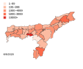
India Assam COVID-19 Death map.svg 765 × 633; 769 KB
-
India Assam COVID-19 map.svg 765 × 633; 776 KB
-
India climatic zone map en.svg 1,639 × 1,852; 354 KB
-
India map of Köppen climate classification.svg 2,760 × 1,630; 498 KB
-
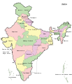
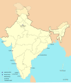
India-map-en.svg 1,519 × 1,773; 303 KB
-
Indonesia Ethnic Groups Map English.svg 512 × 215; 6.74 MB
-
Indonesia map of Köppen climate classification.svg 1,900 × 910; 324 KB
-
Indus River basin map.svg 603 × 472; 17.76 MB
-
Indus river.svg 2,309 × 2,495; 172 KB
-
Iran map of Köppen climate classification.svg 500 × 500; 352 KB
-
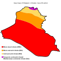
Iraq map of Köppen climate classification.svg 1,900 × 1,900; 111 KB
-
Iraqi Governorates.svg 1,241 × 1,264; 313 KB
-
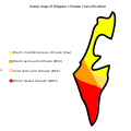
Israel map of Köppen climate classification.svg 1,900 × 1,900; 26 KB
-
Jade gisements.svg 2,282 × 1,507; 112 KB
-
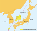
Japan Korea provisional zone E.svg 386 × 322; 168 KB
-
Japan map of Köppen climate classification.svg 1,900 × 1,900; 192 KB
-
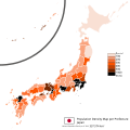
Japan Population density map.svg 1,024 × 1,024; 54 KB
-
Japanese House of Representatives Proportional Representation Blocks.svg 1,400 × 1,600; 778 KB
-
Jordan map of Köppen climate classification.svg 1,900 × 1,900; 93 KB
-
Karnataka 1956 Reorg.svg 693 × 748; 712 KB
-
Kartvelian languages cy.svg 790 × 550; 3.99 MB
-
Kartvelian languages.svg 790 × 550; 3.92 MB
-
Kazakhstan map of Köppen climate classification hu.svg 1,900 × 1,900; 117 KB
-
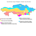
Kazakhstan map of Köppen climate classification.svg 1,900 × 1,900; 232 KB
-
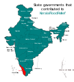
Kerala Flood Relief States.svg 1,594 × 1,772; 310 KB
-
Kyrgyzstan map of Köppen climate classification.svg 1,900 × 1,270; 176 KB
-
Köppen climate classification map of Georgia.svg 1,716 × 913; 182 KB
-
Laos map of Köppen climate classification.svg 1,900 × 1,900; 86 KB
-
Map of Bangladesh-en.svg 1,678 × 2,074; 3.86 MB
-
Map of sinitic languages cropped-en.svg 410 × 620; 275 KB
-
Map of sinitic languages full-en.svg 2,219 × 1,759; 181 KB
-
Map of sinitic languages-en.svg 410 × 920; 283 KB
-
Map of sinitic languages-io.svg 410 × 920; 275 KB
-
Middle East map of Köppen climate classification.svg 1,900 × 1,900; 456 KB
-
Mongolia map of Köppen climate classification.svg 1,900 × 1,330; 203 KB
-
Municipalities of Georgia by Population’s Predominant Gender (2014).svg 1,500 × 891; 1.27 MB
-
Myanmar (Burma) map of Köppen climate classification.svg 1,900 × 1,900; 161 KB
-
Nagorno-Karabakh war map (2020).svg 667 × 462; 972 KB
-
National Water Carrier of Israel-en.svg 280 × 680; 295 KB
-
Naval bases of India.svg 1,486 × 1,734; 557 KB
-
Nepal map of Köppen climate classification.svg 1,900 × 1,130; 68 KB
-
North Korea map of Köppen climate classification.svg 1,900 × 1,900; 88 KB
-
PAGASA Philippine Area of Responsibility - en.svg 919 × 919; 614 KB
-
PAK AU T1.svg 1,000 × 800; 21 KB
-
Pakistan map of Köppen climate classification.svg 1,900 × 1,900; 328 KB
-
Percentage of ethnic Georgians by municipality.svg 680 × 400; 943 KB
-
Punjab 2012 administrativ.svg 900 × 600; 259 KB
-
Punjab map.svg 955 × 585; 57 KB
-
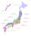
Regions and Prefectures of Japan.svg 2,480 × 3,175; 116 KB
-
ROC Administrative and Claims.svg 754 × 600; 676 KB
-
Sinai Peninsula - en.svg 1,060 × 1,766; 1.89 MB
-
South Korea map of Köppen climate classification.svg 1,900 × 1,900; 136 KB
-
South Korean legislative election 2012 districts(en).svg 592 × 840; 158 KB
-
Southeast Asia map of Köppen climate classification.svg 1,900 × 1,460; 654 KB
-
Syria map of Köppen climate classification.svg 1,900 × 1,762; 88 KB
-
Taiwan ROC political divisions labeled.svg 850 × 1,200; 343 KB
-
Tajikistan map of Köppen climate classification.svg 1,900 × 1,463; 101 KB
-
Total Fertility Rate of Kazakhstan by region - 2010.svg 1,300 × 593; 263 KB
-
Total Fertility Rate of Kazakhstan by region - 2021.svg 1,300 × 593; 263 KB
-
Tsunami map Tohoku2011.svg 1,483 × 942; 121 KB
-
Turkestan 1900-en.svg 643 × 400; 111 KB
-
Turkey Köppen.svg 1,152 × 792; 1.48 MB
-
Turkey map of Köppen climate classification.svg 1,900 × 1,419; 266 KB
-
Turkmenistan map of Köppen climate classification.svg 1,900 × 1,189; 54 KB
-
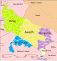
Up-subregions2.svg 2,400 × 2,515; 242 KB
-
UttarakhandDistricts numbered.svg 1,250 × 1,125; 145 KB
-
Uzbekistan map of Köppen climate classification hu.svg 1,900 × 1,148; 89 KB
-
Uzbekistan map of Köppen climate classification.svg 1,900 × 1,148; 152 KB
-
Vietnam map of Köppen climate classification.svg 1,073 × 1,900; 93 KB
-
Zhuhai stadium pedestrian walkway en.svg 512 × 355; 52 KB
-
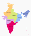
Zonal Councils.svg 1,594 × 1,868; 226 KB


