Category:Endorheic Basins Between Salar de Atacama and Pacific Drainage
Jump to navigation
Jump to search
| Upload media | |||||
| Instance of | |||||
|---|---|---|---|---|---|
| Location | Antofagasta Region, Chile | ||||
| |||||
Subcategories
This category has the following 5 subcategories, out of 5 total.
F
- Frio river (Punta negra) (empty)
L
- Laguna de la Azufrera (1 F)
S
- Salar Aguas Calientes IV (1 F)
- Salar de Imilac (1 F)
- Salar Punta Negra (3 F)
Media in category "Endorheic Basins Between Salar de Atacama and Pacific Drainage"
The following 10 files are in this category, out of 10 total.
-
026-atlasagro.png 490 × 937; 354 KB
-
24°S-MP0001213.pdf 4,454 × 3,229; 1.22 MB
-
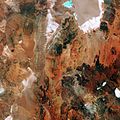
Chile's salt flat ESA360999.jpg 5,000 × 5,000; 27.36 MB
-
Cuenca-026-B.svg 632 × 1,218; 3.88 MB
-
Escondida Copper Mine, Atacama Desert, Chile 2009-12-09 lrg.jpg 1,440 × 960; 344 KB
-
Esquema-mina-escondida.svg 930 × 324; 240 KB
-
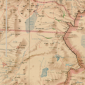
Mapa de Francisco J. San Roman 1892.jpg 2,400 × 3,632; 2.55 MB
-
Mapa-san-roman-MP0002046.pdf 4,316 × 6,402; 9.87 MB
-
Rio-frio-(punta-negra).png 840 × 843; 1.22 MB
-
Txu-oclc-224571178-sf19-15.jpg 5,194 × 4,057; 8.16 MB


