Category:Elmdon
Jump to navigation
Jump to search
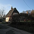
English: Elmdon is a civil parish and village in the Uttlesford district of Essex, England, near the boundary with Cambridgeshire and Hertfordshire. The undulating nature of the local topography differentiates it from countryside to the north which is predominantly fenland and flat. Elmdon parish contains the small village of Duddenhoe End.
village and civil parish in Essex, United Kingdom | |||||
| Upload media | |||||
| Instance of | |||||
|---|---|---|---|---|---|
| Location | Uttlesford, Essex, East of England, England | ||||
| Population |
| ||||
 | |||||
Subcategories
This category has the following 6 subcategories, out of 6 total.
Media in category "Elmdon"
The following 135 files are in this category, out of 135 total.
-
A byway known as Parkhouse Lane - geograph.org.uk - 1420297.jpg 640 × 480; 111 KB
-
A tributary of the Cam - geograph.org.uk - 4290974.jpg 1,024 × 768; 966 KB
-
Across Open Fields - geograph.org.uk - 4503505.jpg 1,024 × 768; 222 KB
-
Across the valley to Elmdon - geograph.org.uk - 4677127.jpg 819 × 1,024; 1.01 MB
-
Across the valley towards New Jersey Farm - geograph.org.uk - 5134426.jpg 768 × 1,024; 1,024 KB
-
Autumn cultivation on the edge of Cambridgeshire - geograph.org.uk - 5906599.jpg 1,024 × 768; 1.02 MB
-
Back in Essex - geograph.org.uk - 6793068.jpg 1,024 × 683; 134 KB
-
Bakers Cottage - geograph.org.uk - 5927340.jpg 1,200 × 900; 332 KB
-
Beard's Lane (Roman Road) - geograph.org.uk - 3424591.jpg 800 × 533; 210 KB
-
Beards Lane - geograph.org.uk - 5523726.jpg 1,024 × 768; 227 KB
-
Blocked field gates on the county boundary - geograph.org.uk - 5134417.jpg 1,024 × 731; 950 KB
-
Bounds Bridge, the B1039 and New Farm - geograph.org.uk - 3889769.jpg 1,200 × 891; 1.28 MB
-
Bridle path by Rockell's Wood - geograph.org.uk - 4054575.jpg 1,600 × 1,064; 527 KB
-
Bridle path near Littlebury Green - geograph.org.uk - 4054511.jpg 1,600 × 1,064; 404 KB
-
Bridleway beside Rockell's Wood - geograph.org.uk - 3428213.jpg 533 × 800; 234 KB
-
Bridleway near Littlebury Green - geograph.org.uk - 3889801.jpg 640 × 480; 225 KB
-
Bridleway through Freewood Farm - geograph.org.uk - 3428035.jpg 800 × 533; 175 KB
-
Bridleway to Littlebury Green - geograph.org.uk - 3423730.jpg 533 × 800; 195 KB
-
Bush Shelter ^ Elmdon Green - geograph.org.uk - 6793744.jpg 1,024 × 683; 146 KB
-
Byway and Free Wood - geograph.org.uk - 6793758.jpg 683 × 1,024; 217 KB
-
Collapsing culvert under farm bridge - geograph.org.uk - 3428184.jpg 800 × 533; 245 KB
-
Combining on the edge of Cambridgeshire - geograph.org.uk - 4156342.jpg 1,024 × 768; 1.11 MB
-
Cottage at Duddenhoe End - geograph.org.uk - 4054635.jpg 1,600 × 1,064; 440 KB
-
Country lane near Elmdon, Essex - geograph.org.uk - 3584344.jpg 640 × 360; 68 KB
-
Countryside near New Farm - geograph.org.uk - 4054528.jpg 1,600 × 1,064; 411 KB
-
Cows at Freewood Farm, Elmdon - geograph.org.uk - 6055195.jpg 4,608 × 3,456; 4.57 MB
-
Dark Lane Panorama - geograph.org.uk - 6792941.jpg 1,024 × 295; 66 KB
-
Dark Lane path - geograph.org.uk - 275666.jpg 640 × 480; 137 KB
-
Direction Sign – Signpost on the village green at Elmdon - geograph.org.uk - 6871989.jpg 1,200 × 1,600; 376 KB
-
Dry fields in early spring - geograph.org.uk - 3889747.jpg 1,200 × 857; 1.37 MB
-
Dry Ford on Dark Lane - geograph.org.uk - 6792937.jpg 1,024 × 683; 296 KB
-
Duddenhoe End Farm - geograph.org.uk - 2484939.jpg 1,024 × 768; 201 KB
-
Duddenhoe Grange - geograph.org.uk - 4069002.jpg 1,600 × 1,200; 591 KB
-
Elmdon Cricket Ground on Christmas morning - geograph.org.uk - 4291614.jpg 1,024 × 732; 1.29 MB
-
Elmdon from Mill Hill - geograph.org.uk - 3427994.jpg 800 × 533; 163 KB
-
Elmdon on Christmas Day - geograph.org.uk - 4290432.jpg 1,024 × 713; 991 KB
-
Elmdon village centre, Essex - geograph.org.uk - 4277257.jpg 1,024 × 768; 162 KB
-
Elmdon war memorial - geograph.org.uk - 6863332.jpg 1,024 × 768; 232 KB
-
Elmdon, a smoking chimney - geograph.org.uk - 4290119.jpg 800 × 800; 818 KB
-
Elmdon, down Essex Hill - geograph.org.uk - 4291601.jpg 1,024 × 1,024; 1.78 MB
-
Elmdon, Essex Hill on Christmas Day - geograph.org.uk - 4290114.jpg 800 × 598; 661 KB
-
Elmdon, Hertford Lane - geograph.org.uk - 4290478.jpg 1,024 × 1,024; 1.5 MB
-
Elmdon, Heydon Lane on Christmas Day - geograph.org.uk - 4290434.jpg 1,024 × 1,024; 1.5 MB
-
Elmdon, plaster, tiles, flint and a blue sky - geograph.org.uk - 4290430.jpg 1,024 × 818; 1.1 MB
-
Elmdon, St Nicholas - geograph.org.uk - 5526083.jpg 4,608 × 3,456; 5.43 MB
-
Elmdon, White House - geograph.org.uk - 4290433.jpg 1,024 × 1,024; 1.2 MB
-
Entering Langley Upper Green - geograph.org.uk - 5471918.jpg 1,024 × 768; 300 KB
-
Entrance to the Village Hall, Elmdon - geograph.org.uk - 5978983.jpg 1,697 × 1,687; 2.47 MB
-
Essex Hill, Elmdon - geograph.org.uk - 3584333.jpg 640 × 360; 86 KB
-
Evening view towards Clavering - geograph.org.uk - 4233594.jpg 640 × 480; 146 KB
-
Farm track and public footpath - geograph.org.uk - 400816.jpg 640 × 480; 101 KB
-
Farmers Track - geograph.org.uk - 4503027.jpg 768 × 1,024; 326 KB
-
Feeding Time - geograph.org.uk - 4503404.jpg 1,024 × 768; 218 KB
-
Flooded path on the Roman Road - geograph.org.uk - 6055207.jpg 4,608 × 3,456; 6.24 MB
-
Footbridge and footpath to Duddenhoe End - geograph.org.uk - 3424574.jpg 533 × 800; 173 KB
-
Footpath - geograph.org.uk - 4503828.jpg 1,024 × 768; 202 KB
-
Footpath and dried-up stream - geograph.org.uk - 3889728.jpg 1,200 × 857; 1.39 MB
-
Footpath And Sign - geograph.org.uk - 5523713.jpg 1,024 × 768; 321 KB
-
Footpath At The Edge Of Rockell's Wood - geograph.org.uk - 4503523.jpg 1,024 × 768; 242 KB
-
Footpath Junction - geograph.org.uk - 4503512.jpg 1,024 × 768; 254 KB
-
Footpath Off Freewood Land - geograph.org.uk - 4503425.jpg 1,024 × 768; 284 KB
-
Footpath to Littlebury Green - geograph.org.uk - 3889718.jpg 1,024 × 1,024; 1.31 MB
-
Freewood Farm - geograph.org.uk - 4055296.jpg 1,600 × 1,064; 542 KB
-
Freewood Farm - geograph.org.uk - 4503394.jpg 1,024 × 768; 207 KB
-
Freewood Lane - geograph.org.uk - 4055290.jpg 1,600 × 1,064; 565 KB
-
Freewood Lane - geograph.org.uk - 4503415.jpg 768 × 1,024; 228 KB
-
Freewood Lane, Elmdon - geograph.org.uk - 3426940.jpg 800 × 533; 175 KB
-
Harvest time on the edge of Cambridgeshire - geograph.org.uk - 4156352.jpg 1,024 × 768; 1.08 MB
-
Haws and hedgerows on the county boundary - geograph.org.uk - 5906617.jpg 1,024 × 768; 1.12 MB
-
Houses in Ickleton Road - geograph.org.uk - 5927103.jpg 1,200 × 900; 308 KB
-
Icknield Way and Free Wood - geograph.org.uk - 6793753.jpg 683 × 1,024; 180 KB
-
Junction near Lodge Farm - geograph.org.uk - 3778189.jpg 4,320 × 3,240; 4.2 MB
-
Knole Lane, Bridge End - geograph.org.uk - 4054633.jpg 1,064 × 1,600; 685 KB
-
Lane by Daw's Grove - geograph.org.uk - 4233649.jpg 640 × 480; 156 KB
-
Lane towards Cooper's End - geograph.org.uk - 4233622.jpg 640 × 480; 252 KB
-
Littlebury Green, path to Audley End - geograph.org.uk - 3889514.jpg 1,024 × 1,024; 1.4 MB
-
Littlebury Green, path to Elmdon Lee - geograph.org.uk - 3889518.jpg 1,200 × 900; 1.34 MB
-
Lodge Farm - geograph.org.uk - 792437.jpg 640 × 470; 98 KB
-
Looking into North Essex - geograph.org.uk - 2067204.jpg 800 × 600; 134 KB
-
Lorking's Lane - geograph.org.uk - 4054638.jpg 1,600 × 1,064; 581 KB
-
Mill Mound - geograph.org.uk - 6793746.jpg 1,024 × 683; 300 KB
-
Minor Road - geograph.org.uk - 5471915.jpg 768 × 1,024; 334 KB
-
New Avenue to Elmond Grange - geograph.org.uk - 6793070.jpg 1,024 × 683; 179 KB
-
New houses at Langley - geograph.org.uk - 4068993.jpg 1,600 × 1,200; 535 KB
-
North Essex fields - geograph.org.uk - 4677141.jpg 1,024 × 731; 994 KB
-
Old Damson Lane, near Elmdon - geograph.org.uk - 1768813.jpg 1,600 × 1,200; 894 KB
-
Open Fields - geograph.org.uk - 5471911.jpg 1,024 × 768; 261 KB
-
Ostler's Green - geograph.org.uk - 400800.jpg 640 × 480; 73 KB
-
Parkhouse Lane - geograph.org.uk - 6793073.jpg 1,024 × 683; 260 KB
-
Parkhouse Lane on Christmas Day - geograph.org.uk - 4290480.jpg 1,024 × 1,024; 1.72 MB
-
Parkhouse Lane, Elmdon - geograph.org.uk - 5976947.jpg 2,000 × 1,500; 1.15 MB
-
Part of Elmdon village on Essex Hill - geograph.org.uk - 1415384.jpg 640 × 459; 74 KB
-
Path across a snowy field towards Langley - geograph.org.uk - 6055211.jpg 4,608 × 3,456; 5.81 MB
-
Path between paddocks near Duddenhoe End - geograph.org.uk - 4054580.jpg 1,600 × 1,064; 464 KB
-
Pightle Farm - geograph.org.uk - 833101.jpg 640 × 480; 89 KB
-
Poppies among the wheat - geograph.org.uk - 4054566.jpg 1,600 × 1,064; 716 KB
-
Rain imminent - geograph.org.uk - 5541157.jpg 800 × 600; 574 KB
-
Road junction and grass triangle - geograph.org.uk - 5458122.jpg 3,648 × 2,736; 2.56 MB
-
Road towards Littlebury Green - geograph.org.uk - 3889790.jpg 640 × 480; 109 KB
-
Rockell's Wood - geograph.org.uk - 4503515.jpg 1,024 × 768; 255 KB
-
Route Of Roman Road - geograph.org.uk - 4503529.jpg 1,024 × 768; 197 KB
-
Royston Road - geograph.org.uk - 4957192.jpg 1,024 × 768; 250 KB
-
Royston Road near Littlebury Green - geograph.org.uk - 5589132.jpg 1,957 × 1,466; 838 KB
-
S Dunstan, Duddenhoe End, Essex - Cemetery - geograph.org.uk - 2241676.jpg 1,000 × 667; 281 KB
-
S Dunstan, Duddenhoe End, Essex - Lych gate - geograph.org.uk - 2241675.jpg 1,000 × 637; 224 KB
-
Sewage treatment works near Elmdon - geograph.org.uk - 267414.jpg 640 × 480; 52 KB
-
Snowy field south of Duddonhoe End in Essex - geograph.org.uk - 6055201.jpg 4,608 × 3,456; 5.01 MB
-
South into Essex - geograph.org.uk - 4156363.jpg 1,024 × 768; 975 KB
-
Spot the path - geograph.org.uk - 4054684.jpg 1,600 × 1,064; 551 KB
-
Stile, Harcamlow Way - geograph.org.uk - 3424877.jpg 533 × 800; 143 KB
-
Sunlight and shadows in early spring - geograph.org.uk - 3889738.jpg 1,200 × 900; 1.46 MB
-
Thatched cottage, Elmdon - geograph.org.uk - 2484696.jpg 1,024 × 768; 150 KB
-
The Carrier Elmdon - geograph.org.uk - 6797755.jpg 1,024 × 683; 157 KB
-
The Carrier, Elmdon - geograph.org.uk - 5927110.jpg 1,200 × 900; 247 KB
-
The centre of Elmdon village - geograph.org.uk - 1420225.jpg 640 × 466; 88 KB
-
The former Carrier Inn, Elmdon - geograph.org.uk - 5976998.jpg 2,000 × 1,295; 659 KB
-
The former King's Head, Elmdon - geograph.org.uk - 5976972.jpg 2,000 × 1,390; 715 KB
-
The little village green, Elmdon - geograph.org.uk - 5977014.jpg 2,000 × 1,383; 777 KB
-
The Old Stores, Elmdon - geograph.org.uk - 5927096.jpg 1,200 × 900; 310 KB
-
The road to Elmdon - geograph.org.uk - 2067194.jpg 800 × 600; 148 KB
-
Through The Wheat - geograph.org.uk - 5472000.jpg 1,024 × 768; 296 KB
-
Towards Freewood Farm - geograph.org.uk - 4291018.jpg 1,024 × 731; 998 KB
-
Track to High Wood - geograph.org.uk - 4233608.jpg 640 × 480; 152 KB
-
Track To High Wood - geograph.org.uk - 5472013.jpg 1,024 × 768; 234 KB
-
Up hill to Littlebury Green - geograph.org.uk - 3889523.jpg 1,200 × 900; 1.41 MB
-
View from beside Rockell's Field Grove - geograph.org.uk - 4054563.jpg 1,600 × 1,064; 363 KB
-
View south of the Harcamlow Way - geograph.org.uk - 4054722.jpg 1,600 × 1,064; 347 KB
-
View towards a moat, from Hertford Lane, Elmdon - geograph.org.uk - 5976964.jpg 2,000 × 1,500; 1.13 MB
-
Village Hall, Duddenhoe End - geograph.org.uk - 2484936.jpg 1,024 × 768; 196 KB


