Category:Electric Streetcar Maps
Jump to navigation
Jump to search
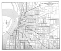
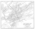
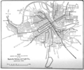
Electric Streetcar Maps are maps that were included in various versions of the McGraw Electric Railway Manual - The Red Book of American Street Railway Investment over various years and titles. They were scanned as part of the Google Books project and maintained as part of the Hathi Trust. The maps were generally created by the companies themselves and submitted to the Manual.
Media in category "Electric Streetcar Maps"
The following 77 files are in this category, out of 77 total.
-
Atlanta Consolidated Street Railway Company c 1894.png 1,756 × 1,266; 2.07 MB
-
Binghamton New York c 1894.png 1,756 × 1,266; 1.58 MB
-
Bridgeport Traction Company c 1894.png 1,362 × 1,848; 1.74 MB
-
Brockton Street Railway c 1894.png 1,470 × 1,562; 1.71 MB
-
Columbus Street Railway and Crosstown Street Railway c 1894.png 1,268 × 1,804; 1.66 MB
-
Galveston City Railway Company c 1894.png 1,860 × 1,276; 1.64 MB
-
Grand Rapids Consolidated Street Railway Company c 1894.png 1,222 × 1,824; 1.87 MB
-
Long Island City Steinway Railway Company c 1894.png 1,764 × 1,338; 2.11 MB
-
Lowell Lawrence and Haverhill Street Railway Company c 1894.png 1,762 × 1,216; 1.2 MB
-
Lynn and Boston Railroad System c. 1894.png 1,756 × 1,296; 1.13 MB
-
Map of Binghamton Railway Company c 1907.png 1,876 × 1,284; 1.72 MB
-
Map of Cleveland Ohio showing the lines of the Cleveland Electric Railway Company c 1907.png 1,978 × 1,298; 1.74 MB
-
Map of Cleveland-Southwestern and Columbus Railway c 1907.png 1,290 × 1,072; 1.37 MB
-
Map of Columbus Ohio showing Street Railway System of Columbus Railway and Light Company.png 1,440 × 1,920; 1.47 MB
-
Map of Dallas Electric Corporation 1912.png 1,304 × 1,914; 2.28 MB
-
Map of Detroit United Railway c 1907.png 1,306 × 1,900; 1.92 MB
-
Map of Eastern Pennsylvania Railways Company c 1907.png 1,638 × 1,000; 1.36 MB
-
Map of Easton Consolidated Electric Company's Street Railway System c 1912.png 1,666 × 1,260; 827 KB
-
Map of Electric Railway Lines in Maine c 1907.png 1,164 × 1,528; 1.64 MB
-
Map of Ft Wayne and Wabash Valley Traction Company and Connecting Lines c. 1907.png 1,348 × 1,884; 2.09 MB
-
Map of Houston Streetcar Lines c 1912.png 1,950 × 1,318; 1.96 MB
-
Map of Illinois Traction System c. 1907.png 1,330 × 1,642; 1.84 MB
-
Map of Illinois Traction System Chicago Ottawa and Peoria RY c 1912.png 1,394 × 1,898; 1.89 MB
-
Map of Indiana showing Interurban Railways c 1907.png 1,360 × 1,952; 1.14 MB
-
Map of Interurban Lines centered on Lexington Kentucky c 1907.png 1,306 × 1,704; 1.72 MB
-
Map of Kansas City-Western Railway c 1907.png 1,968 × 1,228; 891 KB
-
Map of Lehigh Valley Transit Company and Electric Railway Connections c 1912.png 1,196 × 1,890; 663 KB
-
Map of Lines of the Memphis Street Railway c 1907.png 1,624 × 1,364; 1.72 MB
-
Map of Lines of the Memphis Street Railway Company December 31 1911.png 1,420 × 1,314; 1.48 MB
-
Map of Little Rock Railway and Electric Company c 1907.png 1,620 × 1,330; 1.34 MB
-
Map of Norfolk and Portsmouth Traction Company's Lines c 1907.png 1,314 × 1,914; 4.95 MB
-
Map of Northern Electric Railway Connections c 1912.png 1,430 × 1,966; 1.63 MB
-
Map of Northern Texas Electric Company (Fort Worth) 1912.png 1,304 × 1,914; 1.97 MB
-
Map of Ohio Electric Ry and Connections c 1912.png 1,654 × 1,160; 1.53 MB
-
Map of Ohio showing Interurban Railways c 1907.png 1,385 × 1,939; 738 KB
-
Map of Puget Sound Electric Railway c 1912.png 1,314 × 1,916; 1.8 MB
-
Map of Seattle Electric Company c 1912.png 1,318 × 1,950; 2.08 MB
-
Map of Southwest Missouri Railroad Company c 1907.png 1,290 × 1,124; 584 KB
-
Map of Street Railway Lines of the Knoxville Railway and Light Company c 1907.png 1,624 × 1,364; 1.61 MB
-
Map of Street Railway Lines of the Knoxville Railway and Light Company c 1912.png 1,558 × 1,324; 1.78 MB
-
Map of the Aurora Elgin and Chicago RR c 1912.png 1,942 × 1,194; 1.08 MB
-
Map of the East St. Louis and Suburban Company c 1912.png 1,354 × 1,998; 1.33 MB
-
Map of the Eastern Pennsylvania Railways Company c 1912.png 1,596 × 1,004; 1.28 MB
-
Map of the Indiana Union Traction Company c. 1912.png 1,954 × 1,440; 2.23 MB
-
Map of the Railway Lines of the Cumberland County Power and Light Company c 1912.png 1,116 × 1,702; 1.67 MB
-
Map of The Toledo Railways and Light Company's Lines c 1912.png 1,934 × 1,204; 2.05 MB
-
Map of Toledo Railways and Light Company's Lines c 1907.png 1,972 × 1,234; 2.15 MB
-
Map of Tri-City Railway Company in Davenport Rock Island and Moline c 1912.png 1,946 × 1,172; 1.39 MB
-
Map of Twin City Rapid Transit Company c 1907.png 1,990 × 1,310; 2.17 MB
-
Map Showing Lines of Seattle Electric Company c 1907.png 1,386 × 1,986; 2 MB
-
Map Showing Lines of Tacoma Washington Railway and Power Company c 1907.png 1,386 × 1,986; 2.03 MB
-
Map Showing Lines of The Cleveland Railway Company c 1912.png 1,752 × 1,306; 1.96 MB
-
Map Showing Lines of the Dallas Electric Corporation c 1907.png 1,364 × 1,972; 2.33 MB
-
Map Showing Lines of the Houston Electric Company c 1907.png 1,420 × 2,008; 2.63 MB
-
Map Showing Lines of The Milwaukee Electric Railway and Light Company c 1907.png 1,386 × 1,986; 1.32 MB
-
Map Showing Lines of the Montreal Street Railway Company c 1907.png 2,054 × 1,386; 5.26 MB
-
Map Showing Lines of the Montreal Tramways Company c 1912.png 2,038 × 1,314; 2.54 MB
-
Map Showing Lines of the Northern Texas Electric Company (Fort Worth) c 1907.png 1,364 × 1,972; 1.83 MB
-
Map showing Lines Owned and Operated by the Nashville Railway and Light Company c 1907.png 1,624 × 1,364; 1.38 MB
-
Map Showing Lines Owned and Operated by the Nashville Railway and Light Company c 1912.png 1,560 × 1,302; 1.35 MB
-
Map Showing Route of Evansville and Eastern Electric Railway c 1907.png 1,798 × 1,354; 1.39 MB
-
Map Showing the Line of the Conneaut and Erie Traction Company c 1907.png 1,316 × 802; 718 KB
-
Map Showing the Lines of the Twin City Rapid Transit Company c. 1912.png 1,978 × 1,306; 2.13 MB
-
Minneapolis - St Paul Twin City Rapid Transit Company c 1894.png 1,728 × 1,232; 4.87 MB
-
Mobile Light and Railway Company c 1894.png 1,870 × 1,282; 1.87 MB
-
Montreal Street Railway Company c. 1894.png 1,832 × 1,282; 5.12 MB
-
New Orleans Traction Company c 1894.png 1,794 × 1,318; 4.75 MB
-
New York City Union Railway Company c 1894.png 1,330 × 1,898; 2.28 MB
-
Pittsburgh Citizens Traction Company c 1894.png 1,916 × 916; 1.34 MB
-
Rochester Railway Company c 1894.png 1,472 × 2,042; 2.49 MB
-
Terre Haute Electric Railway Company c 1894.png 2,116 × 1,568; 1.1 MB
-
Worcester Consolidated Street Railway Company c 1894.png 2,132 × 1,526; 2.92 MB


