Category:Electoral districts of Quebec
Jump to navigation
Jump to search
Provinces and territories of Canada: Alberta · British Columbia · Manitoba · New Brunswick · Nova Scotia · Ontario · Prince Edward Island · Quebec · Saskatchewan ·
Wikimedia category | |||||
| Upload media | |||||
| Instance of | |||||
|---|---|---|---|---|---|
| Category combines topics | |||||
| Quebec | |||||
province of Canada | |||||
| Spoken text audio | |||||
| Pronunciation audio | |||||
| Instance of | |||||
| Named after | |||||
| Culture | |||||
| Location | Canada | ||||
| Located in or next to body of water | |||||
| Capital | |||||
| Basic form of government |
| ||||
| Legislative body |
| ||||
| Executive body | |||||
| Official language |
| ||||
| Currency | |||||
| Head of state | |||||
| Head of government |
| ||||
| Inception |
| ||||
| Highest point |
| ||||
| Population |
| ||||
| Area |
| ||||
| Replaces |
| ||||
| Different from | |||||
| Minimum temperature record |
| ||||
| official website | |||||
 | |||||
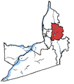
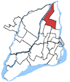
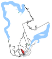
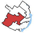
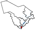
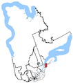
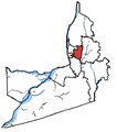
This category shows maps and other materials relating to electoral districts in Quebec.
Subcategories
This category has only the following subcategory.
E
Media in category "Electoral districts of Quebec"
The following 43 files are in this category, out of 43 total.
-
Abitibi-temiscamingue.PNG 283 × 426; 17 KB
-
Abitibi—Témiscamingue.png 543 × 614; 20 KB
-
Ahuntsic.png 437 × 514; 19 KB
-
Alfred-Pellan.png 437 × 514; 19 KB
-
Alfred-pellan.PNG 340 × 431; 18 KB
-
Argenteuil—Papineau—Mirabel.png 543 × 614; 21 KB
-
Beauce (electoral district).png 543 × 614; 21 KB
-
Bourassa, riding.png 437 × 514; 13 KB
-
Brossard—La Prairie.png 369 × 418; 12 KB
-
Chambly—Borduas.png 369 × 418; 12 KB
-
Charlesbourg—Haute-Saint-Charles.png 197 × 182; 4 KB
-
Charlevoix-Montmorency.png 559 × 627; 14 KB
-
Châteauguay—Saint-Constant.png 369 × 418; 12 KB
-
Comtés du Québec 1920.jpg 4,318 × 2,061; 7.55 MB
-
Gatineau(electoraldistrict).jpg 464 × 368; 16 KB
-
Hochelaga.png 437 × 514; 14 KB
-
Honoré-Mercier, riding.png 437 × 514; 14 KB
-
Ile de Montréal avec ses nouvelles circonscriptions.jpg 2,349 × 1,860; 3.37 MB
-
Joliette.png 559 × 627; 14 KB
-
La Pointe-de-l'Île.png 437 × 514; 14 KB
-
Lac-Saint-Louis.png 437 × 514; 14 KB
-
LaSalle-Emard.png 394 × 514; 14 KB
-
Laurier, riding.png 437 × 514; 14 KB
-
Longueuil—Pierre-Boucher.png 369 × 418; 12 KB
-
Louis-Hébert.png 197 × 182; 4 KB
-
Louis-Saint-Laurent.png 197 × 182; 4 KB
-
Manicouagan.png 559 × 627; 14 KB
-
Map of Quebec.jpg 3,477 × 2,914; 2.63 MB
-
Montmagny—L'Islet—Kamouraska—Rivière-du-Loup.png 565 × 629; 21 KB
-
Mount Royal, riding.png 437 × 514; 14 KB
-
Nunavik-Eeyou.png 559 × 627; 14 KB
-
Papineau, riding.png 437 × 514; 13 KB
-
Québec.png 197 × 182; 4 KB
-
Repentigny-centralquebec.PNG 311 × 264; 6 KB
-
Rimouski-Neigette—Témiscouata—Les Basques.png 543 × 614; 21 KB
-
Saint-Bruno—Saint-Hubert.png 369 × 418; 12 KB
-
Saint-hyacinthe-bagot.PNG 317 × 342; 9 KB
-
Saint-Jean.png 369 × 418; 11 KB
-
Saint-Lambert.png 369 × 418; 11 KB
-
Saint-Léonard-Saint-Michel.png 437 × 514; 14 KB
-
Vaudreuil-Soulanges.png 369 × 418; 12 KB
-
Verchères—Les Patriotes.png 369 × 418; 11 KB
-
Wellington (division sénatoriale).png 986 × 636; 68 KB


