Category:Election maps of Stockport
Jump to navigation
Jump to search
This category contains election maps for the Metropolitan Borough of Stockport
Media in category "Election maps of Stockport"
The following 26 files are in this category, out of 26 total.
-
 2019 Stockport Council Election.png 2,000 × 1,954; 301 KB
-
 Stockport (41232639210).png 2,000 × 1,356; 115 KB
-
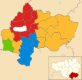
 Stockport 2003 elections map.png 572 × 480; 45 KB
-
 Stockport Council Composition 2014 Map.png 1,754 × 1,712; 451 KB
-
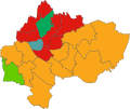
 Stockport Council Gains 2014.png 1,754 × 1,712; 436 KB
-
 Stockport council results map 2002.png 572 × 480; 45 KB
-
 Stockport Metropolitan Borough Council Election 2023.png 831 × 648; 20 KB
-
 Stockport Metropolitan Borough Council Election Results 2023.jpg 831 × 648; 272 KB
-
 Stockport UK local election 2004 map.svg 1,336 × 1,305; 395 KB
-
 Stockport UK local election 2006 map.svg 1,336 × 1,305; 394 KB
-
 Stockport UK local election 2007 map.svg 1,336 × 1,305; 394 KB
-
 Stockport UK local election 2008 map.svg 1,336 × 1,305; 394 KB
-
 Stockport UK local election 2010 map.svg 1,336 × 1,305; 394 KB
-
 Stockport UK local election 2011 map.svg 1,336 × 1,305; 394 KB
-
 Stockport UK local election 2012 map.svg 1,336 × 1,305; 394 KB
-
 Stockport UK local election 2014 map.svg 1,336 × 1,305; 394 KB
-
 Stockport UK local election 2015 map.svg 1,336 × 1,305; 394 KB
-
 Stockport UK local election 2016 map.svg 1,336 × 1,305; 396 KB
-
 Stockport UK local election 2018 map.svg 1,336 × 1,305; 394 KB
-
 Stockport UK local election 2019 map.svg 1,336 × 1,305; 394 KB
-
 Stockport UK local election 2021 map.svg 1,336 × 1,305; 396 KB
-
 Stockport UK local election 2022 map.svg 1,336 × 1,305; 396 KB
-
 Stockport UK ward map 2022.svg 1,336 × 1,305; 395 KB
-
 Stockport UK ward map 2023.svg 644 × 541; 330 KB
-
 Stockport UK ward map 2024.svg 687 × 577; 319 KB
-
 StockportMetropolitanBoroughCouncilElection2023.jpg 831 × 648; 272 KB

.png)


