Category:Election maps of Saskatchewan
Jump to navigation
Jump to search
Provinces and territories of Canada: Alberta · British Columbia · Manitoba · New Brunswick · Newfoundland and Labrador · Nova Scotia · Ontario · Prince Edward Island · Quebec · Saskatchewan · Northwest Territories · Nunavut · Yukon
Subcategories
This category has the following 2 subcategories, out of 2 total.
Media in category "Election maps of Saskatchewan"
The following 17 files are in this category, out of 17 total.
-
1905 Saskatchewan general election - Results by riding (simple).svg 5,333 × 5,573; 316 KB
-
2020 Saskatchewan general election map.png 2,003 × 1,748; 1.51 MB
-
30th Saskatchewan General Election Map.svg 1,800 × 1,850; 1.48 MB
-
45th Saskatchewan general election map.png 5,625 × 5,781; 940 KB
-
Sask07.PNG 949 × 980; 42 KB
-
Sask11.PNG 949 × 980; 39 KB
-
Saskatchewan (39th Parl).PNG 457 × 581; 14 KB
-
Saskatchewan Election 2011 Map.svg 638 × 781; 206 KB
-
Saskatchewan Election 2016 Results Map.svg 612 × 743; 3.45 MB
-
Saskatchewan general election 2020 - Results by Riding.svg 612 × 744; 743 KB
-
Saskatchewan general election, 1971 results by riding.svg 512 × 570; 151 KB
-
Saskatchewan general election, 2003 results by riding.svg 638 × 781; 225 KB
-
Saskatchewan general election, 2007 results by riding.svg 638 × 781; 216 KB
-
Saskatoon Meewasin 2017.svg 425 × 425; 641 KB
-
SK1995.png 1,052 × 808; 43 KB
-
SK1999.PNG 1,052 × 808; 48 KB
-
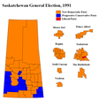
SKElection1991.png 863 × 816; 39 KB


