Category:Election maps of Mauritania
Jump to navigation
Jump to search
Countries of Africa: Algeria · Angola · Benin · Botswana · Burkina Faso · Burundi · Cameroon · Cape Verde · Chad · Comoros · Democratic Republic of the Congo · Djibouti · Egypt‡ · Equatorial Guinea · Ethiopia · Gabon · The Gambia · Ghana · Guinea · Guinea-Bissau · Ivory Coast · Kenya · Lesotho · Liberia · Libya · Madagascar · Malawi · Mali · Mauritania · Mauritius · Morocco · Mozambique · Namibia · Niger · Nigeria · Rwanda · São Tomé and Príncipe · Senegal · Seychelles · Sierra Leone · South Africa · South Sudan · Sudan · Tanzania · Togo · Tunisia · Uganda · Zambia · Zimbabwe
Limited recognition: Sahrawi Arab Democratic Republic · Somaliland – Other areas: Canary Islands · Madeira · Mayotte · Réunion
‡: partly located in Africa
Limited recognition: Sahrawi Arab Democratic Republic · Somaliland – Other areas: Canary Islands · Madeira · Mayotte · Réunion
‡: partly located in Africa
Subcategories
This category has only the following subcategory.
Media in category "Election maps of Mauritania"
The following 30 files are in this category, out of 30 total.
-
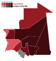
1992 Mauritanian Presidential Election - Results by Wilaya.svg 1,283 × 1,384; 78 KB
-
1992 Mauritanian presidential election.svg 4,040 × 4,442; 87 KB
-
1992-mauritanian-presidential-election.png 5,113 × 6,015; 720 KB
-
1997 Mauritanian Presidential Election - Results by Wilaya.svg 1,283 × 1,384; 63 KB
-
1997 Mauritanian presidential election.svg 4,040 × 4,442; 87 KB
-
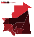
2003 Mauritanian Presidential Election - Results by Wilaya.svg 1,283 × 1,384; 63 KB
-
Mauritania president election 2007 second round.svg 1,213 × 1,288; 35 KB
-
2007 Mauritanian presidential election - First round results (gradient).svg 4,263 × 4,599; 108 KB
-
2007 Mauritanian Presidential Election - Results by Wilaya (First Round).svg 1,283 × 1,384; 91 KB
-
2007 Mauritanian Presidential Election - Results by Wilaya (Second Round).svg 1,283 × 1,384; 78 KB
-
2007 Mauritanian presidential election - Secound round results.svg 4,040 × 4,442; 87 KB
-
2009 Mauritanian Presidential Election - Results by Wilaya.svg 1,283 × 1,384; 76 KB
-
2014 Mauritanian Presidential Election - Results by Wilaya.svg 1,283 × 1,384; 68 KB
-
2018 Mauritanian legislative elections (seats per constituency).svg 10,000 × 9,200; 372 KB
-
2019 Mauritanian Presidential Election Map.svg 1,500 × 900; 237 KB
-
2023 Mauritanian parliamentary election - Seat distribution.svg 1,140 × 960; 749 KB
-
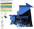
2024 Mauritanian presidential election – overall result per commune.svg 4,309 × 3,628; 475 KB
-
2024 Mauritanian presidential election – overall result per moughataa.svg 4,309 × 3,628; 386 KB
-
2024 Mauritanian presidential election – overall result per wilaya.svg 4,309 × 3,628; 244 KB
-
Constituencies used in the 2018 Mauritanian legislative election.svg 7,700 × 7,700; 85 KB
-
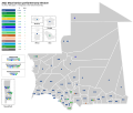
Electoral districts of Mauritania (2013).svg 800 × 823; 172 KB
-
Electoral districts of Mauritania (2018).svg 800 × 823; 262 KB
-
Mauritania president election 2007 first round.svg 1,213 × 1,288; 35 KB
-
Nouakchott district used in the 2018 Mauritanian legislative election.svg 7,700 × 7,700; 85 KB


