Category:Election maps of Jammu and Kashmir (union territory)
Jump to navigation
Jump to search
States of India: Andhra Pradesh · Arunachal Pradesh · Assam · Bihar · Chhattisgarh · Goa · Gujarat · Haryana · Himachal Pradesh · Jharkhand · Karnataka · Kerala · Madhya Pradesh · Maharashtra · Manipur · Meghalaya · Mizoram · Nagaland · Odisha · Punjab · Rajasthan · Sikkim · Tamil Nadu · Telangana · Tripura · Uttar Pradesh · Uttarakhand · West Bengal
Union territories: Andaman and Nicobar Islands · Chandigarh · Dadra and Nagar Haveli and Daman and Diu · Delhi · Jammu and Kashmir · Ladakh · Puducherry
Former states of India: Jammu and Kashmir ·
Former union territories:
Union territories: Andaman and Nicobar Islands · Chandigarh · Dadra and Nagar Haveli and Daman and Diu · Delhi · Jammu and Kashmir · Ladakh · Puducherry
Former states of India: Jammu and Kashmir ·
Former union territories:
Subcategories
This category has only the following subcategory.
Media in category "Election maps of Jammu and Kashmir (union territory)"
The following 10 files are in this category, out of 10 total.
-
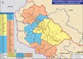
 2024 General Election to Legislative Assembly of UT of Jammu and Kashmir.jpg 3,504 × 2,469; 913 KB
-
 2024 General Election to Legislative Assembly of UT of Jammu and Kashmir.pdf 1,752 × 1,237; 1.82 MB
-

-
 2024 Jammu and Kashmir Legislative Assembly Election JKPDP Seat Sharing.svg 720 × 900; 2.21 MB
-

-
 2024 Jammu and Kashmir Legislative Assembly Election Result Map.svg 720 × 900; 2.21 MB
-
 2024 Jammu and Kashmir Legislative Assembly election result.svg 720 × 900; 2.2 MB
-
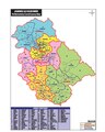
 Constituencies of the Jammu and Kashmir Legislative Assembly (New).svg 720 × 900; 2.2 MB
-
 INDIA seat distribution for Assembly election 2024.png 1,638 × 2,050; 530 KB
-
 J&K AC map new.pdf 1,122 × 1,406; 968 KB


.svg)
