Category:Election maps of Goiânia
Jump to navigation
Jump to search
Capitals of Brazil: Aracaju · Belém · Belo Horizonte · Boa Vista · Campo Grande · Cuiabá · Curitiba · Florianópolis · Fortaleza · Goiânia · João Pessoa · Macapá · Maceió · Manaus · Natal · Palmas · Porto Alegre · Porto Velho · Recife · Rio Branco · Rio de Janeiro · Salvador · São Luís · São Paulo · Teresina · Vitória ·
Media in category "Election maps of Goiânia"
The following 11 files are in this category, out of 11 total.
-
GO 58.png 1,005 × 1,905; 514 KB
-
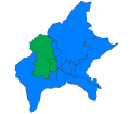
Goiânia 1996.svg 512 × 448; 52 KB
-
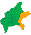
Goiânia 2000.svg 512 × 448; 53 KB
-
Goiânia 2004.svg 512 × 448; 53 KB
-
Goiânia 2008.svg 512 × 448; 53 KB
-
Goiânia 2012.svg 512 × 448; 53 KB
-
Goiânia 2016.svg 512 × 448; 53 KB
-
Goiânia 2020.svg 700 × 800; 40 KB
-
Goiânia 2024.png 800 × 915; 68 KB
-
Mapa da eleição para prefeito em Goiânia em 1985.svg 541 × 553; 16 KB
-
Mapa da eleição para prefeito em Goiânia em 1996.svg 541 × 553; 18 KB


