Category:Edwinstowe
Jump to navigation
Jump to search
Deutsch: Edwinstowe ist ein Dorf im Sherwood Forest, im Norden der Grafschaft Nottinghamshire, England.
Nederlands: Edwinstowe is een plaats in het bestuurlijke gebied Newark and Sherwood, in het Engelse graafschap Nottinghamshire.
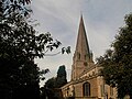
village in Sherwood Forest, Nottinghamshire, England  L'église d'Edwinstowe. | |||||
| Upload media | |||||
| Instance of | |||||
|---|---|---|---|---|---|
| Location | Newark and Sherwood, Nottinghamshire, East Midlands, England | ||||
| Population |
| ||||
 | |||||
Subcategories
This category has the following 9 subcategories, out of 9 total.
B
- Benchmarks in Edwinstowe (4 F)
C
- Center Parcs Sherwood Forest (139 F)
E
- Edwinstowe railway station (3 F)
- Edwinstowe War Memorial (5 F)
M
T
- Thoresby Colliery (18 F)
Media in category "Edwinstowe"
The following 200 files are in this category, out of 562 total.
(previous page) (next page)-
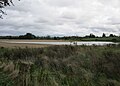
 A bend in the track - geograph.org.uk - 256642.jpg 640 × 480; 319 KB
-
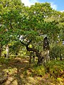
 A large Ancient Oak - geograph.org.uk - 5937897.jpg 1,024 × 768; 354 KB
-
 A leafy bridleway - geograph.org.uk - 2103124.jpg 1,600 × 1,200; 680 KB
-
 A little clearing in the forest - geograph.org.uk - 2668171.jpg 4,058 × 1,639; 4.1 MB
-
 A path through Sherwood Forest - geograph.org.uk - 6357703.jpg 5,000 × 3,750; 7.58 MB
-
 A rest stop - geograph.org.uk - 5846754.jpg 1,280 × 1,280; 809 KB
-
 A scary looking Oak - geograph.org.uk - 2103138.jpg 1,024 × 768; 241 KB
-
 A small open area north of the Major Oak - geograph.org.uk - 1927302.jpg 768 × 1,024; 525 KB
-

-
 A sunlit glade in Sherwood Forest - geograph.org.uk - 5547812.jpg 600 × 800; 245 KB
-
 A track through Sherwood Forest - geograph.org.uk - 6356898.jpg 3,648 × 2,736; 4.54 MB
-
 A6075 by Sherwood Heath - geograph.org.uk - 4743175.jpg 3,072 × 1,728; 1.33 MB
-
 A6075 near Thoresby Colliery - geograph.org.uk - 349338.jpg 640 × 444; 87 KB
-
 A614 beware of the dips - geograph.org.uk - 3857095.jpg 1,024 × 768; 215 KB
-

-
 A616 near Bilhaugh - geograph.org.uk - 5671634.jpg 640 × 481; 62 KB
-
 A616 through the woods - geograph.org.uk - 3454986.jpg 3,004 × 1,856; 2.88 MB
-
 Abbey Figures - geograph.org.uk - 56774.jpg 640 × 452; 92 KB
-
 After drought comes flood - geograph.org.uk - 5914362.jpg 1,024 × 735; 130 KB
-
 All forlorn - geograph.org.uk - 4743191.jpg 3,072 × 1,728; 4.1 MB
-
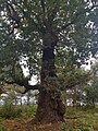
 An ancient oak tree in Sherwood Forest - geograph.org.uk - 6356877.jpg 3,600 × 4,800; 7.77 MB
-
 An area of heathland within Sherwood Forest - geograph.org.uk - 6357734.jpg 6,000 × 4,500; 6.99 MB
-
 An area of heathland within Sherwood Forest - geograph.org.uk - 6357738.jpg 6,000 × 4,500; 7.82 MB
-
 An incredibly lucky frog.... - geograph.org.uk - 3450972.jpg 1,522 × 1,099; 687 KB
-
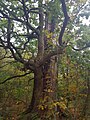
 Ancient Oak (geograph 5936705).jpg 1,024 × 768; 367 KB
-
 Ancient Oak - geograph.org.uk - 5936529.jpg 768 × 1,024; 361 KB
-
 Ancient Oak - geograph.org.uk - 5936633.jpg 768 × 1,024; 355 KB
-
 Ancient Oak - geograph.org.uk - 5936642.jpg 768 × 1,024; 371 KB
-
 Ancient Oak - geograph.org.uk - 5936675.jpg 768 × 1,024; 399 KB
-
 Ancient Oak - geograph.org.uk - 5937810.jpg 768 × 1,024; 322 KB
-
 Ancient Oak - geograph.org.uk - 5937838.jpg 768 × 1,024; 319 KB
-
 Ancient Oak - geograph.org.uk - 5937885.jpg 768 × 1,024; 357 KB
-
 Ancient Oak - geograph.org.uk - 5938008.jpg 768 × 1,024; 260 KB
-
 Ancient Oak in birch woodland - geograph.org.uk - 5937887.jpg 768 × 1,024; 340 KB
-
 Ancient oak tree - geograph.org.uk - 3451984.jpg 533 × 800; 177 KB
-
 Ancient oak trees in Sherwood Forest - geograph.org.uk - 6356602.jpg 5,000 × 3,750; 7.37 MB
-
 Ancient Oaks - geograph.org.uk - 5936730.jpg 1,024 × 768; 349 KB
-
 Ancient oaks in Sherwood Forest - geograph.org.uk - 2666005.jpg 1,263 × 1,920; 1.22 MB
-
 Ancient oaks Sherwood Forest - geograph.org.uk - 2501396.jpg 640 × 480; 126 KB
-
 Ancient oaks, Sherwood Forest - geograph.org.uk - 2501395.jpg 640 × 480; 145 KB
-
 Ancient Sherwood Forest oaks - geograph.org.uk - 2666013.jpg 1,920 × 1,164; 1.11 MB
-
 Approaching Holly Farm near Lidgett - geograph.org.uk - 5857502.jpg 1,600 × 1,200; 490 KB
-
 Approaching Lidgett - geograph.org.uk - 4743232.jpg 1,935 × 999; 1.57 MB
-
 Approaching Ollerton Services - geograph.org.uk - 4394622.jpg 640 × 480; 48 KB
-
 Approaching the Major Oak - geograph.org.uk - 3343413.jpg 640 × 520; 132 KB
-
 Approaching the summit - geograph.org.uk - 4057759.jpg 1,024 × 768; 196 KB
-
-
 Assarts Wood - geograph.org.uk - 2742572.jpg 640 × 427; 159 KB
-
 Autumn colour near the Centre Tree - geograph.org.uk - 2666033.jpg 1,280 × 1,920; 2.19 MB
-
 B-Hole No. 5, Sherwood Forest - geograph.org.uk - 4808037.jpg 5,184 × 3,888; 6.58 MB
-
 B20451.jpg 2,968 × 3,958; 5.05 MB
-
 B33693.jpg 3,024 × 4,032; 6.03 MB
-
 Backlit autumn woodland - geograph.org.uk - 2667997.jpg 1,600 × 1,064; 775 KB
-
 Banded oak - geograph.org.uk - 4166601.jpg 1,024 × 683; 421 KB
-
 Barred old road towards The Buck Gates - geograph.org.uk - 4747934.jpg 3,072 × 1,728; 2.85 MB
-
 Beech tree - coppice stump with many stems - geograph.org.uk - 3978812.jpg 1,024 × 768; 326 KB
-
 Bench in Birklands, Sherwood Forest - geograph.org.uk - 4807660.jpg 5,184 × 3,888; 6.28 MB
-
 Bilberry (Vaccinium myrtillus) in Sherwood Forest - geograph.org.uk - 6357586.jpg 3,648 × 2,736; 4.03 MB
-
 Bilberry (Vaccinium myrtillus) in Sherwood Forest - geograph.org.uk - 6357590.jpg 3,648 × 2,736; 5.14 MB
-
 Birch trees in Sherwood Forest - geograph.org.uk - 1927299.jpg 1,024 × 768; 556 KB
-
 Birch trees in Sherwood Forest - geograph.org.uk - 1927312.jpg 768 × 1,024; 580 KB
-

-
 Black Pool - geograph.org.uk - 3183337.jpg 3,237 × 2,590; 6.49 MB
-
 Bluebells - panoramio (3).jpg 3,240 × 2,160; 1.95 MB
-
 Bluebells - panoramio (4).jpg 3,240 × 2,160; 1.77 MB
-
 Bluebells - panoramio (5).jpg 3,240 × 2,160; 1.87 MB
-
 Bridge across River Maun on Robin Hood Way - geograph.org.uk - 3450960.jpg 4,000 × 3,000; 2.16 MB
-
 Bridleway crossing the railway west of Lidgett - geograph.org.uk - 5857506.jpg 1,600 × 1,200; 456 KB
-
 Bridleway Sherwood Forest Country Park - geograph.org.uk - 4333670.jpg 1,024 × 768; 329 KB
-
 Bridleway towards Lidgett - geograph.org.uk - 5857512.jpg 1,600 × 1,200; 700 KB
-
 Budby South Forest - Heathland View - geograph.org.uk - 774267.jpg 640 × 480; 109 KB
-

-
 Bungalow on Ollerton Road (A6075) - geograph.org.uk - 4394278.jpg 640 × 480; 57 KB
-

-

-
 Bus stopping at The Dukeries Lodge - geograph.org.uk - 4742442.jpg 800 × 533; 93 KB
-
 Centre Tree - geograph.org.uk - 3450288.jpg 4,000 × 2,248; 2.49 MB
-
 Centre Tree - geograph.org.uk - 3451978.jpg 533 × 800; 138 KB
-
 Church Street, Edwinstowe, Notts. - geograph.org.uk - 5067021.jpg 4,032 × 3,024; 7.48 MB
-
 Church Street, Edwinstowe, Notts. - geograph.org.uk - 5067526.jpg 4,032 × 3,024; 7.47 MB
-
 Church Street, Edwinstowe, Notts. - geograph.org.uk - 5067594.jpg 3,128 × 2,346; 1.87 MB
-
 Church Street, Edwinstowe, Notts. - geograph.org.uk - 5067614.jpg 2,412 × 2,324; 2.19 MB
-
 Churchyard path - geograph.org.uk - 4169116.jpg 1,024 × 683; 318 KB
-
 Clearing In Sherwood Forest - geograph.org.uk - 3657642.jpg 640 × 481; 326 KB
-
 Clearing In Sherwood Forest - geograph.org.uk - 3657645.jpg 640 × 481; 294 KB
-
 Clipstone Drive - geograph.org.uk - 6490646.jpg 1,280 × 960; 722 KB
-
 Clumber Avenue, Edwinstowe - geograph.org.uk - 3892831.jpg 640 × 480; 62 KB
-
 Coach park Sherwood visitor centre - geograph.org.uk - 1109865.jpg 640 × 480; 99 KB
-
 Coal wagons standing idle - geograph.org.uk - 4742678.jpg 800 × 533; 132 KB
-
 Converging footpaths - geograph.org.uk - 4057749.jpg 1,024 × 768; 170 KB
-
 Cottages in Church Street, Edwinstowe - geograph.org.uk - 4057744.jpg 1,024 × 768; 170 KB
-
 Creature in the Forest - geograph.org.uk - 1334913.jpg 640 × 427; 125 KB
-
 Creepy Trees - geograph.org.uk - 1143120.jpg 480 × 640; 83 KB
-
 Cross on site of St Edwin's chapel - geograph.org.uk - 3451049.jpg 2,248 × 4,000; 2.16 MB
-
 Crossing the line - geograph.org.uk - 4057752.jpg 1,024 × 768; 182 KB
-
 Crossing the railway on Robin Hood's Way - geograph.org.uk - 2103132.jpg 1,024 × 768; 254 KB
-
 Crossroads in the forest - geograph.org.uk - 4058657.jpg 1,024 × 768; 277 KB
-
 Culloden Plantation, Sherwood Forest - geograph.org.uk - 4394151.jpg 640 × 480; 98 KB
-
 Cut Mark, Edwinstowe Church - geograph.org.uk - 3423951.jpg 480 × 640; 115 KB
-
 Cut Mark, Edwinstowe Village Hall - geograph.org.uk - 3424006.jpg 640 × 480; 120 KB
-
 Cycle route 6 at Clipstone Old Quarter - geograph.org.uk - 3452001.jpg 800 × 533; 187 KB
-
 Cycle Route 6 past Centre Tree - geograph.org.uk - 3515278.jpg 3,776 × 2,520; 4.14 MB
-

-
 Cycle trail, Culloden Plantation - geograph.org.uk - 4394156.jpg 640 × 480; 127 KB
-
 Distant Thoresby Colliery - geograph.org.uk - 4743226.jpg 3,072 × 1,580; 3.37 MB
-
 Eastfield hedgeline - geograph.org.uk - 2790574.jpg 640 × 427; 117 KB
-
 Edge of the forest - geograph.org.uk - 256592.jpg 640 × 480; 249 KB
-

-

-

-

-
 Edwinstowe - Church Street No 6 - geograph.org.uk - 3456191.jpg 1,600 × 1,341; 724 KB
-
 Edwinstowe - footpath to Ollerton - geograph.org.uk - 2348621.jpg 1,600 × 1,200; 405 KB
-
 Edwinstowe - Hall - geograph.org.uk - 3446970.jpg 1,600 × 1,219; 397 KB
-
 Edwinstowe - High Street No 40 - geograph.org.uk - 3204181.jpg 1,150 × 1,600; 604 KB
-
 Edwinstowe - Sherwood Forest Art & Craft Centre.jpg 1,600 × 1,200; 777 KB
-
 Edwinstowe - The Dukeries Lodge - geograph.org.uk - 2348612.jpg 1,600 × 1,200; 417 KB
-
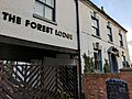
 Edwinstowe - The Forest Lodge Hotel - geograph.org.uk - 3456186.jpg 1,600 × 1,200; 656 KB
-
 Edwinstowe - Thoresby Colliery - geograph.org.uk - 2351793.jpg 1,600 × 1,200; 419 KB
-
 Edwinstowe - Thoresby Colliery Signal Box - geograph.org.uk - 2351782.jpg 1,600 × 1,200; 343 KB
-
 Edwinstowe Banner.jpg 3,246 × 464; 1.14 MB
-
 Edwinstowe Church Street - geograph.org.uk - 5564837.jpg 4,237 × 3,178; 2.91 MB
-
 Edwinstowe Churchyard - geograph.org.uk - 5564843.jpg 3,482 × 2,611; 2.51 MB
-
 Edwinstowe Cricket and Fair ground - geograph.org.uk - 3450324.jpg 3,942 × 2,138; 1.34 MB
-
 Edwinstowe Cricket Ground - geograph.org.uk - 6181003.jpg 1,024 × 768; 890 KB
-
 Edwinstowe cricket ground - geograph.org.uk - 6356522.jpg 3,648 × 2,736; 2.96 MB
-
 Edwinstowe Crossroads, Notts. - geograph.org.uk - 5067054.jpg 4,032 × 3,024; 6.5 MB
-
 Edwinstowe fire station - geograph.org.uk - 1631901.jpg 640 × 427; 207 KB
-
 Edwinstowe Fire Station - geograph.org.uk - 3892840.jpg 640 × 480; 69 KB
-
 Edwinstowe Hall, Church Street, Edwinstowe (1).jpg 4,025 × 2,916; 2.72 MB
-
 Edwinstowe Hall, Church Street, Edwinstowe (2).jpg 4,048 × 3,036; 3.34 MB
-
 Edwinstowe Hall, Church Street, Edwinstowe (3).jpg 3,824 × 2,972; 2.56 MB
-
 Edwinstowe High Street - geograph.org.uk - 1927287.jpg 1,024 × 857; 577 KB
-
 Edwinstowe High Street - geograph.org.uk - 3658026.jpg 640 × 481; 270 KB
-
 Edwinstowe High Street - geograph.org.uk - 5116202.jpg 640 × 453; 77 KB
-
 Edwinstowe High Street - geograph.org.uk - 6180960.jpg 1,024 × 1,024; 1.04 MB
-
 Edwinstowe in the distance - geograph.org.uk - 2409600.jpg 640 × 414; 62 KB
-
 Edwinstowe Road - geograph.org.uk - 2790575.jpg 640 × 427; 60 KB
-
 Edwinstowe village - geograph.org.uk - 5564834.jpg 3,411 × 2,559; 2.2 MB
-
 Edwinstowe village - geograph.org.uk - 5564848.jpg 3,781 × 2,836; 2.51 MB
-
 Edwinstowe Village Hall - geograph.org.uk - 3424016.jpg 640 × 480; 87 KB
-
 Edwinstowe, a grand house and St Mary's steeple - geograph.org.uk - 6181000.jpg 1,024 × 1,024; 1.09 MB
-
 Edwinstowe, at the corner of East Lane - geograph.org.uk - 6181026.jpg 1,024 × 683; 702 KB
-
 Edwinstowe, at the crossroads - geograph.org.uk - 6181015.jpg 1,024 × 768; 853 KB
-
 Edwinstowe, Church Street - geograph.org.uk - 6181008.jpg 1,024 × 768; 807 KB
-
 Edwinstowe, cottages on Mill Lane - geograph.org.uk - 6180880.jpg 1,024 × 1,024; 1.08 MB
-
 Edwinstowe, Dukeries Lodge - Friar Tuck - geograph.org.uk - 6320500.jpg 1,024 × 819; 879 KB
-
 Edwinstowe, Dukeries Lodge - Little John - geograph.org.uk - 6320494.jpg 731 × 1,024; 906 KB
-

-
 Edwinstowe, Dukeries sunset - geograph.org.uk - 6181077.jpg 1,024 × 768; 745 KB
-
 Edwinstowe, former Railway Tea Rooms - geograph.org.uk - 6180915.jpg 1,024 × 731; 869 KB
-
 Edwinstowe, High Street and The Dukeries Lodge - geograph.org.uk - 6180896.jpg 819 × 1,024; 883 KB
-
 Edwinstowe, Notts - geograph.org.uk - 4225495.jpg 2,996 × 2,849; 2.12 MB
-
 Edwinstowe, over rooftops on a wet morning - geograph.org.uk - 6188766.jpg 1,024 × 732; 804 KB
-
 Edwinstowe, railway bridge over Mill Lane - geograph.org.uk - 6180877.jpg 1,024 × 1,024; 1.21 MB
-
 Edwinstowe, Royal Oak - geograph.org.uk - 3658017.jpg 640 × 481; 257 KB
-
 Edwinstowe, St Mary - geograph.org.uk - 6180994.jpg 819 × 1,024; 1,007 KB
-
 Edwinstowe, The Dukeries Lodge - geograph.org.uk - 6180906.jpg 1,024 × 819; 863 KB
-
 Edwinstowe, the entrance to The Dukeries Lodge - geograph.org.uk - 6180900.jpg 768 × 1,024; 862 KB
-
 Edwinstowe, the postman's van on a wet morning - geograph.org.uk - 6260798.jpg 1,024 × 819; 934 KB
-
 Edwinstowe, towards Thoresby Colliery Signal Box - geograph.org.uk - 6180810.jpg 1,024 × 731; 825 KB
-
 Edwinstowecricket.jpg 800 × 600; 345 KB
-

-
 English Longhorn cattle in within Sherwood Forest - geograph.org.uk - 6357726.jpg 5,000 × 3,750; 6.38 MB
-
 Entering Edwinstowe - geograph.org.uk - 4394218.jpg 640 × 480; 70 KB
-
 Entrance to an enclosure - geograph.org.uk - 4058666.jpg 1,024 × 768; 288 KB
-
 Entrance to the former Thoresby Colliery - geograph.org.uk - 4750016.jpg 800 × 533; 164 KB
-
 Entrance to Thoresby Colliery - geograph.org.uk - 4394260.jpg 640 × 480; 64 KB
-
 Entrance to Thoresby Colliery - geograph.org.uk - 4748502.jpg 3,072 × 1,728; 3.85 MB
-
 Fallen Ancient Oak - geograph.org.uk - 5937831.jpg 1,024 × 768; 357 KB
-
 Farm telehandler - geograph.org.uk - 2103129.jpg 1,024 × 768; 184 KB
-

-

-
 Farmland toward Lidgett - geograph.org.uk - 4394172.jpg 640 × 480; 74 KB
-
 Farmland towards Budby South Forest - geograph.org.uk - 3892911.jpg 640 × 480; 54 KB
-
 Farmland towards Thoresby Colliery - geograph.org.uk - 4394268.jpg 640 × 480; 58 KB
-
 Farmland, Rufford - geograph.org.uk - 4394056.jpg 640 × 480; 61 KB
-
 Field by Ollerton - geograph.org.uk - 4438948.jpg 6,000 × 4,000; 4.45 MB
-
 Fir Tree Farm - geograph.org.uk - 4394108.jpg 640 × 372; 56 KB
-
 Florries Canteen - geograph.org.uk - 4748084.jpg 3,072 × 1,728; 1.45 MB
-
 Footbridge on the Robin Hood Way - geograph.org.uk - 3451993.jpg 800 × 533; 128 KB
-
 Footbridge over The River Maun - geograph.org.uk - 4807677.jpg 5,184 × 3,888; 6.01 MB
-
 Footbridge over the River Maun near Edwinstowe - geograph.org.uk - 5857517.jpg 1,600 × 1,200; 600 KB
-
 Footpath crossing Mill Lane - geograph.org.uk - 1870171.jpg 640 × 480; 48 KB
-
 Footpath junction in Sherwood Forest - geograph.org.uk - 3349986.jpg 640 × 464; 82 KB
-
 Footpath on former spoil heap - geograph.org.uk - 1828671.jpg 1,024 × 768; 484 KB
-
 Footpath through the trees - geograph.org.uk - 1927318.jpg 768 × 1,024; 564 KB
-
 Footpath to birch woodland - geograph.org.uk - 1828674.jpg 1,024 × 768; 538 KB
-
 Footpath to the visitor centre - geograph.org.uk - 1927306.jpg 768 × 1,024; 534 KB
-
 Forest Corner Cafe on the A616 - geograph.org.uk - 2800063.jpg 640 × 480; 66 KB
-
 Forest footpath towards the Major Oak - geograph.org.uk - 1927298.jpg 1,024 × 768; 571 KB
-
 Forest Lodge Hotel, Church St, Edwinstowe (1).jpg 2,638 × 3,197; 1.16 MB
-
 Forest Lodge Hotel, Church St, Edwinstowe (2).jpg 4,048 × 3,036; 2.31 MB
-
 Forest Lodge Hotel, Church St, Edwinstowe (3).jpg 3,036 × 4,048; 2.34 MB
-
 Forest Lodge Hotel, Church St, Edwinstowe (4).jpg 4,048 × 3,036; 2.64 MB
-
 Former Telephone Exchange, Edwinstowe - geograph.org.uk - 2201558.jpg 3,072 × 2,304; 1.76 MB
-
 German Shepherd Training at South Forest Farm - geograph.org.uk - 3676758.jpg 4,000 × 3,000; 3 MB
-

-
 Grazing, Villa Real Farm - geograph.org.uk - 3892804.jpg 640 × 480; 56 KB
-
 Green Drive to the right - geograph.org.uk - 6566416.jpg 5,184 × 3,888; 7.32 MB


.jpg)


_in_Sherwood_Forest_-_geograph.org.uk_-_6357586.jpg)
_in_Sherwood_Forest_-_geograph.org.uk_-_6357590.jpg)


.jpg)
.jpg)
.jpg)


_-_geograph.org.uk_-_4394278.jpg)
_-_geograph.org.uk_-_4394265.jpg)


.jpg)
.jpg)
.jpg)


_-_geograph.org.uk_-_4394041.jpg)
_-_geograph.org.uk_-_4394275.jpg)


.jpg)
.jpg)
.jpg)
.jpg)


