Category:Educational geographical atlas of the Russian Empire (1898)
Jump to navigation
Jump to search
Media in category "Educational geographical atlas of the Russian Empire (1898)"
The following 23 files are in this category, out of 23 total.
-
1898 Political maps of Asia.jpg 2,954 × 2,415; 1.31 MB
-
Berezinsky waterway (1898).jpg 1,347 × 656; 148 KB
-
Canal of Alexander of Württemberg (1898).jpg 1,476 × 710; 183 KB
-
Cascade on the River Teza (1898).jpg 1,192 × 598; 109 KB
-
Diagram of eclipses (1898).jpg 889 × 1,150; 204 KB
-
Dnieper-Bug waterway (1898).jpg 2,909 × 1,078; 429 KB
-
Ethnographic map of the world (1898).jpg 2,972 × 2,288; 1.03 MB
-
Geographic Atlas (1898).jpg 2,916 × 2,123; 730 KB
-
Lunar phases (1898).jpg 735 × 1,354; 146 KB
-
Map of Europe (1898).jpg 2,931 × 2,360; 1.33 MB
-
Map of North America (1898).jpg 2,926 × 2,414; 1.22 MB
-
Map of ocean currents (1898).jpg 2,978 × 2,180; 1.45 MB
-
Map of Palestine (1898).jpg 2,906 × 4,492; 2 MB
-
Map of South America (1898).jpg 2,948 × 3,812; 2.58 MB
-
Mariinsky waterway (1898).jpg 2,878 × 1,696; 873 KB
-
Oginsky waterway (1898).jpg 2,155 × 723; 237 KB
-
Physical map of the Russian Empire (1898).jpg 5,980 × 3,270; 7.65 MB
-
Seasons on Earth.jpg 1,645 × 1,141; 197 KB
-
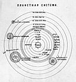
Solar System (1898).jpg 1,238 × 1,336; 235 KB
-
Tikhvin waterway (1898).jpg 2,482 × 859; 321 KB
-
Volga, upper reaches (1898).jpg 2,841 × 1,401; 659 KB
-
Vyshnevolotsk waterway (1898).jpg 1,429 × 1,027; 274 KB
-
Историческая карта Российской империи.jpg 6,102 × 3,740; 6.09 MB


