Category:Edgbaston
Jump to navigation
Jump to search
English: Edgbaston is an area in the city of Birmingham in England. It curves around the south and west of the original town of Birmingham, and is bordered by Moseley to the south east and by Smethwick and Winson Green to the north west.
Español: Edgbaston es una parte de la ciudad de Birmingham, en Inglaterra (Reino Unido). Constituye un distrito formal gobernado por su propia junta de distrito. Está dividido, como el resto de los distritos de Birmingham, en cuatro wards: el homónimo de Edgbaston y los de Bartley Green, Harborne y Quinton.
Suomi: Edgbaston on yksi Birminghamin kaupungin kymmenestä vaalipiiristä. Se muodostuu neljästä äänestysalueesta: Bartley Green, Edgbaston, Harborne ja Quinton. Vuonna 2009 Edgbastonissa oli 93 100 asukasta.
Français : Edgbaston est un quartier de la ville de Birmingham, au Royaume-Uni. Il constitue l'une des onze subdivisions de la ville habitants au moment du recensement de 2001.
Gaeilge: Is ceantar suite i m Birmingham é Edgbaston.
हिन्दी: एजबेस्टन इंग्लैण्ड के बर्मिंघम नगर का एक क्षेत्र है।
Lietuvių: Edžbastonas – Anglijos miesto Birmingamo pietvakarinė dalis bei administracinis rajonas. Į Edžbastono rajoną įeina Edžbastono, Bartlei Gryno ir Kvintono apygardos. 96 568 gyventojai (2011 m.). Pašto kodas – B15. Tai edukacinis ir gyvenamasis rajonas, su žaliasiais plotais ir nedidelių kotedžų kvartalais.
Polski: Edgbaston – dzielnica w Anglii, w West Midlands, w dystrykcie Birmingham. W 2011 dzielnica liczyła 24426 mieszkańców. Edgbaston jest wspomniana w Domesday Book (1086) jako Celboldestone.
Svenska: miniatyr|Edgbaston
area in the city of Birmingham, England .jpg) | |||||
| Upload media | |||||
| Instance of | |||||
|---|---|---|---|---|---|
| Location | Birmingham, West Midlands, England | ||||
 | |||||
Subcategories
This category has the following 43 subcategories, out of 43 total.
2
- 21 Yateley Road, Edgbaston (2 F)
3
- 35 Calthorpe Road, Edgbaston (2 F)
A
B
- Birmingham Central Synagogue (8 F)
C
- Calthorpe Park, Birmingham (8 F)
- Carpenter Road, Edgbaston (15 F)
- Chamberlain Tower (55 F)
- Church Road railway station (3 F)
E
- Century Tower, Edgbaston (3 F)
- Edgbaston Pool (20 F)
- Edgbaston Priory Club (4 F)
- Edgbaston Village tram stop (2 F)
- Edgbaston Waterworks (7 F)
F
G
- Garth House, Edgbaston (9 F)
J
- St James' Church, Edgbaston (4 F)
- Joseph Sturge memorial (7 F)
M
- Muirhead Tower (13 F)
P
- Perrott's Folly (12 F)
Q
S
T
- The Westbourne Centre (9 F)
U
W
- Winterbourne House and Garden (66 F)
Media in category "Edgbaston"
The following 200 files are in this category, out of 328 total.
(previous page) (next page)-
 'Hawthorns' 10 Sir Harry's Road, Edgbaston - geograph.org.uk - 6344442.jpg 2,774 × 2,081; 2.09 MB
-
 1 Arthur Road (Aston House), Edgbaston - geograph.org.uk - 6343345.jpg 2,774 × 2,081; 2.07 MB
-
 11, Sir Harry's Road, Edgbaston - geograph.org.uk - 6343945.jpg 2,326 × 3,101; 2.11 MB
-
 12 Carpenter Road, Edgbaston - geograph.org.uk - 6332690.jpg 2,081 × 2,774; 2.03 MB
-
 12, Sir Harry's Road, Edgbaston - geograph.org.uk - 6343942.jpg 2,938 × 2,203; 2.17 MB
-
 13 Carpenter Road, Edgbaston - geograph.org.uk - 6332694.jpg 2,638 × 1,976; 1.68 MB
-
 14 Carpenter Road, Edgbaston - geograph.org.uk - 6332706.jpg 2,081 × 2,774; 2.12 MB
-
 15 Carpenter Road, Edgbaston - geograph.org.uk - 6343333.jpg 2,448 × 1,836; 1.89 MB
-
 16 ^ 17 Chad Road, Edgbaston - geograph.org.uk - 6325292.jpg 3,264 × 2,448; 2.19 MB
-
 165 - 177, Bristol Road, Edgbaston - geograph.org.uk - 6344774.jpg 3,264 × 2,448; 2.05 MB
-
 17 and 19 Rotton Park Road, Edgbaston.jpg 2,592 × 1,936; 1.68 MB
-
 17-19 Rotton Park Road Edgbaston (4624082869) (2).jpg 4,032 × 2,598; 7.42 MB
-
 17-Yateley-Road,-Edgbaston,-Birmingham---Herbert-Tudor-Buckland.jpg 2,536 × 1,976; 3.31 MB
-
 179, Bristol Road, Edgbaston - geograph.org.uk - 6344794.jpg 3,264 × 2,448; 1.82 MB
-
 181, Bristol Road, Edgbaston - geograph.org.uk - 6344761.jpg 2,938 × 2,203; 2.03 MB
-
 198 ^ 200 Hagley Road, Edgbaston - geograph.org.uk - 6368594.jpg 2,774 × 2,081; 1.93 MB
-
 2 Vernon Road, Edgbaston.png 1,011 × 655; 810 KB
-
 204 Hagley Road, Edgbaston - geograph.org.uk - 6368597.jpg 3,264 × 2,448; 2.12 MB
-
 210 Hagley Road, Edgbaston - geograph.org.uk - 6368599.jpg 3,264 × 2,448; 2.08 MB
-
 214 Hagley Road, Edgbaston - geograph.org.uk - 6368602.jpg 2,938 × 2,203; 2.1 MB
-
 22 Wheatsheaf Road, Edgbaston.png 475 × 674; 610 KB
-
 24 Priory Rd 1.jpg 4,837 × 3,404; 4.74 MB
-
 24 Priory Rd 2.jpg 5,333 × 3,577; 4.99 MB
-
 2A Woodbourne Road and 20 Westfield Road, Birmingham - geograph.org.uk - 6363064.jpg 2,285 × 1,714; 1.92 MB
-
 3 Carpenter Road, Edgbaston - geograph.org.uk - 6332585.jpg 3,264 × 2,448; 2.36 MB
-
 34 ^ 34a Westfield Road, Edgbaston - geograph.org.uk - 6368667.jpg 2,611 × 1,958; 1.97 MB
-
 36 Clarendon Road, Edgbaston.jpg 524 × 947; 170 KB
-
 4 ^ 5 Carpenter Road, Edgbaston - geograph.org.uk - 6332590.jpg 3,264 × 2,448; 2.01 MB
-
 423, 425 ^ 427 Harborne Road, Edgbaston - geograph.org.uk - 6327079.jpg 2,774 × 2,081; 1.99 MB
-
 49 Carpenter Road, Edgbaston - geograph.org.uk - 6332627.jpg 2,774 × 2,081; 2.07 MB
-
 50 Carpenter Road, Edgbaston - geograph.org.uk - 6332623.jpg 2,448 × 1,836; 1.84 MB
-
 6 Carpenter Road, Edgbaston - geograph.org.uk - 6332594.jpg 3,264 × 2,448; 2.8 MB
-
 6 Chad Road, Edgbaston - geograph.org.uk - 6325287.jpg 3,264 × 2,448; 1.95 MB
-
 6 ^ 7, Sir Harry's Road, Edgbaston - geograph.org.uk - 6344473.jpg 3,264 × 2,448; 1.92 MB
-
 7 Carpenter Road, Edgbaston - geograph.org.uk - 6332598.jpg 2,611 × 1,958; 2.15 MB
-
 7 Portland Road, Edgbaston - geograph.org.uk - 6321946.jpg 2,448 × 3,264; 1.56 MB
-
 8, Sir Harry's Road, Edgbaston - geograph.org.uk - 6344462.jpg 3,133 × 2,350; 2.23 MB
-
 9 Carpenter Road, Edgbaston - geograph.org.uk - 6332607.jpg 2,938 × 2,203; 1.86 MB
-
 9 Portland Road, Edgbaston - geograph.org.uk - 6324897.jpg 2,448 × 3,264; 2 MB
-
 9, Sir Harry's Road, Edgbaston - geograph.org.uk - 6344450.jpg 3,264 × 2,448; 2.23 MB
-
 A busy corner in Edgbaston - geograph.org.uk - 14350.jpg 640 × 426; 87 KB
-
 A triangle of trees - geograph.org.uk - 5647951.jpg 1,600 × 900; 521 KB
-
 A38 at its junction with A4029, Edgbaston - geograph.org.uk - 6307844.jpg 1,529 × 1,600; 1.14 MB
-
 A38 Bristol Road - geograph.org.uk - 6387912.jpg 4,000 × 3,000; 3.34 MB
-
 A38 in Edgbaston - geograph.org.uk - 1890161.jpg 640 × 480; 63 KB
-
 Aerial Photo - RAF 540 77 pffo 0001 (Park Mount House).png 1,380 × 766; 456 KB
-
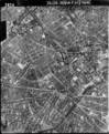 Aerial Photo - RAF 541 15 RP 3024.png 4,321 × 5,251; 23.22 MB
-

-
 Ampton Road - geograph.org.uk - 5647944.jpg 1,600 × 900; 403 KB
-
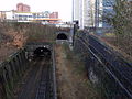
 Approach to University railway station - geograph.org.uk - 5864473.jpg 1,024 × 768; 193 KB
-
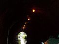
 Approaching Edgbaston Tunnel, 2001 - geograph.org.uk - 5568420.jpg 911 × 600; 92 KB
-
 Arches within Birmingham University - geograph.org.uk - 6084710.jpg 768 × 1,024; 187 KB
-

-

-
 Augustus Road - geograph.org.uk - 1405067.jpg 640 × 426; 453 KB
-
 Augustusrdbridge0.jpg 750 × 563; 91 KB
-
 B4217 in Edgbaston - geograph.org.uk - 1890146.jpg 640 × 480; 64 KB
-
 Bamboo, Birmingham Botanical Gardens - geograph.org.uk - 6067780.jpg 960 × 1,280; 877 KB
-
 Beethoven, Virgil and Michaelangelo - geograph.org.uk - 6084762.jpg 1,024 × 768; 157 KB
-
 Berrow Court Hotel, Edgbaston.jpg 1,636 × 1,224; 534 KB
-

-
 Birmingham Botanical Gardens - geograph.org.uk - 6064804.jpg 1,280 × 853; 366 KB
-
 Birmingham Botanical Gardens - geograph.org.uk - 6102973.jpg 2,053 × 1,331; 851 KB
-

-
 Birmingham Centre for Energy Storage - geograph.org.uk - 6053485.jpg 480 × 640; 85 KB
-

-
 Birmingham Oratory - geograph.org.uk - 6039415.jpg 4,000 × 3,000; 1.75 MB
-
 Birmingham University - Biosciences - geograph.org.uk - 6053507.jpg 640 × 480; 106 KB
-
 Birmingham University - boiler house - geograph.org.uk - 6053512.jpg 480 × 640; 128 KB
-

-

-

-
 Birmingham University - hired heat - geograph.org.uk - 6053493.jpg 640 × 480; 94 KB
-

-

-

-
 Birmingham Womens Hospital.jpg 3,291 × 1,775; 1.41 MB
-
 Birmingham, Bridge No 86 - geograph.org.uk - 6051615.jpg 1,024 × 768; 151 KB
-
 BirminghamCanal.JPG 2,816 × 2,112; 1.11 MB
-
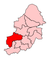 BirminghamEdgbaston2007Constituency.svg 238 × 282; 77 KB
-
 BirminghamEdgbastonConstituency.png 180 × 230; 3 KB
-
 BirminghamEdgbastonConstituency.svg 180 × 230; 41 KB
-
 Black And White - geograph.org.uk - 1222121.jpg 640 × 489; 103 KB
-
 Blue plaque Joseph Sturge.jpg 697 × 691; 133 KB
-
 Botanical Gardens - fountain and chimney - geograph.org.uk - 6146654.jpg 480 × 640; 130 KB
-
 Botanical Gardens - scarecrow garden - geograph.org.uk - 6146641.jpg 640 × 480; 136 KB
-
 Botanical Gardens - Study Centre - geograph.org.uk - 6145544.jpg 640 × 480; 94 KB
-
 Botanical Gardens -chimney - geograph.org.uk - 6146667.jpg 480 × 640; 68 KB
-

-
 Bridge View - geograph.org.uk - 1849695.jpg 640 × 480; 113 KB
-

-
 Bus at Queen Elizabeth Hospital - geograph.org.uk - 5864462.jpg 1,024 × 768; 193 KB
-
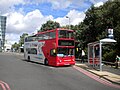
 Bus on Harborne Road, Five Ways - geograph.org.uk - 6482903.jpg 1,024 × 727; 195 KB
-
 Calthorpe House, Birmingham May 2008.JPG 2,240 × 1,488; 1.37 MB
-
 Canal-tunnel.jpg 800 × 600; 41 KB
-
 Carlyle Road, Edgbaston - geograph.org.uk - 841290.jpg 640 × 480; 111 KB
-
 Cavalier House, Hagley Road, Edgbaston - geograph.org.uk - 6368596.jpg 2,081 × 2,774; 2.11 MB
-
 Chad Road, Birmingham - geograph.org.uk - 6179857.jpg 800 × 600; 158 KB
-
 Chadbrook Crest tower - geograph.org.uk - 6325301.jpg 979 × 1,306; 571 KB
-

-
 Cream-spot Ladybird on Sunflower (3889181029).jpg 1,644 × 1,662; 2.02 MB
-
 Cross City Line and disused railway line - Islington Row Middleway (6905766665).jpg 3,648 × 2,736; 2.43 MB
-
 Cross City Line and disused railway line - Islington Row Middleway (6905772337).jpg 3,648 × 2,736; 2.42 MB
-
 Crows v Seagulls (386666698).jpg 1,280 × 569; 167 KB
-
 Cycle infrastructure beside the A38 - geograph.org.uk - 6344802.jpg 1,306 × 979; 680 KB
-
 Cycle path along the River Rea - geograph.org.uk - 127712.jpg 640 × 480; 151 KB
-
 Dahlia, Birmingham Botanical Gardens - geograph.org.uk - 6067355.jpg 1,280 × 1,280; 323 KB
-
 Daybreak over Edgbaston (4670987136).jpg 2,048 × 1,536; 2.08 MB
-
 Demolition of houses Pershore Road, Edgbaston (8541447865).jpg 2,560 × 1,920; 1.9 MB
-
 Demolition of houses Pershore Road, Edgbaston (8541449291).jpg 2,560 × 1,920; 2.54 MB
-
 Demolition of houses Pershore Road, Edgbaston (8541450795).jpg 2,560 × 1,920; 2.57 MB
-
 Echinocactus grusonii, Birmingham Botanical Gardens - geograph.org.uk - 6067365.jpg 1,280 × 1,280; 795 KB
-
 St James Road, Edgbaston - railway bridge and canal bridge (6898953576).jpg 3,648 × 2,736; 2.25 MB
-
 Edgbaston - May 2006 - Pearl's a Singer and a bit of a Show-off (4861838496).jpg 1,255 × 994; 1.11 MB
-

-
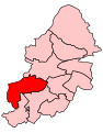
 Edgbaston Birmingham UK ward 2010.svg 1,045 × 1,266; 304 KB
-

-
 Edgbaston Cricket Ground taking shape (5013763201).jpg 3,224 × 994; 1.65 MB
-
 Edgbaston GeorgeRd sign north.jpg 813 × 1,280; 907 KB
-
 Edgbaston GeorgeRd sign south.jpg 915 × 1,280; 854 KB
-
 Edgbaston Golf Club - entrance lodge - geograph.org.uk - 6343358.jpg 2,774 × 2,081; 2.23 MB
-
 Edgbaston Mill - Aldi from the bus (5478629329).jpg 2,592 × 1,944; 979 KB
-
 Edgbaston Mill - Aldi from the bus (5478630289).jpg 2,592 × 1,944; 899 KB
-
 Edgbaston Mill - future site of a hotel (5478628113).jpg 2,592 × 1,944; 1.09 MB
-
 Edgbaston Old Church - geograph.org.uk - 6325589.jpg 4,000 × 3,000; 3.27 MB
-
 Edgbaston Park Hotel, University of Birmingham - geograph.org.uk - 6106973.jpg 1,280 × 960; 558 KB
-
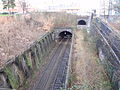
 Edgbaston Railway Tunnel, N Chadwick, 2513832.jpg 640 × 430; 111 KB
-
 Edgbaston Reservoir (panoramic view -1) (386666344).jpg 2,048 × 352; 206 KB
-
 Edgbaston Reservoir (panoramic view -2) (386666411).jpg 2,048 × 536; 162 KB
-
 Edgbaston Road Vicinity, Birmingham 5 - geograph.org.uk - 6126128.jpg 3,833 × 2,983; 3.25 MB
-
 Edgbaston Road Vicinity, Birmingham 5 - geograph.org.uk - 6126150.jpg 3,363 × 2,463; 2.97 MB
-
 Edgbaston vote share.png 1,028 × 637; 42 KB
-
 Edgbaston, a new typeface on the scoreboard - geograph.org.uk - 6175210.jpg 819 × 1,024; 1.06 MB
-
 Church of St Germain.JPG 2,808 × 2,050; 1.1 MB
-
 Edgbaston, on the first morning of a match - geograph.org.uk - 6175214.jpg 1,024 × 768; 850 KB
-
 Edgbaston001.JPG 2,816 × 2,112; 1.33 MB
-
 Empty Office - geograph.org.uk - 1222107.jpg 640 × 480; 76 KB
-

-
 Entrance to the Great Hall - geograph.org.uk - 6084752.jpg 1,024 × 768; 185 KB
-

-
 Fishing at the Reservoir (386666790).jpg 1,280 × 799; 180 KB
-
 Five Ways - geograph.org.uk - 6318361.jpg 6,000 × 4,000; 7.68 MB
-
 Five Ways skyline and Birmingham Central Mosque.jpg 2,352 × 1,764; 2.9 MB
-
 Five-Ways-and-Birmingham-Central-Mosque-II.jpg 3,841 × 2,881; 7.78 MB
-

-
 Footpath and cyclepath - geograph.org.uk - 6312030.jpg 768 × 1,024; 367 KB
-
 Footpath between Kemp Close and Emscote Road, Warwick - geograph.org.uk - 6681657.jpg 1,600 × 1,200; 1.14 MB
-
 Footpath to Queen Elizabeth Hospital, Birmingham - geograph.org.uk - 6571870.jpg 1,600 × 1,200; 3.69 MB
-

-
 Former Methodist Church - Barnsley Road Sandon Road, Edgbaston (6934046042).jpg 3,648 × 2,736; 2.43 MB
-
-
 GEORGE CADBURY - 32 George Road Edgbaston Birmingham B15 1PJ.jpg 2,000 × 1,500; 676 KB
-
 George I - geograph.org.uk - 1850046.jpg 600 × 800; 137 KB
-
 Gladstone Demonstration ticket, 1877-05-31.jpg 1,342 × 889; 120 KB
-
 Green Heart, University of Birmingham - geograph.org.uk - 6248164.jpg 4,032 × 1,960; 3.77 MB
-
 Guild of Students - geograph.org.uk - 1850051.jpg 800 × 600; 103 KB
-

-
 Hagley Road and Five Ways Island - geograph.org.uk - 408313.jpg 640 × 480; 100 KB
-
 Hallfield School - Church Road, Edgbaston - Gothic lodge (5870031439).jpg 3,648 × 2,736; 2.25 MB
-
 Harborne Lane A4040 towards Harborne - geograph.org.uk - 6331111.jpg 1,469 × 1,102; 493 KB
-
 Harborne Road Harborne Birmingham - geograph.org.uk - 5635108.jpg 640 × 480; 60 KB
-

-
 Harborne Road, Birmingham - geograph.org.uk - 6064797.jpg 1,280 × 960; 783 KB
-
 Herbacious border, Birmingham Botanical Gardens - geograph.org.uk - 6067775.jpg 1,280 × 960; 968 KB
-
 High Point tower block - geograph.org.uk - 6325305.jpg 1,306 × 979; 586 KB
-
 Houses being demolished - Pershore Road - Edgbaston Road - Edgbaston (8524251317).jpg 2,560 × 1,920; 3.47 MB
-
 Image of Joseph Chamberlain - geograph.org.uk - 6082860.jpg 1,024 × 768; 219 KB
-
 IQ Five - Islington Row Middleway - London Midland Class 170 (6905781129).jpg 3,648 × 2,736; 2.23 MB
-

-
 King Edward VI School - geograph.org.uk - 1850021.jpg 800 × 600; 145 KB
-
 Knutsford Lodge, Edgbaston.jpg 2,592 × 1,936; 2.08 MB
-

-

-
 Lawn aviary, Birmingham Botanical Gardens - geograph.org.uk - 6066337.jpg 1,280 × 853; 394 KB
-
 Lens flare at the Reservoir (386667079).jpg 1,280 × 853; 116 KB
-
 Lines family sketchbook - Disc1 041 - Moseley Park + Edgbaston (bottom).jpg 1,958 × 1,192; 1.12 MB
-
 Lines family sketchbook - Disc1 057 - Near Edgbaston.jpg 2,492 × 1,912; 947 KB
-
 Looking east along Carpenter Road, Edgbaston - geograph.org.uk - 6343352.jpg 1,469 × 1,102; 860 KB
-
 Loudon Terrace, Birmingham Botanical Gardens - geograph.org.uk - 6067351.jpg 1,280 × 960; 662 KB
-

-
 Main Library at Birmingham University - geograph.org.uk - 6035139.jpg 1,600 × 900; 401 KB
-
 Mariner Avenue, Edgbaston - geograph.org.uk - 842326.jpg 640 × 480; 101 KB
-
 Martineau Gardens.jpg 2,576 × 1,932; 2.06 MB
-
 Maternity statue at the Birmingham Women's Hospital.JPG 2,112 × 2,816; 1.14 MB
-
 Medieval Garden, Birmingham Botanical Gardens - geograph.org.uk - 6067681.jpg 960 × 1,280; 590 KB
-
 Memory Pool, Birmingham Botanical Gardens - geograph.org.uk - 6067765.jpg 1,280 × 960; 727 KB
-
 Metchley Cottage, Edgbaston - geograph.org.uk - 6327078.jpg 2,774 × 2,081; 2.01 MB
-
 Metchley Lane joins Harborne Park Road - geograph.org.uk - 6332548.jpg 1,469 × 1,102; 579 KB
-

-
 Metchley Park Road - geograph.org.uk - 1849375.jpg 640 × 480; 108 KB
-
 Metchley Roman Fort site - geograph.org.uk - 6332558.jpg 2,448 × 1,836; 2.18 MB
-
 Monument Road, Edgbaston - geograph.org.uk - 841958.jpg 640 × 480; 97 KB
-
 Moor Green Allotments - geograph.org.uk - 336758.jpg 640 × 426; 176 KB
-
 More moored narrowboats (386666245).jpg 1,280 × 1,121; 245 KB
-
 Morning sun illuminates the Mothership (5096336436).jpg 2,716 × 938; 1.37 MB
-
 New cycleway in the Bristol Road in June 2019.jpg 4,592 × 3,448; 6.49 MB
-
 New cycleway in the Bristol Road outside the University of Birmingham in June 2019.jpg 4,592 × 3,448; 4.25 MB
-
 New Fosse Way - geograph.org.uk - 6312039.jpg 1,024 × 768; 303 KB
-

-
 Offices on Chad Road, Birmingham - geograph.org.uk - 6179858.jpg 800 × 600; 150 KB

,_Edgbaston_-_geograph.org.uk_-_6343345.jpg)


_(2).jpg)


.png)


_after_a_very_heavy_shower_-_geograph.org.uk_-_1405076.jpg)


.jpg)


_near_Selly_Park_-_Bournbrook_-_geograph.org.uk_-_127662.jpg)


.jpg)
.jpg)
.jpg)
.jpg)


.jpg)
.jpg)
.jpg)
.jpg)

.jpg)
.jpg)
.jpg)


.jpg)
.jpg)
.jpg)


.jpg)


_-_geograph.org.uk_-_6179849.jpg)


.jpg)


_towards_Birmingham_city_centre_-_geograph.org.uk_-_6179851.jpg)

.jpg)


.jpg)

.jpg)
,_Birmingham_-_geograph.org.uk_-_3552378.jpg)


.jpg)
.jpg)


.jpg)


.jpg)
_(386666344).jpg)
_(386666411).jpg)
.jpg)