Category:Ecclesmachan
Jump to navigation
Jump to search
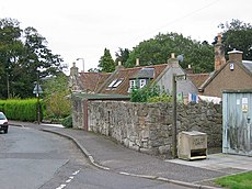
English: Ecclesmachan ( Gaelic: Eaglais Mhachain) (NT058736) is a village in West Lothian. It lies just north of Uphall on the B8046 road. As at 2001, the population of the civil parish of Ecclesmachan was 529 and was 811 in 1991.
Gàidhlig: Tha Eaglais Mhachain ann an Lodainn an Iar. 'S e seo na co-chomharran aige: 55° 56′ 47.95″ Tuath agus 3° 30′ 32.77″ Iar.
village in West Lothian, Scotland, UK | |||||
| Upload media | |||||
| Instance of | |||||
|---|---|---|---|---|---|
| Location |
| ||||
 | |||||
Subcategories
This category has the following 3 subcategories, out of 3 total.
Media in category "Ecclesmachan"
The following 18 files are in this category, out of 18 total.
-
Broadlaw, West Lothian - geograph.org.uk - 1148546.jpg 640 × 479; 106 KB
-
Disused road, East Broadlaw. - geograph.org.uk - 56095.jpg 640 × 480; 53 KB
-
Ecclesmachan Church.jpg 2,880 × 2,160; 2.8 MB
-
Ecclesmachan.jpg 640 × 480; 82 KB
-
Fine herbaceous border - geograph.org.uk - 503472.jpg 640 × 480; 144 KB
-
Heading for Ecclesmachan - geograph.org.uk - 1148630.jpg 640 × 480; 92 KB
-
Liston family graves, Ecclesmachan.jpg 640 × 480; 138 KB
-
Mains Burn - geograph.org.uk - 1148462.jpg 640 × 480; 98 KB
-
Nutrient recycling - geograph.org.uk - 1150967.jpg 640 × 480; 85 KB
-
Oatridge golf course - geograph.org.uk - 1148551.jpg 640 × 480; 117 KB
-
Ploughing, Binny. - geograph.org.uk - 56101.jpg 640 × 480; 63 KB
-
Possible medieval baptismal font 03.jpg 4,000 × 3,000; 4.69 MB
-
Shelterbelt - geograph.org.uk - 1149087.jpg 640 × 475; 140 KB
-
West Lothian Stripes. - geograph.org.uk - 61258.jpg 640 × 480; 55 KB
-
Winter barley and gorse near Newbigging - geograph.org.uk - 1270769.jpg 640 × 480; 107 KB
-
Winter grazing - geograph.org.uk - 1149079.jpg 640 × 480; 96 KB
-
Winter wheat near Greendykes - geograph.org.uk - 1270764.jpg 640 × 480; 87 KB


