Category:Eathorpe
Jump to navigation
Jump to search
village in United Kingdom | |||||
| Upload media | |||||
| Instance of | |||||
|---|---|---|---|---|---|
| Location | Warwick, Warwickshire, West Midlands, England | ||||
| Population |
| ||||
 | |||||
English: Eathorpe is a small village five miles east of Leamington Spa, in the English county of Warwickshire. It is in its own parish, in the electoral ward of Cubbington. It is very close to the B4455, which follows the line of the Roman Fosse Way, and the River Leam. According to the 2001 census, the parish had a population of 113.
Subcategories
This category has the following 2 subcategories, out of 2 total.
C
T
- The Plough, Eathorpe (5 F)
Media in category "Eathorpe"
The following 136 files are in this category, out of 136 total.
-
 'Snowgirl' at Eathorpe village hall - geograph.org.uk - 1651176.jpg 409 × 600; 67 KB
-

-

-

-

-

-
 Approaching Eathorpe - geograph.org.uk - 3737769.jpg 1,280 × 856; 398 KB
-
 B4455 Fosse Way heading north - geograph.org.uk - 6237957.jpg 1,024 × 684; 348 KB
-

-
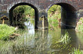
 Bridge over River Leam at Eathorpe - geograph.org.uk - 2682146.jpg 2,000 × 1,501; 669 KB
-
 Bridge over River Leam at Eathorpe - geograph.org.uk - 2683011.jpg 2,000 × 1,333; 409 KB
-
 Bridge over the River Leam - geograph.org.uk - 5463585.jpg 640 × 480; 59 KB
-
 Bridge, Eathorpe (2) - geograph.org.uk - 1135999.jpg 640 × 462; 111 KB
-
 Bridge, Eathorpe - geograph.org.uk - 1127647.jpg 640 × 467; 182 KB
-
 Bridleway near Eathorpe - geograph.org.uk - 1122199.jpg 640 × 486; 153 KB
-
 Burnthurst - geograph.org.uk - 27539.jpg 640 × 480; 90 KB
-
 Bus timetable at Eathorpe - geograph.org.uk - 3737754.jpg 856 × 1,280; 234 KB
-
 Buttercups at Eathorpe - geograph.org.uk - 1300745.jpg 640 × 485; 160 KB
-
 Christmas floods at Eathorpe - geograph.org.uk - 3793848.jpg 3,000 × 1,800; 5.09 MB
-
 Copse at Eathorpe Hall (2) - geograph.org.uk - 1300747.jpg 640 × 471; 183 KB
-
 Copse at Eathorpe Hall - geograph.org.uk - 1126408.jpg 541 × 640; 221 KB
-

-
 Eathorpe - geograph.org.uk - 2976357.jpg 640 × 480; 119 KB
-
 Eathorpe - geograph.org.uk - 3737736.jpg 1,280 × 856; 431 KB
-
 Eathorpe - geograph.org.uk - 3737907.jpg 1,280 × 856; 321 KB
-
 Eathorpe - geograph.org.uk - 507704.jpg 640 × 480; 120 KB
-
 Eathorpe Bridge - geograph.org.uk - 3742777.jpg 1,280 × 856; 261 KB
-
 Eathorpe Bus Shelter - geograph.org.uk - 2519268.jpg 640 × 435; 114 KB
-
 Eathorpe bus shelter - geograph.org.uk - 3737908.jpg 1,280 × 856; 343 KB
-
 Eathorpe Christmas illuminations (1) - geograph.org.uk - 1631390.jpg 640 × 416; 88 KB
-
 Eathorpe Christmas illuminations (2) - geograph.org.uk - 1631392.jpg 640 × 426; 84 KB
-
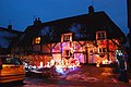 Eathorpe Christmas illuminations (3) - geograph.org.uk - 1631393.jpg 640 × 426; 82 KB
-
 Eathorpe Christmas illuminations (4) - geograph.org.uk - 1631394.jpg 640 × 414; 91 KB
-
 Eathorpe Christmas illuminations (5) - geograph.org.uk - 1631396.jpg 640 × 426; 70 KB
-
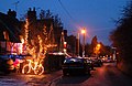
 Eathorpe Christmas Lights - geograph.org.uk - 2748081.jpg 800 × 600; 129 KB
-
 Eathorpe Corn Mill - geograph.org.uk - 2976394.jpg 640 × 480; 139 KB
-
 Eathorpe Farmland - geograph.org.uk - 2614389.jpg 640 × 480; 77 KB
-
 Eathorpe Footpath - geograph.org.uk - 2617487.jpg 640 × 480; 95 KB
-
 Eathorpe Hall parkland - geograph.org.uk - 1300748.jpg 481 × 640; 151 KB
-
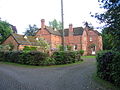
 Eathorpe Lodge - geograph.org.uk - 6315793.jpg 1,600 × 1,200; 731 KB
-
 Eathorpe Park - geograph.org.uk - 1122395.jpg 640 × 504; 151 KB
-
 Eathorpe Park Hotel - geograph.org.uk - 2614561.jpg 640 × 480; 125 KB
-
 Eathorpe Park Lodge - geograph.org.uk - 2614538.jpg 640 × 480; 87 KB
-
 Eathorpe Park Lodge, Warwickshire - geograph.org.uk - 1112352.jpg 640 × 532; 159 KB
-
 Eathorpe Park, driveway - geograph.org.uk - 1122396.jpg 640 × 498; 163 KB
-
 Eathorpe Pumping Station - geograph.org.uk - 6198613.jpg 2,080 × 1,560; 3.65 MB
-
 Eathorpe Recreation Ground - geograph.org.uk - 2519253.jpg 640 × 480; 123 KB
-

-
 Eathorpe village hall, Warwickshire - geograph.org.uk - 1086051.jpg 640 × 464; 79 KB
-
 Eathorpe village in the snow - geograph.org.uk - 1651173.jpg 640 × 426; 92 KB
-
 Eathorpe water mill, Warwickshire - geograph.org.uk - 1086052.jpg 640 × 442; 89 KB
-
 Eathorpe water works - geograph.org.uk - 1113297.jpg 640 × 456; 125 KB
-
 Eathorpe weir (3) - geograph.org.uk - 1136020.jpg 640 × 431; 140 KB
-
 Eathorpe weir - geograph.org.uk - 156337.jpg 640 × 480; 399 KB
-
 Eathorpe weir in winter - geograph.org.uk - 1104759.jpg 640 × 553; 134 KB
-
 Eathorpe, south turn on Fossway - geograph.org.uk - 1126403.jpg 640 × 563; 138 KB
-
 Eathorpe-Penns Lane - geograph.org.uk - 2521490.jpg 640 × 480; 125 KB
-
 Eathorpe-River Leam - geograph.org.uk - 1571975.jpg 640 × 480; 114 KB
-
 Eathorpe.jpg 640 × 480; 120 KB
-
 EathorpeMill.jpg 2,400 × 1,658; 846 KB
-

-
 Entering Easthorpe - geograph.org.uk - 2804145.jpg 800 × 600; 150 KB
-
 Entrance to Eathorpe River Intake Works - geograph.org.uk - 2976342.jpg 640 × 480; 143 KB
-
 Entrance to Eathorpe water works - geograph.org.uk - 1113304.jpg 640 × 438; 144 KB
-
 Flood Plain of the River Leam - geograph.org.uk - 2976281.jpg 640 × 480; 119 KB
-
 Footpath towards Hunningham - geograph.org.uk - 3155004.jpg 640 × 480; 86 KB
-
 Fosse Way at Eathorpe turn - geograph.org.uk - 2079996.jpg 640 × 480; 91 KB
-

-
 Fosse Way, Eathorpe - geograph.org.uk - 1117222.jpg 640 × 452; 91 KB
-
 Grounds of Eathorpe Pumping Station - geograph.org.uk - 2976311.jpg 640 × 480; 138 KB
-
 Harvest House, Eathorpe - geograph.org.uk - 1136033.jpg 640 × 487; 110 KB
-
 Irrigation near Eathorpe - geograph.org.uk - 1267039.jpg 640 × 432; 63 KB
-
 Ivy Cottage, Eathorpe - geograph.org.uk - 1136041.jpg 640 × 496; 94 KB
-
 Lane out of Eathorpe - geograph.org.uk - 3739332.jpg 1,280 × 856; 373 KB
-
 Lane past Eathorpe Hall - geograph.org.uk - 2683002.jpg 2,000 × 1,498; 556 KB
-
 Lane towards Eathorpe - geograph.org.uk - 3155012.jpg 640 × 480; 82 KB
-

-
 Lodge, Eathorpe - geograph.org.uk - 3155009.jpg 640 × 480; 110 KB
-

-

-
 Mill headwater, Eathorpe - geograph.org.uk - 1136004.jpg 640 × 488; 98 KB
-
 Parsons Barn Farm (1) - geograph.org.uk - 1122188.jpg 640 × 481; 96 KB
-
 Parsons barn farm (2) - geograph.org.uk - 1122191.jpg 640 × 456; 69 KB
-
 Parsons Barn Farm driveway - geograph.org.uk - 1122194.jpg 640 × 498; 86 KB
-
 Phonebox, Eathorpe - geograph.org.uk - 1136008.jpg 640 × 507; 121 KB
-
 Poplars Farmhouse, Eathorpe - geograph.org.uk - 1136012.jpg 640 × 491; 80 KB
-
 Power poles, Marton Moor - geograph.org.uk - 1131560.jpg 575 × 640; 79 KB
-

-

-
 River Leam at Eathorpe - geograph.org.uk - 5236202.jpg 2,500 × 1,875; 4.19 MB
-
 River Leam east of the Fosseway (1) - geograph.org.uk - 1288557.jpg 640 × 426; 148 KB
-
 River Leam east of the Fosseway (2) - geograph.org.uk - 1288564.jpg 640 × 473; 109 KB
-
 River Leam east of the Fosseway (3) - geograph.org.uk - 1288568.jpg 640 × 508; 127 KB
-
 River Leam from Fosse Way bridge (1) - geograph.org.uk - 1131579.jpg 640 × 496; 81 KB
-
 River Leam from Fosse Way bridge (2) - geograph.org.uk - 1131582.jpg 640 × 485; 83 KB
-
 River Leam north of Eathorpe - geograph.org.uk - 1427642.jpg 492 × 640; 153 KB
-
 River Leam south of Eathorpe - geograph.org.uk - 1109786.jpg 640 × 493; 89 KB
-
 River Leam under Fosseway bridge - geograph.org.uk - 1288552.jpg 640 × 422; 136 KB
-
 River Leam west of Fosseway - geograph.org.uk - 1288572.jpg 640 × 481; 148 KB
-
 River Leam, Eathorpe - geograph.org.uk - 3739502.jpg 1,280 × 856; 576 KB
-
 River Leam, Eathorpe - geograph.org.uk - 3744369.jpg 1,280 × 856; 439 KB
-
 Road from Eathorpe meets the Fosse Way - geograph.org.uk - 5440324.jpg 640 × 428; 140 KB
-

-

-

-

-

-

-
 Swan on the River Leam near Eathorpe - geograph.org.uk - 1427650.jpg 640 × 426; 133 KB
-
 The Lodge at Eathorpe Hall - geograph.org.uk - 2682130.jpg 2,000 × 1,496; 630 KB
-
 The Lodge at Eathorpe in late autumn - geograph.org.uk - 2535044.jpg 1,928 × 1,081; 657 KB
-
 The Lodge, Eathorpe - geograph.org.uk - 6442185.jpg 892 × 1,024; 337 KB
-
 The main street in Eathorpe - geograph.org.uk - 1109799.jpg 640 × 476; 85 KB
-

-
 The Old Post Office, Eathorpe - geograph.org.uk - 3155014.jpg 640 × 480; 71 KB
-

-

-

-

-

-

-

-

-
 View from footpath to Hunningham - geograph.org.uk - 2682990.jpg 2,000 × 1,492; 533 KB
-

-
 Village street, Eathorpe - geograph.org.uk - 3155019.jpg 640 × 480; 114 KB
-

-
 Weir at Eathorpe - geograph.org.uk - 2976408.jpg 640 × 480; 174 KB
-
 Weir on River Leam at Eathorpe - geograph.org.uk - 6438811.jpg 1,024 × 733; 358 KB
-
 Weir on the River Leam Eathorpe - geograph.org.uk - 3155027.jpg 640 × 480; 129 KB
-
-

-
 Approaching Eathorpe from the west - geograph.org.uk - 1427502.jpg 640 × 426; 123 KB
-
 Eathorpe - geograph.org.uk - 11972.jpg 480 × 640; 102 KB
-

-


_-_geograph.org.uk_-_1135999.jpg)


_-_geograph.org.uk_-_1300747.jpg)


_-_geograph.org.uk_-_1631390.jpg)
_-_geograph.org.uk_-_1631392.jpg)
_-_geograph.org.uk_-_1631393.jpg)
_-_geograph.org.uk_-_1631394.jpg)
_-_geograph.org.uk_-_1631396.jpg)


_-_geograph.org.uk_-_1136020.jpg)


_-_geograph.org.uk_-_1122188.jpg)
_-_geograph.org.uk_-_1122191.jpg)


_-_geograph.org.uk_-_1288557.jpg)
_-_geograph.org.uk_-_1288564.jpg)
_-_geograph.org.uk_-_1288568.jpg)
_-_geograph.org.uk_-_1131579.jpg)
_-_geograph.org.uk_-_1131582.jpg)


_-_geograph.org.uk_-_1535723.jpg)
_-_geograph.org.uk_-_1535725.jpg)
_-_geograph.org.uk_-_1535733.jpg)


_-_geograph.org.uk_-_1427507.jpg)
_-_geograph.org.uk_-_1427474.jpg)