Category:Eastwood, West Yorkshire
Jump to navigation
Jump to search
village near Todmorden, West Yorkshire, England, UK  | |||||
| Upload media | |||||
| Instance of | |||||
|---|---|---|---|---|---|
| Location | Todmorden, Calderdale, West Yorkshire, Yorkshire and the Humber, England | ||||
 | |||||
English: Eastwood is a small, settled locality within the civil parish of Todmorden and Metropolitan Borough of Calderdale, in West Yorkshire, England. It lies to the southwest, and Hebden Bridge, which is 2 miles to the northeast, along the course of the River Calder.
Subcategories
This category has only the following subcategory.
E
Media in category "Eastwood, West Yorkshire"
The following 71 files are in this category, out of 71 total.
-
 A Storm Brews Over Stoodley Pike. - geograph.org.uk - 502521.jpg 640 × 426; 218 KB
-
 Boundary stone, Blackstone Edge Road - geograph.org.uk - 1470534.jpg 632 × 640; 214 KB
-

-

-
 Calderdale Way, Withens Clough - geograph.org.uk - 46529.jpg 640 × 427; 118 KB
-

-

-

-
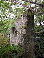 Derelict mill and waterfall in Jumble Hole Clough - geograph.org.uk - 17272.jpg 773 × 1,024; 337 KB
-

-
 Eastwood Co-Op, Halifax Road - geograph.org.uk - 1550697.jpg 480 × 640; 95 KB
-
 Eastwood Old Hall.jpg 592 × 444; 177 KB
-
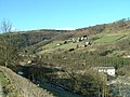
 Eastwood, Todmorden.jpg 640 × 480; 149 KB
-
 Engraved stone, Withens Gate - geograph.org.uk - 46512.jpg 427 × 640; 202 KB
-
 Former Co-op on Burnley Road (geograph 2135641).jpg 640 × 480; 122 KB
-

-
 Halifax Road - geograph.org.uk - 1202806.jpg 640 × 366; 62 KB
-
 Halifax Road at Bridge Royd, Stansfield - geograph.org.uk - 1532026.jpg 640 × 446; 100 KB
-
 Height Wood - geograph.org.uk - 1254803.jpg 640 × 427; 130 KB
-
 Horsfall Street, near Lobb Mill Vidaduct - geograph.org.uk - 431015.jpg 640 × 426; 160 KB
-

-
 Looking down on the Rochdale Canal - geograph.org.uk - 91621.jpg 640 × 480; 119 KB
-
-
 Mileage Sign, Rochdale Canal. - geograph.org.uk - 509256.jpg 640 × 480; 133 KB
-
 Mysterious carving at Higher Underbank - geograph.org.uk - 28469.jpg 640 × 480; 132 KB
-
 Nanholme Mill - geograph.org.uk - 1461985.jpg 640 × 480; 92 KB
-
 Pennine Bridleway below Stoodley Pike - geograph.org.uk - 224085.jpg 640 × 480; 109 KB
-
 Pennine Bridleway, Erringden Moor - geograph.org.uk - 179779.jpg 640 × 480; 112 KB
-
 Pennine Way Guide Post - geograph.org.uk - 463369.jpg 640 × 475; 129 KB
-

-
 Perseverance Works, Rochdale Road - geograph.org.uk - 1202810.jpg 640 × 551; 57 KB
-
 River Calder near Eastwood - geograph.org.uk - 404762.jpg 640 × 427; 106 KB
-
 Rochdale Canal - geograph.org.uk - 509189.jpg 640 × 480; 128 KB
-
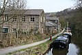
 Rochdale Canal, Eastwood - geograph.org.uk - 5298.jpg 640 × 409; 42 KB
-

-

-
 Sheep on Langfield Common - geograph.org.uk - 103000.jpg 1,600 × 1,200; 1.09 MB
-
 Stock Hey Farmhouse - geograph.org.uk - 1254809.jpg 640 × 426; 132 KB
-
 Stone water trough, Mankinholes - geograph.org.uk - 94331.jpg 640 × 480; 170 KB
-
 Stone, Blake Moor - geograph.org.uk - 46491.jpg 640 × 427; 164 KB
-
 Stoodley Bridge, Rochdale Canal - geograph.org.uk - 404707.jpg 640 × 427; 108 KB
-

-
 The River Calder, Height Wood - geograph.org.uk - 364004.jpg 640 × 480; 175 KB
-
-
 Trig Pillar, Blake Moor - geograph.org.uk - 401715.jpg 640 × 480; 80 KB
-
 Trig point, Little Holder Stones - geograph.org.uk - 46472.jpg 640 × 427; 141 KB
-
 Turvin Clough - geograph.org.uk - 401696.jpg 640 × 467; 165 KB
-

-
 Withens Gate - geograph.org.uk - 46511.jpg 640 × 427; 138 KB
-
 Withins Gate on Pennine Way - geograph.org.uk - 708557.jpg 604 × 406; 71 KB
-

-
 Buck Stones Well - geograph.org.uk - 25875.jpg 715 × 536; 184 KB
-

-

-
 Footpath along White Holme Drain - geograph.org.uk - 336502.jpg 640 × 426; 134 KB
-
 Footpath, Dick's Lane at Law Hill - geograph.org.uk - 26480.jpg 715 × 536; 130 KB
-
 Footpath, Withens Clough - geograph.org.uk - 46519.jpg 640 × 427; 151 KB
-
 Ford, Stoodley Clough, Height Wood - geograph.org.uk - 271660.jpg 1,600 × 1,200; 923 KB
-
 Higham - geograph.org.uk - 362566.jpg 640 × 480; 104 KB
-
 Holder Stones - geograph.org.uk - 46505.jpg 640 × 427; 168 KB
-

-
 Light Hazzles Reservoir - geograph.org.uk - 97001.jpg 640 × 480; 80 KB
-
 Little Holder Stones. - geograph.org.uk - 97003.jpg 640 × 480; 92 KB
-
 Open access land, Turvin Clough - geograph.org.uk - 76946.jpg 640 × 427; 124 KB
-
 Outlet, Little Moor Clough. - geograph.org.uk - 42974.jpg 640 × 427; 107 KB
-
 Red Dykes. - geograph.org.uk - 349280.jpg 640 × 480; 60 KB
-

-
 Turley Holes and Higher House Moor - geograph.org.uk - 46485.jpg 640 × 427; 174 KB
-
 Warland Drain - geograph.org.uk - 235263.jpg 640 × 462; 129 KB
-
 White Holme Moss and Wool Pack Stones - geograph.org.uk - 336495.jpg 640 × 426; 110 KB
-
 Withens Clough and Red Dykes. - geograph.org.uk - 349274.jpg 640 × 480; 64 KB


.jpg)


