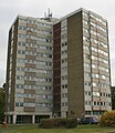
Category:Eastwood, Essex
Jump to navigation
Jump to search
suburb of Southend-on-Sea, Essex, England, UK | |||||
| Upload media | |||||
| Instance of | |||||
|---|---|---|---|---|---|
| Part of | |||||
| Location | Southend-on-Sea, Essex, East of England, England | ||||
 | |||||
Subcategories
This category has the following 5 subcategories, out of 5 total.
Media in category "Eastwood, Essex"
The following 50 files are in this category, out of 50 total.
-
A1015, Eastwood - geograph.org.uk - 5923905.jpg 1,024 × 576; 143 KB
-
A127 towards Southend - geograph.org.uk - 5729203.jpg 640 × 428; 76 KB
-
A127 towards Southend - geograph.org.uk - 5729216.jpg 640 × 428; 89 KB
-
A127, Eastwood - geograph.org.uk - 5739132.jpg 640 × 426; 58 KB
-
Airport fringe, Southend-on-Sea - geograph.org.uk - 3772032.jpg 1,600 × 1,064; 353 KB
-
B1013 - geograph.org.uk - 3881001.jpg 1,600 × 1,064; 250 KB
-
Beaver Tower, Mansell Close, Eastwood - geograph.org.uk - 5171637.jpg 2,268 × 2,613; 905 KB
-
Bellhouse Road at the junction of Leighfields Road - geograph.org.uk - 6124838.jpg 1,874 × 1,206; 960 KB
-
Bellhouse Road, Eastwood - geograph.org.uk - 6113626.jpg 1,920 × 1,280; 1.03 MB
-
Bellhouse Road, Eastwood - geograph.org.uk - 6113925.jpg 1,920 × 1,280; 1.02 MB
-
Brendon Way - geograph.org.uk - 5739139.jpg 640 × 426; 108 KB
-
Eastwood Academy - geograph.org.uk - 5923904.jpg 1,600 × 900; 291 KB
-
Eastwood.ogg 1.0 s; 12 KB
-
Ed's barber shop on Rayleigh Road, Eastwood - geograph.org.uk - 6113632.jpg 1,920 × 1,280; 1.35 MB
-
Edge City, Southend-on-Sea - geograph.org.uk - 3772270.jpg 1,600 × 899; 245 KB
-
Exford Avenue, Westcliff-on-Sea - geograph.org.uk - 3771792.jpg 1,600 × 1,064; 468 KB
-
Green Lane, Eastwood - geograph.org.uk - 2419094.jpg 640 × 480; 344 KB
-
House and garden on Bellhouse Road, Eastwood - geograph.org.uk - 6124837.jpg 1,872 × 1,204; 1.81 MB
-
Housing on Hurst Way - geograph.org.uk - 3421883.jpg 640 × 480; 286 KB
-
Junction of the A127 and B1013, Prittlewell - geograph.org.uk - 2959993.jpg 1,600 × 1,200; 401 KB
-
Landing 06, Southend Airport - geograph.org.uk - 2156296.jpg 1,024 × 682; 92 KB
-
Navigation Aid - geograph.org.uk - 2237936.jpg 2,000 × 1,500; 1.68 MB
-
New airport link-road - geograph.org.uk - 2589782.jpg 3,008 × 2,000; 2.7 MB
-
New house, Shirley Road, Eastwood - geograph.org.uk - 2602832.jpg 640 × 480; 72 KB
-
New route for Eastwoodbury Lane - geograph.org.uk - 2373312.jpg 640 × 480; 256 KB
-
Oakwood Avenue, Eastwood - geograph.org.uk - 6850816.jpg 1,920 × 1,280; 1.21 MB
-
Premier Inn, Southend Airport - geograph.org.uk - 3772040.jpg 1,600 × 1,064; 361 KB
-
Prince Avenue, Westcliff-on-Sea - geograph.org.uk - 4698965.jpg 640 × 427; 82 KB
-
Rayleigh Road at the junction of Bellhouse Road - geograph.org.uk - 6113638.jpg 1,920 × 1,280; 945 KB
-
Royal Bank of Scotland offices, Westcliff-on-Sea - geograph.org.uk - 3771794.jpg 1,600 × 899; 241 KB
-
Shalynn Cattery, Prince Avenue, Westcliff-on-Sea - geograph.org.uk - 4698961.jpg 1,024 × 693; 146 KB
-
Shalynn Cattery, Prince Avenue, Westcliff-on-Sea - geograph.org.uk - 4698964.jpg 1,024 × 683; 309 KB
-
Shops on Bridgwater Drive - geograph.org.uk - 3421868.jpg 640 × 457; 189 KB
-
Sliproad for the B1013, Prittlewell - geograph.org.uk - 2959994.jpg 1,600 × 1,200; 606 KB
-
Southend Airport, aerial 2015 - geograph.org.uk - 4524874.jpg 427 × 640; 69 KB
-
Sunnydays Children's Centre - geograph.org.uk - 3586062.jpg 640 × 480; 68 KB
-
Tesco Express - geograph.org.uk - 4224864.jpg 640 × 480; 67 KB
-
The A127 by the Airborne industrial estate, Eastwood - geograph.org.uk - 2960580.jpg 1,600 × 1,200; 536 KB
-
The A127 by the Progress Road Business Park - geograph.org.uk - 2960642.jpg 1,600 × 1,200; 597 KB
-
The A127, Eastwood - geograph.org.uk - 2960578.jpg 1,600 × 1,200; 578 KB
-
The A127, Eastwood - geograph.org.uk - 2960579.jpg 1,600 × 1,200; 548 KB
-
The Arterial Road - geograph.org.uk - 2168708.jpg 764 × 1,024; 221 KB
-
The Loyal Toast on Western Approaches - geograph.org.uk - 5553027.jpg 1,500 × 1,125; 118 KB
-
Through the Prop - geograph.org.uk - 2166474.jpg 1,024 × 682; 243 KB
-
Trees beside Eastwood Road North - geograph.org.uk - 6016194.jpg 1,600 × 1,067; 740 KB
-
Whitehouse Road, Eastwood - geograph.org.uk - 2419090.jpg 640 × 478; 323 KB
-
Eastwood sign, Rochford Corner - geograph.org.uk - 317097.jpg 546 × 640; 64 KB
-
The Loyal Toast, Eastwood - geograph.org.uk - 251364.jpg 432 × 640; 86 KB


