Category:East Ilsley
Jump to navigation
Jump to search
village in the United Kingdom  | |||||
| Upload media | |||||
| Instance of | |||||
|---|---|---|---|---|---|
| Location | West Berkshire, Berkshire, South East England, England | ||||
| Population |
| ||||
| Area |
| ||||
| official website | |||||
 | |||||
Subcategories
This category has the following 6 subcategories, out of 6 total.
A
- A34 road at East Ilsley (20 F)
B
C
M
P
- East Ilsley village pond (3 F)
S
- The Swan, East Ilsley (7 F)
Media in category "East Ilsley"
The following 200 files are in this category, out of 346 total.
(previous page) (next page)-

-
 A very overgrown bridleway - geograph.org.uk - 3528135.jpg 800 × 598; 167 KB
-
 A34 bridge over Fiddler's Lane - geograph.org.uk - 2356404.jpg 3,594 × 2,397; 1.21 MB
-
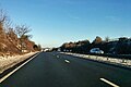
 A34 northbound - geograph.org.uk - 3341294.jpg 640 × 461; 36 KB
-
 A34 northbound - geograph.org.uk - 5637443.jpg 640 × 428; 88 KB
-
 A34 northbound - geograph.org.uk - 5637452.jpg 640 × 428; 90 KB
-
 A34 northbound - geograph.org.uk - 5637459.jpg 640 × 428; 76 KB
-
 A34 northbound - geograph.org.uk - 5637484.jpg 640 × 428; 76 KB
-
 A34 northbound - geograph.org.uk - 5637492.jpg 640 × 428; 83 KB
-
 A34 on Shrill Down - geograph.org.uk - 861499.jpg 640 × 427; 82 KB
-

-
 A34 southbound exit slip at Beedon - geograph.org.uk - 3103633.jpg 640 × 480; 47 KB
-
 A34 Southbound near Beedon - geograph.org.uk - 4147664.jpg 640 × 480; 217 KB
-
 Abingdon Lane Down - geograph.org.uk - 2550204.jpg 1,285 × 1,920; 221 KB
-
 All-weather gallop on Compton Downs - geograph.org.uk - 2637092.jpg 1,920 × 2,560; 524 KB
-
 Along the Old Wheat Road - geograph.org.uk - 5940528.jpg 4,733 × 3,387; 2.81 MB
-
 Approaching East Ilsley from the south - geograph.org.uk - 3528156.jpg 800 × 600; 107 KB
-
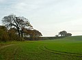
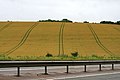
 Arable farmland with bank of trees - geograph.org.uk - 2692661.jpg 2,516 × 1,908; 678 KB
-
 Arable farmland with banks of trees - geograph.org.uk - 2691867.jpg 2,560 × 1,869; 547 KB
-
 Arable farmland with banks of trees - geograph.org.uk - 2691888.jpg 2,560 × 1,755; 687 KB
-
 Arable farmland with banks of trees - geograph.org.uk - 2691909.jpg 2,492 × 1,866; 747 KB
-
 Ashridge Wood OBH - geograph.org.uk - 4684858.jpg 3,808 × 2,544; 3.4 MB
-
 Ball Pit Road looking south - geograph.org.uk - 3528100.jpg 600 × 800; 110 KB
-
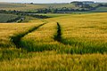
 Barley Field near East Ilsley - geograph.org.uk - 33276.jpg 640 × 480; 232 KB
-
 Barn and crash barrier - geograph.org.uk - 3048689.jpg 427 × 640; 78 KB
-
 Barn by bridleway - geograph.org.uk - 3528111.jpg 600 × 800; 136 KB
-
 Barn on Shrill Down - geograph.org.uk - 3044314.jpg 427 × 640; 63 KB
-
 Battle of Ashdown - geograph.org.uk - 5375821.jpg 1,024 × 768; 141 KB
-
 Beech tree, Dark Lane - geograph.org.uk - 2587610.jpg 1,920 × 2,560; 1.01 MB
-
 Bend in the Path - geograph.org.uk - 5374989.jpg 1,024 × 768; 327 KB
-
 Berkshire Downs Farmland - geograph.org.uk - 4035193.jpg 4,000 × 3,000; 2.9 MB
-
 Boham's Road - geograph.org.uk - 1155110.jpg 640 × 427; 220 KB
-
 Byway over the railway bridge - geograph.org.uk - 1155067.jpg 426 × 640; 146 KB
-

-
 Bridleway going east from junction - geograph.org.uk - 3528112.jpg 800 × 600; 180 KB
-
 Bridleway going south from Ball Pit Road - geograph.org.uk - 3528106.jpg 600 × 800; 181 KB
-
 Bridleway near East Ilsley - geograph.org.uk - 3688233.jpg 1,024 × 764; 183 KB
-
 Bridleway with barn - geograph.org.uk - 2565872.jpg 640 × 478; 66 KB
-
 Byway above East Ilsley - geograph.org.uk - 1585666.jpg 640 × 480; 170 KB
-
 Byway approaching the Ridgeway - geograph.org.uk - 2637071.jpg 1,920 × 2,440; 798 KB
-
 Byway beneath the A34, Shrill Down - geograph.org.uk - 496824.jpg 640 × 480; 171 KB
-
 Byway heading down to the A34 bridge - geograph.org.uk - 4790911.jpg 640 × 480; 72 KB
-
 Byway heading south-west to East Ilsley - geograph.org.uk - 6239706.jpg 1,024 × 769; 194 KB
-
 Byway heading to Woolvers Road - geograph.org.uk - 4791679.jpg 640 × 480; 140 KB
-
 Byway on Compton Downs, the Churn road - geograph.org.uk - 6239704.jpg 1,024 × 759; 195 KB
-
 Byway to Compton - geograph.org.uk - 1154627.jpg 640 × 427; 178 KB
-
 Byway to East Ilsley - geograph.org.uk - 1154617.jpg 640 × 427; 182 KB
-
 Byway to East Ilsley - geograph.org.uk - 1591944.jpg 640 × 427; 201 KB
-
 Byway, East Ilsley - geograph.org.uk - 902387.jpg 640 × 480; 162 KB
-
 Chalky Soil - geograph.org.uk - 3688241.jpg 1,600 × 1,200; 519 KB
-
 Changing Soil - geograph.org.uk - 3689163.jpg 1,600 × 1,231; 730 KB
-
 Chapel in East Ilsley - geograph.org.uk - 5459468.jpg 1,024 × 683; 175 KB
-
 Cherry Tree ^ Some Other Stuff - geograph.org.uk - 3688271.jpg 1,600 × 1,095; 559 KB
-
 Chilton Village - geograph.org.uk - 5376001.jpg 1,024 × 768; 89 KB
-
 Compton Downs - geograph.org.uk - 525933.jpg 640 × 480; 148 KB
-
 Compton Downs, downhill towards Churn - geograph.org.uk - 6240015.jpg 1,024 × 758; 143 KB
-
 Compton Hundred 1 - geograph.org.uk - 5375806.jpg 600 × 800; 92 KB
-
 Compton Hundred 2 - geograph.org.uk - 5375810.jpg 600 × 800; 91 KB
-
 Compton Hundred 3 - geograph.org.uk - 5375815.jpg 600 × 800; 87 KB
-
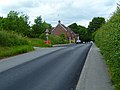
 Country road near East Ilsley - geograph.org.uk - 3640412.jpg 640 × 471; 134 KB
-
 Dark Lane - geograph.org.uk - 2572178.jpg 502 × 640; 71 KB
-
 Dead tree in the Buds - geograph.org.uk - 5375992.jpg 600 × 800; 203 KB
-
 Dennisford Road - geograph.org.uk - 2637087.jpg 1,225 × 1,117; 161 KB
-
 Dennisford Track Byway - geograph.org.uk - 881793.jpg 640 × 480; 95 KB
-
 Disappearing Ridgeway - geograph.org.uk - 5375989.jpg 1,024 × 768; 232 KB
-
 Diseased Trees - geograph.org.uk - 5376295.jpg 600 × 800; 208 KB
-
 Double bend sign on the A34 - geograph.org.uk - 3048602.jpg 640 × 415; 72 KB
-
 Downland flowers - geograph.org.uk - 2550266.jpg 1,920 × 2,249; 869 KB
-
 Downland View near East Ilsley - geograph.org.uk - 4035157.jpg 1,600 × 1,200; 517 KB
-
 Downland, East Ilsley, Berkshire - geograph.org.uk - 4627316.jpg 3,940 × 2,993; 2.11 MB
-
 Downs below Yew Tree Hill - geograph.org.uk - 1591949.jpg 640 × 427; 201 KB
-
 East Ilsley - geograph.org.uk - 5375803.jpg 1,024 × 768; 139 KB
-
 East Ilsley Baptist Church - geograph.org.uk - 1924666.jpg 3,296 × 2,472; 1.88 MB
-
 East Ilsley Baptist Church - geograph.org.uk - 3340575.jpg 2,604 × 3,652; 925 KB
-
 East Ilsley crossroads - geograph.org.uk - 1591957.jpg 640 × 427; 201 KB
-
 East Ilsley from the A34 - geograph.org.uk - 1160307.jpg 640 × 426; 104 KB
-
 East Ilsley Millennium Green - geograph.org.uk - 4035165.jpg 4,000 × 3,000; 3.4 MB
-
 East Ilsley Millennium Green - geograph.org.uk - 881767.jpg 640 × 480; 78 KB
-
 East Ilsley playground - geograph.org.uk - 1364671.jpg 640 × 480; 72 KB
-
 East Ilsley Pump Close Up - geograph.org.uk - 3352002.jpg 1,200 × 1,600; 790 KB
-
 East Ilsley Village - geograph.org.uk - 5450903.jpg 1,024 × 683; 136 KB
-
 East Ilsley village seen from Dennisford Road - geograph.org.uk - 2576632.jpg 2,381 × 1,581; 413 KB
-
 East Ilsley, Crown ^ Horns - geograph.org.uk - 5751459.jpg 1,024 × 768; 187 KB
-
 East Ilsley, UK - panoramio.jpg 3,264 × 2,448; 2.2 MB
-
 Electricity Cabinets by A34 - geograph.org.uk - 5679695.jpg 3,888 × 2,592; 2.35 MB
-
 Failed Bridleway - geograph.org.uk - 4035178.jpg 1,600 × 1,200; 651 KB
-
 Farm buildings on Dennisford Road - geograph.org.uk - 1656684.jpg 640 × 480; 97 KB
-
 Farm buildings on Dennisford Road - geograph.org.uk - 1656729.jpg 640 × 471; 40 KB
-
 Farmland - geograph.org.uk - 1364611.jpg 640 × 480; 76 KB
-
 Farmland between Dennisford Road and Thorndown - geograph.org.uk - 2691437.jpg 2,560 × 1,716; 375 KB
-
 Farmland, East Ilsley - geograph.org.uk - 2319926.jpg 640 × 480; 177 KB
-
 Farmland, East Ilsley - geograph.org.uk - 6186867.jpg 1,024 × 683; 154 KB
-
 Farmland, East Ilsley - geograph.org.uk - 6193981.jpg 1,024 × 683; 174 KB
-
 Farmland, West Ilsley - geograph.org.uk - 5987910.jpg 1,024 × 768; 303 KB
-
 Field and track on Nutfield Down - geograph.org.uk - 3048636.jpg 427 × 640; 72 KB
-

-
 Field entrance - geograph.org.uk - 2692058.jpg 1,920 × 2,476; 648 KB
-
 Field entrance and muck heap off Churn Road - geograph.org.uk - 2659507.jpg 2,249 × 1,920; 540 KB
-
 Field junction - geograph.org.uk - 2691960.jpg 2,387 × 1,827; 602 KB
-
 Field margins and banks - geograph.org.uk - 2691514.jpg 2,560 × 1,839; 615 KB
-
 Field near East Ilsley - geograph.org.uk - 3340569.jpg 1,500 × 1,000; 308 KB
-
 Field tracks and crash barrier - geograph.org.uk - 3048663.jpg 640 × 427; 70 KB
-
 Fields between East Ilsley and Compton - geograph.org.uk - 2636770.jpg 2,560 × 1,920; 516 KB
-
 Fields west of the A34 - geograph.org.uk - 2693427.jpg 640 × 480; 69 KB
-
 Fish Hill - geograph.org.uk - 2578140.jpg 640 × 569; 92 KB
-
 Flooded meadows in East Ilsley - geograph.org.uk - 3876303.jpg 640 × 455; 86 KB
-
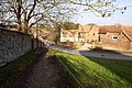 Footpath into the village - geograph.org.uk - 3346746.jpg 1,500 × 1,000; 270 KB
-
 Footpath through oilseed rape - geograph.org.uk - 3528144.jpg 600 × 800; 126 KB
-
 Footpath to Several Down - geograph.org.uk - 80324.jpg 640 × 481; 48 KB
-
 Footpath to the church - geograph.org.uk - 3346743.jpg 1,500 × 1,000; 229 KB
-
 From Gore Hill to Didcot - geograph.org.uk - 5375998.jpg 1,024 × 768; 139 KB
-
 Frozen field - geograph.org.uk - 1154606.jpg 640 × 427; 160 KB
-
 Frozen field - geograph.org.uk - 1154610.jpg 640 × 427; 188 KB
-
 Gate on Compton Downs just off The Ridgeway - geograph.org.uk - 6604220.jpg 1,024 × 768; 172 KB
-
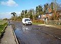 Groundwater Flooding On The Road - geograph.org.uk - 3352013.jpg 1,024 × 743; 247 KB
-
 Haydon Lane, East Ilsley - geograph.org.uk - 1652679.jpg 640 × 449; 56 KB
-
 Horse Riding - geograph.org.uk - 1894928.jpg 3,888 × 2,592; 4.66 MB
-
 House with a Well, East Ilsley - geograph.org.uk - 2557468.jpg 1,600 × 1,200; 440 KB
-
 Ilsley Down Riding Route - geograph.org.uk - 861383.jpg 640 × 427; 109 KB
-
 Ilsley Road runs across Compton Downs - geograph.org.uk - 4661814.jpg 1,500 × 999; 131 KB
-
 Ilsley Road south of Ilsley Barn Farm - geograph.org.uk - 2905464.jpg 3,410 × 2,488; 980 KB
-
 Ilsley Road south of Ilsley Down - geograph.org.uk - 2905314.jpg 3,554 × 2,381; 1.08 MB
-
 Ilsley Road to Compton - geograph.org.uk - 4661811.jpg 1,500 × 999; 143 KB
-
 Junction on Shrill Down - geograph.org.uk - 861480.jpg 640 × 427; 95 KB
-
 Kennet House, East Ilsley (geograph 4425988).jpg 4,320 × 3,240; 3.96 MB
-
 Kissing gate on the footpath - geograph.org.uk - 3346741.jpg 1,500 × 1,000; 334 KB
-
 Land near East Ilsley - geograph.org.uk - 3688223.jpg 1,024 × 768; 278 KB
-

-
 Little Ashridge Wood - geograph.org.uk - 2578168.jpg 480 × 640; 70 KB
-
 Little Ashridge Wood - geograph.org.uk - 2578170.jpg 640 × 480; 75 KB
-

-
 Looking back - geograph.org.uk - 5376153.jpg 1,024 × 768; 311 KB
-
 Looking back at the village - geograph.org.uk - 4035136.jpg 1,600 × 1,162; 653 KB
-
 Looking East - geograph.org.uk - 5450976.jpg 1,024 × 683; 148 KB
-
 Looking east off the Ridgeway at Bury Down - geograph.org.uk - 2236951.jpg 1,024 × 681; 177 KB
-
-
 Looking south on overgrown bridleway - geograph.org.uk - 3528139.jpg 800 × 678; 186 KB
-
 Lynchets on Windmill Hill - geograph.org.uk - 2603933.jpg 2,560 × 1,656; 313 KB
-
 Lynchets on Windmill Hill - geograph.org.uk - 2605197.jpg 2,560 × 1,920; 466 KB
-
 Manor Farm - geograph.org.uk - 1591954.jpg 640 × 426; 173 KB
-
 Mast in the Woods - geograph.org.uk - 5376293.jpg 1,024 × 768; 303 KB
-

-
 More warning - geograph.org.uk - 861533.jpg 640 × 427; 65 KB
-
 Move over Schladming - geograph.org.uk - 1155024.jpg 640 × 427; 165 KB
-
 Mural Panoramic - geograph.org.uk - 5374993.jpg 3,114 × 743; 461 KB
-
 No entry - geograph.org.uk - 3528145.jpg 800 × 600; 140 KB
-
 Off Green Hams Lane - geograph.org.uk - 861461.jpg 640 × 427; 53 KB
-
 Off Green Hams Lane - geograph.org.uk - 861468.jpg 640 × 427; 52 KB
-
 Old Railway Line - geograph.org.uk - 5376142.jpg 1,024 × 768; 103 KB
-
 Ordnance Survey Drawings - East Ilsley (OSD 158).jpg 3,163 × 4,000; 5.81 MB
-
 Out of the Cutting - geograph.org.uk - 5375975.jpg 1,024 × 768; 289 KB
-
 Parked Roller - geograph.org.uk - 2549613.jpg 3,216 × 2,380; 1.08 MB
-

-

-
 Path on Windmill Down - geograph.org.uk - 3689197.jpg 1,600 × 974; 479 KB
-
 Ploughing Match - geograph.org.uk - 2662114.jpg 2,560 × 1,920; 526 KB
-
 Poppies in the barley - geograph.org.uk - 861536.jpg 640 × 427; 89 KB
-
 Pot Head Scarecrow, East Ilsley - geograph.org.uk - 2537045.jpg 640 × 456; 113 KB
-

-

-
 Ridgeway approaching Gore Hill - geograph.org.uk - 1001868.jpg 640 × 480; 54 KB
-
 River Pang at East Ilsley - geograph.org.uk - 3352026.jpg 1,600 × 1,184; 794 KB
-

-
 River Pang Below East Ilsley - geograph.org.uk - 3352039.jpg 800 × 542; 104 KB
-
 River Pang Between E. Ilsley ^ Compton - geograph.org.uk - 3352044.jpg 1,024 × 722; 163 KB
-

-
 River Pang beyond the A34 - geograph.org.uk - 3876503.jpg 640 × 480; 72 KB
-

-

-

-

-

-

-
 River Pang in East Ilsley - geograph.org.uk - 3876290.jpg 640 × 480; 93 KB
-
 River Pang in East Ilsley - geograph.org.uk - 3878710.jpg 640 × 480; 95 KB
-
 River Pang in East Ilsley - geograph.org.uk - 3878759.jpg 640 × 480; 102 KB
-
 River Pang in East Ilsley - geograph.org.uk - 3878888.jpg 640 × 480; 89 KB
-
 River Pang leaving East Ilsley - geograph.org.uk - 3878940.jpg 640 × 480; 83 KB
-
 River Pang seen from Windmill Hill - geograph.org.uk - 3875174.jpg 640 × 485; 90 KB
-
 River Pang springs at Churn - geograph.org.uk - 3876359.jpg 640 × 463; 52 KB
-
 River Pang springs at Churn - geograph.org.uk - 3876364.jpg 640 × 468; 59 KB
-
 River Pang springs at Churn - geograph.org.uk - 3876367.jpg 640 × 496; 62 KB
-
 River Pang springs at Churn - geograph.org.uk - 3876375.jpg 640 × 463; 59 KB
-
 River Pang springs at Churn - geograph.org.uk - 3876405.jpg 640 × 466; 45 KB
-
 River Pang springs at Churn - geograph.org.uk - 3876412.jpg 640 × 475; 53 KB
-
 River Pang springs at East Ilsley - geograph.org.uk - 3875109.jpg 640 × 450; 57 KB
-
 River Pang springs at East Ilsley - geograph.org.uk - 3875117.jpg 640 × 480; 79 KB
-
 River Pang springs at East Ilsley - geograph.org.uk - 3875127.jpg 640 × 480; 72 KB
-
 River Pang springs in East Ilsley - geograph.org.uk - 3875105.jpg 640 × 443; 76 KB
-
 River Pang springs near Churn - geograph.org.uk - 3876428.jpg 640 × 428; 44 KB
-
 River Pang upstream of A34 - geograph.org.uk - 3860358.jpg 1,600 × 899; 251 KB
-
 Road Sign on the Ridgeway - geograph.org.uk - 5061756.jpg 3,338 × 2,221; 1.48 MB
-
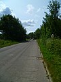
 Road to Stanmore - geograph.org.uk - 1722242.jpg 640 × 480; 67 KB
-
 Road to West Ilsley - geograph.org.uk - 3340570.jpg 1,500 × 1,000; 198 KB
-
 Rosehips Along Dark Lane - geograph.org.uk - 3689172.jpg 1,024 × 702; 170 KB
-
 Sheep fold - geograph.org.uk - 2572207.jpg 640 × 480; 118 KB
-
 Sheep pastures beside Dark Lane - geograph.org.uk - 2572190.jpg 640 × 464; 63 KB
-
 Short Track - geograph.org.uk - 1720481.jpg 1,024 × 768; 239 KB
-
 Sign for East Ilsley and Compton - geograph.org.uk - 1160304.jpg 426 × 640; 64 KB
-
 Sign on Shrill Down - geograph.org.uk - 861492.jpg 427 × 640; 109 KB
_-_geograph.org.uk_-_3937804.jpg)


.jpg)


.jpg)


