Category:Earthquakes of 2010
Jump to navigation
Jump to search
Wikimedia category | |||||
| Upload media | |||||
| Instance of | |||||
|---|---|---|---|---|---|
| Category combines topics | |||||
| Category contains | |||||
| |||||
Subcategories
This category has the following 20 subcategories, out of 20 total.
Media in category "Earthquakes of 2010"
The following 200 files are in this category, out of 239 total.
(previous page) (next page)-
2010 Bonin Islands Earthquake - Intensity Map.png 976 × 689; 400 KB
-
2010 Earthquakes.png 333 × 167; 83 KB
-
2010 etiopia earthquake.jpg 402 × 457; 61 KB
-
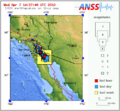
2010 Gulf of California earthquake.png 418 × 351; 91 KB
-
2010 Indiana earthquake.jpg 463 × 461; 149 KB
-
2010 Kaohsiung earthquake intensity USGS.jpg 612 × 721; 82 KB
-
2010 South Texas earthquake shakemap.jpg 612 × 703; 120 KB
-
2010 Southern California Earthquake Storm.PNG 500 × 461; 74 KB
-
3.6 US earthquake Jul162010.jpg 612 × 708; 120 KB
-
5.8 October 21 2010 Chile.jpg 612 × 710; 63 KB
-
6,5 Acre, Brazil earthquake shakemap.jpg 612 × 715; 159 KB
-
6.4 Honshu Japan, July 4, 2010.jpg 612 × 715; 84 KB
-
6.5 Andaman Islands earthquake map.jpg 612 × 719; 56 KB
-
7.2 Vanuatu earthquake.jpg 612 × 718; 59 KB
-
7.7 Nicobar Islands, India.jpg 612 × 715; 54 KB
-
Aftershocks20110225.png 1,160 × 730; 111 KB
-
Alertas sobre casa de adobe despues del terremoto de 2010 en Chanco.JPG 4,272 × 2,848; 2.92 MB
-
April 26, 2010 Taiwan Earthquake 0259 UTC.jpg 416 × 481; 61 KB
-
Earthquake distribution 2010.gif 574 × 435; 113 KB
-
Earthquake in Papua New Guinea magnitude 7, in August 2010.jpg 612 × 706; 76 KB
-
Greece 5.0 earthquake location map - USGS.jpg 409 × 532; 62 KB
-
Lolol, Chile aftershock location map.jpg 414 × 527; 72 KB
-
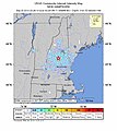
M 3.2 - New Hampshire.jpg 612 × 684; 278 KB
-
M 3.5 - 4km W of Hermosa Beach, CA.jpg 612 × 684; 97 KB
-
M 3.6 - 1km NW of Germantown, Maryland.jpg 612 × 718; 132 KB
-
M 3.7 - 5km SW of Manhattan Beach, CA.jpg 612 × 684; 98 KB
-
M 3.7 - off the east coast of the United States.jpg 612 × 684; 241 KB
-
M 3.8 - 8km NW of Village of Campton Hills, Illinois.jpg 612 × 718; 103 KB
-
M 3.8 - near the coast of South Australia.jpg 612 × 684; 159 KB
-
M 3.8 - Oklahoma.jpg 612 × 684; 75 KB
-
M 3.9 - 15km S of Camarillo, CA.jpg 612 × 684; 103 KB
-
M 3.9 - Central California.jpg 612 × 641; 94 KB
-
M 4.1 - 6km S of Redlands, CA.jpg 612 × 684; 103 KB
-
M 4.1 - Ethiopia.jpg 213 × 240; 11 KB
-
M 4.1 - Oklahoma.jpg 612 × 684; 78 KB
-
M 4.1 - San Francisco Bay area, California.jpg 612 × 644; 99 KB
-
M 4.2 - 56km WSW of Rosarito, B.C., MX.jpg 612 × 619; 96 KB
-
M 4.2 - Washington.jpg 612 × 684; 284 KB
-
M 4.3 - 4km N of Banning, CA.jpg 612 × 684; 125 KB
-
M 4.3 - 4km W of Beaumont, CA.jpg 612 × 684; 103 KB
-
M 4.3 - Henan, China.jpg 214 × 240; 10 KB
-
M 4.4 - 2km NE of Pico Rivera, CA.jpg 612 × 684; 104 KB
-
M 4.4 - 56km SW of Rosarito, B.C., MX.jpg 612 × 618; 96 KB
-
M 4.4 - Anatahan region, Northern Mariana Islands.jpg 283 × 317; 13 KB
-
M 4.4 - Guizhou, China.jpg 612 × 718; 136 KB
-
M 4.4 - Oklahoma.jpg 612 × 718; 118 KB
-
M 4.4 - Sichuan-Chongqing border region, China.jpg 216 × 239; 14 KB
-
M 4.4 - western Iran.jpg 269 × 304; 18 KB
-
M 4.5 - 15km NNW of Borrego Springs, CA.jpg 612 × 624; 184 KB
-
M 4.5 - 18km ESE of Ocotillo, CA.jpg 612 × 621; 160 KB
-
M 4.5 - 20km WNW of Progreso, B.C., MX.jpg 612 × 621; 161 KB
-
M 4.5 - 31km E of Primo Tapia, B.C., MX.jpg 612 × 619; 118 KB
-
M 4.5 - Punjab-Himachal Pradesh border region, India.jpg 612 × 718; 120 KB
-
M 4.5 - South Island of New Zealand.jpg 266 × 300; 17 KB
-
M 4.5 - western Xizang-India border region.jpg 283 × 316; 42 KB
-
M 4.6 - 18km W of Progreso, B.C., MX.jpg 612 × 621; 158 KB
-
M 4.6 - 19km ESE of Ocotillo, CA.jpg 612 × 621; 156 KB
-
M 4.6 - Hebei, China.jpg 217 × 244; 13 KB
-
M 4.6 - near the west coast of Honshu, Japan.jpg 285 × 318; 32 KB
-
M 4.6 - Rajasthan, India.jpg 612 × 718; 112 KB
-
M 4.6 - Region Metropolitana, Chile.jpg 612 × 684; 219 KB
-
M 4.6 - Southern Alaska.jpg 612 × 684; 250 KB
-
M 4.6 - Utah.jpg 612 × 684; 249 KB
-
M 4.7 - Nepal-India border region.jpg 266 × 300; 25 KB
-
M 4.7 - Pakistan.jpg 612 × 718; 131 KB
-
M 4.7 - Shanxi, China.jpg 282 × 318; 30 KB
-
M 4.7 - Sichuan-Chongqing border region, China.jpg 612 × 718; 133 KB
-
M 4.7 - South Island of New Zealand.jpg 214 × 240; 12 KB
-
M 4.8 - 19km ESE of Ocotillo, CA.jpg 612 × 621; 160 KB
-
M 4.8 - northern Sumatra, Indonesia.jpg 270 × 300; 13 KB
-
M 4.8 - South Island of New Zealand 2010-10-18.jpg 214 × 240; 13 KB
-
M 4.8 - South Island of New Zealand 2010-11-14.jpg 214 × 240; 13 KB
-
M 4.8 - South Island of New Zealand.jpg 214 × 240; 13 KB
-
M 4.8 - Southern Alaska.jpg 612 × 684; 270 KB
-
M 4.8 - Wyoming.jpg 612 × 684; 237 KB
-
M 4.9 - 17km WNW of Progreso, B.C., MX.jpg 612 × 718; 119 KB
-
M 4.9 - 19km ESE of Ocotillo, CA.jpg 612 × 718; 121 KB
-
M 4.9 - Nei Mongol-Shanxi border region, China.jpg 268 × 301; 17 KB
-
M 4.9 - offshore Valparaiso, Chile.jpg 283 × 318; 24 KB
-
M 4.9 - Sichuan-Yunnan-Guizhou region, China.jpg 612 × 717; 137 KB
-
M 4.9 - Southern Alaska.jpg 612 × 684; 273 KB
-
M 4.9 - western Iran.jpg 612 × 718; 137 KB
-
M 4.9 - Yunnan, China.jpg 282 × 318; 40 KB
-
M 5.0 - 20km ESE of Ocotillo, CA.jpg 612 × 621; 159 KB
-
M 5.0 - 20km S of Alberto Oviedo Mota, B.C., MX.jpg 612 × 718; 113 KB
-
M 5.0 - eastern Sichuan, China.jpg 214 × 240; 16 KB
-
M 5.0 - North Island of New Zealand.jpg 214 × 240; 11 KB
-
M 5.0 - Poland.jpg 612 × 719; 109 KB
-
M 5.0 - western Iran.jpg 612 × 718; 130 KB
-
M 5.0 - Yunnan, China.jpg 284 × 317; 43 KB
-
M 5.1 - eastern Honshu, Japan.jpg 266 × 300; 15 KB
-
M 5.1 - eastern Sichuan, China.jpg 612 × 718; 131 KB
-
M 5.1 - Ethiopia.jpg 612 × 717; 133 KB
-
M 5.1 - Java, Indonesia.jpg 612 × 717; 78 KB
-
M 5.1 - Puerto Rico.jpg 612 × 718; 58 KB
-
M 5.1 - southern Iran.jpg 266 × 300; 12 KB
-
M 5.2 - Nepal-India border region.jpg 612 × 718; 134 KB
-
M 5.2 - Pakistan.jpg 612 × 718; 130 KB
-
M 5.2 - southern Xinjiang, China.jpg 282 × 315; 41 KB
-
M 5.2 - Western Australia.jpg 612 × 718; 103 KB
-
M 5.2 - Yunnan, China.jpg 612 × 717; 139 KB
-
M 5.3 - 12km SW of Alberto Oviedo Mota, B.C., MX.jpg 612 × 619; 145 KB
-
M 5.3 - northern Algeria.jpg 612 × 718; 114 KB
-
M 5.4 - 12km WNW of Alberto Oviedo Mota, B.C., MX.jpg 612 × 619; 147 KB
-
M 5.4 - 20km NNW of Borrego Springs, CA.jpg 612 × 718; 118 KB
-
M 5.4 - 9km SW of Delta, B.C., MX.jpg 612 × 619; 145 KB
-
M 5.4 - Central Alaska.jpg 612 × 684; 216 KB
-
M 5.4 - Kyrgyzstan-Tajikistan-Xinjiang border region.jpg 214 × 240; 19 KB
-
M 5.4 - Ontario-Quebec border region, Canada.jpg 612 × 719; 128 KB
-
M 5.4 - southern Iran.jpg 612 × 718; 108 KB
-
M 5.4 - Sulawesi, Indonesia 2010-06-16.jpg 266 × 300; 14 KB
-
M 5.4 - Sulawesi, Indonesia.jpg 286 × 317; 25 KB
-
M 5.4 - Tajikistan.jpg 612 × 718; 148 KB
-
M 5.5 - northeastern Iran.jpg 612 × 718; 116 KB
-
M 5.5 - Serbia.jpg 612 × 718; 142 KB
-
M 5.5 - southern Iran.jpg 612 × 718; 111 KB
-
M 5.6 - central Afghanistan.jpg 612 × 718; 148 KB
-
M 5.6 - Guatemala.jpg 612 × 717; 137 KB
-
M 5.6 - near the east coast of Honshu, Japan.jpg 612 × 684; 189 KB
-
M 5.6 - Sucre, Venezuela.jpg 612 × 717; 96 KB
-
M 5.7 - 12km SSW of Estacion Coahuila, B.C., MX.jpg 612 × 619; 138 KB
-
M 5.7 - 8km ESE of Ocotillo, CA.jpg 612 × 718; 120 KB
-
M 5.7 - Hindu Kush region, Afghanistan.jpg 612 × 684; 247 KB
-
M 5.7 - Oaxaca, Mexico.jpg 612 × 717; 102 KB
-
M 5.7 - Ryukyu Islands, Japan.jpg 612 × 684; 108 KB
-
M 5.8 - Costa Rica.jpg 612 × 684; 229 KB
-
M 5.8 - northern Iran.jpg 612 × 718; 104 KB
-
M 5.8 - offshore Valparaiso, Chile.jpg 612 × 684; 208 KB
-
M 5.8 - Puerto Rico.jpg 612 × 684; 155 KB
-
M 5.8 - southern Iran.jpg 612 × 718; 99 KB
-
M 5.9 - 61km WSW of Ferndale, California.jpg 612 × 660; 97 KB
-
M 5.9 - Andaman Islands, India region.jpg 612 × 717; 56 KB
-
M 5.9 - Cayman Islands region.jpg 612 × 684; 136 KB
-
M 5.9 - Costa Rica.jpg 612 × 717; 88 KB
-
M 5.9 - Haiti region.jpg 612 × 717; 84 KB
-
M 5.9 - Libertador General Bernardo O'Higgins, Chile.jpg 612 × 718; 108 KB
-
M 5.9 - near the east coast of Honshu, Japan.jpg 612 × 684; 193 KB
-
M 5.9 - offshore El Salvador.jpg 612 × 684; 223 KB
-
M 5.9 - southern Iran.jpg 612 × 718; 126 KB
-
M 6.0 - Bio-Bio, Chile.jpg 612 × 684; 207 KB
-
M 6.0 - Costa Rica.jpg 612 × 717; 90 KB
-
M 6.0 - Haiti region.jpg 612 × 717; 86 KB
-
M 6.0 - Mindoro, Philippines.jpg 612 × 717; 84 KB
-
M 6.0 - northern Peru.jpg 612 × 684; 272 KB
-
M 6.0 - offshore Bio-Bio, Chile.jpg 612 × 718; 101 KB
-
M 6.0 - offshore Valparaiso, Chile.jpg 612 × 684; 201 KB
-
M 6.1 - central Peru.jpg 612 × 684; 254 KB
-
M 6.1 - offshore Bio-Bio, Chile.jpg 612 × 718; 95 KB
-
M 6.2 - Bougainville region, Papua New Guinea.jpg 214 × 240; 6 KB
-
M 6.2 - eastern New Guinea region, Papua New Guinea.jpg 612 × 717; 102 KB
-
M 6.2 - Kepulauan Barat Daya, Indonesia.jpg 215 × 241; 7 KB
-
M 6.2 - Maule, Chile.jpg 612 × 718; 121 KB
-
M 6.2 - near the coast of Tarapaca, Chile.jpg 612 × 717; 107 KB
-
M 6.2 - offshore Valparaiso, Chile.jpg 612 × 718; 104 KB
-
M 6.3 - Antofagasta, Chile 2010-07-12.jpg 265 × 300; 15 KB
-
M 6.3 - Antofagasta, Chile.jpg 215 × 244; 11 KB
-
M 6.3 - Atacama, Chile.jpg 612 × 718; 106 KB
-
M 6.3 - Bering Sea.jpg 284 × 318; 10 KB
-
M 6.3 - Bio-Bio, Chile.jpg 612 × 718; 100 KB
-
M 6.3 - Drake Passage.jpg 270 × 301; 9 KB
-
M 6.3 - Fiji region.jpg 612 × 717; 59 KB
-
M 6.3 - Hindu Kush region, Afghanistan.jpg 612 × 684; 308 KB
-
M 6.3 - Mariana Islands region.jpg 214 × 240; 4 KB
-
M 6.3 - Mauritius - Reunion region.jpg 214 × 240; 4 KB
-
M 6.3 - Molucca Sea.jpg 283 × 318; 19 KB
-
M 6.3 - near the east coast of Honshu, Japan.jpg 612 × 718; 83 KB
-
M 6.3 - New Britain region, Papua New Guinea 2010-08-15.jpg 284 × 317; 20 KB
-
M 6.3 - New Britain region, Papua New Guinea.jpg 612 × 717; 74 KB
-
M 6.3 - northern Mid-Atlantic Ridge.jpg 283 × 319; 14 KB
-
M 6.3 - Oaxaca, Mexico.jpg 612 × 717; 112 KB
-
M 6.3 - off the east coast of the Kamchatka Peninsula, Russia.jpg 266 × 300; 13 KB
-
M 6.3 - south of the Fiji Islands.jpg 266 × 300; 5 KB
-
M 6.3 - south of the Mariana Islands.jpg 266 × 300; 6 KB
-
M 6.3 - South Sandwich Islands region.jpg 214 × 240; 4 KB
-
M 6.3 - southern East Pacific Rise.jpg 212 × 241; 4 KB
-
M 6.3 - southwestern Ryukyu Islands, Japan.jpg 268 × 303; 9 KB
-
M 6.3 - Vanuatu.jpg 266 × 300; 8 KB
-
M 6.4 - Andreanof Islands, Aleutian Islands, Alaska 2010-10-08.jpg 282 × 318; 15 KB
-
M 6.4 - Andreanof Islands, Aleutian Islands, Alaska.jpg 283 × 317; 15 KB
-
M 6.4 - Near Islands, Aleutian Islands, Alaska.jpg 214 × 240; 5 KB
-
M 6.4 - Pacific-Antarctic Ridge.jpg 214 × 240; 4 KB
-
M 6.4 - south of the Fiji Islands.jpg 266 × 300; 4 KB
-
M 6.4 - Vanuatu.jpg 266 × 300; 8 KB
-
M 6.5 - Acre, Brazil.jpg 282 × 319; 18 KB
-
M 6.5 - Andaman Islands, India region.jpg 282 × 319; 17 KB
-
M 6.5 - Andreanof Islands, Aleutian Islands, Alaska.jpg 214 × 240; 5 KB
-
M 6.5 - Bering Sea.jpg 285 × 320; 10 KB
-
M 6.5 - eastern New Guinea region, Papua New Guinea.jpg 282 × 317; 24 KB
-
M 6.5 - near the east coast of Honshu, Japan.jpg 612 × 718; 92 KB
-
M 6.5 - southeast Indian Ridge.jpg 214 × 240; 4 KB
-
M 6.5 - southeast of Taiwan.jpg 283 × 319; 13 KB
-
M 6.5 - southeast of the Ryukyu Islands, Japan.jpg 612 × 684; 118 KB
-
M 6.5 - southern Sumatra, Indonesia.jpg 283 × 319; 19 KB
-
M 6.5 - Vanuatu.jpg 214 × 241; 7 KB
-
M 6.6 - Andaman Islands, India region.jpg 612 × 717; 57 KB
-
M 6.6 - Bio-Bio, Chile.jpg 612 × 718; 111 KB
-
M 6.6 - Mariana Islands region.jpg 282 × 316; 13 KB
-
M 6.6 - Moro Gulf, Mindanao, Philippines 2010-07-29.jpg 266 × 300; 11 KB
-
M 6.6 - Moro Gulf, Mindanao, Philippines.jpg 266 × 300; 12 KB
-
M 6.6 - near the north coast of Papua, Indonesia.jpg 612 × 717; 110 KB


