Category:Earley
Jump to navigation
Jump to search

town in Berkshire, England  | |||||
| Upload media | |||||
| Instance of | |||||
|---|---|---|---|---|---|
| Location | Wokingham, Berkshire, South East England, England | ||||
| Population |
| ||||
| official website | |||||
 | |||||
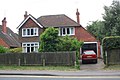
English: Earley is a town in Berkshire, England with a population of about 30,000 people. It is east of the town of Reading and is contiguous with it. It is part of [w:Wokingham (borough)
Nederlands: Earley (ook wel Erleigh en Erlegh) is een stad in het Engelse graafschap Berkshire. De stad ligt in het district Wokingham en telt 32.036 inwoners.
Polski: Earley - miasto w Wielkiej Brytanii, w Anglii, w regionie South East England, w hrabstwie Berkshire. W 2001r. miasto to zamieszkiwało 32 036 osób.
Română: Earley este un oraş în comitatul Berkshire, regiunea South East, Anglia. Oraşul se află în districtul unitar Wokingham.
Subcategories
This category has the following 10 subcategories, out of 10 total.
E
- Earley railway station (11 F)
F
H
M
- Maiden Erlegh Lake (1 F)
N
P
- Church of St Peter, Earley (3 F)
S
- Sol Joel Park (1 F)
T
W
Media in category "Earley"
The following 200 files are in this category, out of 490 total.
(previous page) (next page)-
 'Byways', Pepper Lane - geograph.org.uk - 4222976.jpg 1,024 × 683; 192 KB
-
 'Littlecot', Elm Road - geograph.org.uk - 4147181.jpg 1,024 × 683; 156 KB
-
 'The George' gets a new pub sign - geograph.org.uk - 4392794.jpg 1,024 × 683; 197 KB
-
 'The Poacher' public house - geograph.org.uk - 2495139.jpg 640 × 480; 90 KB
-
 1 - panoramio (29).jpg 2,592 × 1,936; 6.36 MB
-
 25, Church Road.jpg 2,661 × 1,995; 1.64 MB
-
 A footbridge along the 'Thames Path' - geograph.org.uk - 3438357.jpg 640 × 480; 162 KB
-
 A path between the Thames and Broken Brow - geograph.org.uk - 5276457.jpg 2,314 × 3,472; 2.5 MB
-
 A playground awaits its users - geograph.org.uk - 2584522.jpg 2,048 × 1,536; 1.36 MB
-
 A Reading Trolleybus at the Wokingham Road terminus (1) - geograph.org.uk - 2976504.jpg 1,473 × 1,232; 376 KB
-
 A Reading trolleybus at the Wokingham Road terminus (2) - geograph.org.uk - 3703139.jpg 1,471 × 1,232; 360 KB
-
 A327 Shinfield Road - geograph.org.uk - 6578014.jpg 1,024 × 684; 337 KB
-
 A327 Shinfield Road - geograph.org.uk - 6578020.jpg 1,024 × 684; 341 KB
-
 A329 crosses Loddon Bridge - geograph.org.uk - 6372783.jpg 1,024 × 512; 185 KB
-
 A329 service road Earley Reading - geograph.org.uk - 5501306.jpg 1,012 × 633; 248 KB
-
 A329 service road Earley Reading - geograph.org.uk - 5502505.jpg 863 × 577; 143 KB
-
 A329 service road Earley Reading - geograph.org.uk - 5502526.jpg 640 × 418; 114 KB
-
 A329 service road Earley Reading - geograph.org.uk - 5502549.jpg 3,648 × 2,736; 1.24 MB
-
 A329 Wokingham Road, Earley - geograph.org.uk - 6372804.jpg 1,024 × 684; 235 KB
-
 A329 Wokingham Road, Earley - geograph.org.uk - 6372808.jpg 1,024 × 684; 263 KB
-
 A329 Wokingham Road, Reading - geograph.org.uk - 6372816.jpg 1,024 × 684; 243 KB
-
 A329 Wokingham Road, Reading - geograph.org.uk - 6372820.jpg 1,024 × 684; 253 KB
-
 A3290 - geograph.org.uk - 4744201.jpg 640 × 426; 43 KB
-
 A3290 - geograph.org.uk - 4968848.jpg 640 × 426; 43 KB
-
 A4 - A3290 roundabout - geograph.org.uk - 3401252.jpg 640 × 398; 63 KB
-
 A4 - A3290 roundabout - geograph.org.uk - 3402450.jpg 639 × 422; 71 KB
-
 A4, London Rd - geograph.org.uk - 4744184.jpg 640 × 395; 46 KB
-
 A4, westbound - geograph.org.uk - 4744187.jpg 640 × 426; 44 KB
-
 A4, westbound - geograph.org.uk - 4744189.jpg 640 × 426; 55 KB
-
 A4, westbound - geograph.org.uk - 4744193.jpg 640 × 426; 42 KB
-
 Adelaide Road at the junction of Wykeham Road - geograph.org.uk - 4341909.jpg 2,560 × 1,920; 2 MB
-
 Adelaide Road, Earley - geograph.org.uk - 4341881.jpg 2,560 × 1,920; 1.98 MB
-
 Aftermath of house fire, Wilderness Road - geograph.org.uk - 3674455.jpg 2,288 × 1,712; 723 KB
-
 Allendale Road, Earley - geograph.org.uk - 1244565.jpg 640 × 428; 122 KB
-
 Andrews Road, Maiden Erlegh - geograph.org.uk - 630486.jpg 640 × 480; 111 KB
-
 Approaching the A4 on the A3290 - geograph.org.uk - 4450268.jpg 800 × 604; 147 KB
-
 Archway Lodge, University of Reading - geograph.org.uk - 4060471.jpg 1,024 × 683; 248 KB
-
 Au Morandarte Flickr Reading Buses 226 on Route 17, Earley Three Tuns (14777328676).jpg 3,888 × 2,592; 3.92 MB
-
 Bailey bridge across the River Loddon - geograph.org.uk - 4667882.jpg 1,600 × 1,200; 638 KB
-
 Barnsdale Road - geograph.org.uk - 3025777.jpg 3,648 × 2,736; 1.43 MB
-
 Benchmark at entrance to Old Whiteknights House - geograph.org.uk - 4127145.jpg 1,024 × 683; 250 KB
-
 Benchmark on 'Littlecot' - geograph.org.uk - 4147164.jpg 1,024 × 683; 209 KB
-
 Benchmark on Archway Lodge - geograph.org.uk - 4060456.jpg 683 × 1,024; 227 KB
-

-
 Benchmark on boundary wall of ^31 Shinfield Road - geograph.org.uk - 4121152.jpg 683 × 1,024; 335 KB
-
 Benchmark on Bridge 3424 - geograph.org.uk - 4232040.jpg 683 × 1,024; 268 KB
-
 Benchmark on building at Leighton Park School - geograph.org.uk - 4220625.jpg 674 × 1,024; 269 KB
-
-

-
 Benchmark on Earley Station - geograph.org.uk - 4173743.jpg 683 × 1,024; 261 KB
-

-
 Benchmark on garage of 'Byways' - geograph.org.uk - 4222962.jpg 683 × 1,024; 222 KB
-
 Benchmark on garage of ^116 Shinfield Road - geograph.org.uk - 4097226.jpg 658 × 1,024; 148 KB
-
 Benchmark on letter box beside Silverdale Road - geograph.org.uk - 4178870.jpg 1,024 × 652; 317 KB
-
 Benchmark on Mays Lane railway bridge - geograph.org.uk - 4170507.jpg 683 × 1,024; 279 KB
-
-

-
 Benchmark on railway bridge, Culver Lane - geograph.org.uk - 4163487.jpg 648 × 1,024; 281 KB
-
 Benchmark on wall beside Park House Lodge - geograph.org.uk - 4127176.jpg 682 × 1,024; 254 KB
-
 Benchmark on wall of Kenton Road - geograph.org.uk - 4178896.jpg 683 × 1,024; 350 KB
-
 Benchmark on ^1 Pitt's Lane - geograph.org.uk - 4395407.jpg 632 × 1,024; 179 KB
-
 Benchmark on ^11 Wellington Avenue - geograph.org.uk - 4097498.jpg 683 × 1,024; 152 KB
-
 Benchmark on ^111 Mays Lane - geograph.org.uk - 4170478.jpg 683 × 1,024; 275 KB
-
 Benchmark on ^119 Whiteknights Road - geograph.org.uk - 4202798.jpg 693 × 1,024; 251 KB
-
 Benchmark on ^129 Wilderness Road - geograph.org.uk - 4222999.jpg 683 × 1,024; 180 KB
-
 Benchmark on ^13 Maiden Erlegh Drive - geograph.org.uk - 4173389.jpg 1,024 × 634; 207 KB
-
 Benchmark on ^14 Mays Lane - geograph.org.uk - 4170643.jpg 1,024 × 683; 260 KB
-
 Benchmark on ^15 Green Road - geograph.org.uk - 4171237.jpg 683 × 1,024; 212 KB
-
 Benchmark on ^16 Betchworth Avenue - geograph.org.uk - 4178922.jpg 683 × 1,024; 244 KB
-
 Benchmark on ^17 The Parade - geograph.org.uk - 4178906.jpg 654 × 1,024; 296 KB
-
 Benchmark on ^172 Shinfield Road - geograph.org.uk - 4096156.jpg 683 × 1,024; 201 KB
-
 Benchmark on ^175 Church Road - geograph.org.uk - 4165529.jpg 659 × 1,024; 251 KB
-
 Benchmark on ^185 Beech Lane - geograph.org.uk - 4141355.jpg 683 × 1,024; 223 KB
-
 Benchmark on ^194 Shinfield Road - geograph.org.uk - 4096119.jpg 609 × 1,024; 165 KB
-
 Benchmark on ^227 Wokingham Road - geograph.org.uk - 4173622.jpg 666 × 1,024; 196 KB
-
 Benchmark on ^228 Shinfield Road - geograph.org.uk - 4095790.jpg 1,024 × 683; 198 KB
-
 Benchmark on ^26 Elm Road - geograph.org.uk - 4095749.jpg 683 × 1,024; 189 KB
-
 Benchmark on ^27 Wilderness Road - geograph.org.uk - 4202997.jpg 683 × 1,024; 262 KB
-
 Benchmark on ^342 Wokingham Road - geograph.org.uk - 4203053.jpg 683 × 1,024; 183 KB
-
 Benchmark on ^46 Shinfield Road - geograph.org.uk - 4125944.jpg 702 × 1,024; 183 KB
-
 Benchmark on ^51 Whiteknights Road - geograph.org.uk - 4171493.jpg 683 × 1,024; 187 KB
-
 Benchmark on ^528 Wokingham Road - geograph.org.uk - 4173873.jpg 683 × 1,024; 221 KB
-
 Benchmark on ^55 Pitt's Lane - geograph.org.uk - 4238131.jpg 683 × 1,024; 249 KB
-
 Benchmark on ^60 Stanhope Road - geograph.org.uk - 4094734.jpg 683 × 1,024; 210 KB
-
 Benchmark on ^66 Shinfield Road - geograph.org.uk - 4097235.jpg 656 × 1,024; 216 KB
-
 Benchmark on ^675 Oxford Road - geograph.org.uk - 4241357.jpg 683 × 1,024; 275 KB
-
 Benchmark on ^69 Wilderness Road - geograph.org.uk - 4178966.jpg 683 × 1,024; 260 KB
-
 Benchmark on ^82 Anderson Avenue - geograph.org.uk - 4163638.jpg 683 × 1,024; 241 KB
-
 Benchmark on ^89 Pitt's Lane - geograph.org.uk - 4236499.jpg 683 × 1,024; 224 KB
-
 Benchmark on ^9 Wilderness Road - geograph.org.uk - 4202945.jpg 683 × 1,024; 238 KB
-
 Benchmark on ^90 Elm Road - geograph.org.uk - 4095701.jpg 683 × 1,024; 239 KB
-
 Benchmark on ^94 Pitt's Lane - geograph.org.uk - 4236443.jpg 683 × 1,024; 166 KB
-
 Berkshire Physiotherapy Centre, Earley - geograph.org.uk - 4340428.jpg 2,560 × 1,920; 1.98 MB
-
 Betchworth Avenue, Woodley - geograph.org.uk - 4181898.jpg 3,904 × 2,309; 1.37 MB
-
 Boats moored at Kennetmouth - geograph.org.uk - 5695684.jpg 4,592 × 3,056; 3.7 MB
-
 Borough of Wokingham , M4 Motorway - geograph.org.uk - 5725481.jpg 6,000 × 4,000; 7.69 MB
-
 Borough of Wokingham , M4 Motorway - geograph.org.uk - 5725483.jpg 6,000 × 4,000; 6.77 MB
-
 Borough of Wokingham , M4 Motorway - geograph.org.uk - 5725484.jpg 6,000 × 4,000; 6.01 MB
-
 Borough of Wokingham , M4 Motorway - geograph.org.uk - 5725485.jpg 4,000 × 6,000; 7.8 MB
-
 Borough of Wokingham , M4 Motorway - geograph.org.uk - 5725488.jpg 5,744 × 3,829; 5.74 MB
-
 Borough of Wokingham , M4 Motorway - geograph.org.uk - 5725489.jpg 5,616 × 3,744; 7.86 MB
-
 Borough of Wokingham , M4 Motorway - geograph.org.uk - 5725490.jpg 6,000 × 4,000; 6.41 MB
-

-
 Brakes Warehouse, London Road - geograph.org.uk - 3693952.jpg 1,600 × 1,063; 304 KB
-
 Bridge 3424 over Shepherd's House Lane - geograph.org.uk - 4232063.jpg 683 × 1,024; 228 KB
-
 Bridge Art - geograph.org.uk - 2325356.jpg 10,891 × 2,314; 2.66 MB
-
 Bridge carrying Mays Lane over railway - geograph.org.uk - 4170556.jpg 1,024 × 683; 174 KB
-
 Bridge over the A4 - geograph.org.uk - 4744194.jpg 640 × 385; 41 KB
-
 Bridge taking a gas pipe - geograph.org.uk - 3569049.jpg 640 × 424; 112 KB
-
 Bridge taking railway over Culver Lane - geograph.org.uk - 4163522.jpg 1,024 × 683; 213 KB
-
 Building at Leighton Park School - geograph.org.uk - 4220684.jpg 1,024 × 683; 201 KB
-
 Burst water main, Wilderness Road, Earley - geograph.org.uk - 1851422.jpg 1,024 × 683; 185 KB
-
 Bus shelter developing a green roof - geograph.org.uk - 3129064.jpg 4,608 × 3,456; 3.56 MB
-
 Bus stop on Cutbush Lane - geograph.org.uk - 3487710.jpg 800 × 563; 89 KB
-
 Business Park Lake - geograph.org.uk - 3880115.jpg 1,600 × 1,163; 484 KB
-
 Busy Sports Field - geograph.org.uk - 3751968.jpg 1,024 × 687; 100 KB
-
 Cannock Way, Earley - geograph.org.uk - 6673570.jpg 1,024 × 683; 204 KB
-

-
 Cattle grazing near Sindlesham Mill - geograph.org.uk - 6488574.jpg 6,000 × 4,000; 6.83 MB
-
 Cavity in Auckland Road - geograph.org.uk - 4180440.jpg 3,760 × 2,776; 1.7 MB
-
 Chalfont Park - panoramio.jpg 4,000 × 3,000; 2.91 MB
-
 Church Lane and Brooker's Hill - geograph.org.uk - 1466559.jpg 640 × 480; 54 KB
-
 Church Road at the junction of St Peter's Road - geograph.org.uk - 4340242.jpg 2,560 × 1,920; 1.99 MB
-
 Church Road Bridge, A3290 - geograph.org.uk - 4744203.jpg 640 × 426; 48 KB
-
 Church Road railway bridge - geograph.org.uk - 4223931.jpg 1,024 × 683; 240 KB
-
 Church Road, Earley - geograph.org.uk - 4341458.jpg 2,560 × 1,920; 1.98 MB
-
 Church Road, Earley - geograph.org.uk - 4341975.jpg 2,560 × 1,920; 1.99 MB
-
 Clarendon Road, Reading - geograph.org.uk - 4341455.jpg 2,560 × 1,920; 1.96 MB
-
 Coca Coma - geograph.org.uk - 3840814.jpg 1,600 × 1,200; 433 KB
-
 Costa on Suttons Park Avenue, Earley - geograph.org.uk - 6295556.jpg 1,868 × 1,198; 1.52 MB
-

-
 Crossing the River Loddon, from the railway - geograph.org.uk - 5779333.jpg 1,156 × 1,600; 227 KB
-
 Cutbush Lane Bridge, M4 - geograph.org.uk - 5219396.jpg 640 × 426; 48 KB
-
 Cyclists on Rushey Way, Lower Earley - geograph.org.uk - 6488573.jpg 6,000 × 4,000; 7.66 MB
-
 Deflated gasholder - geograph.org.uk - 4946904.jpg 640 × 426; 38 KB
-
 Double rainbow over Park House - geograph.org.uk - 2123563.jpg 640 × 480; 82 KB
-

-
 Earley , A3290 Sliproad - geograph.org.uk - 6262208.jpg 4,608 × 3,456; 4.95 MB
-
 Earley , London Road A4 - geograph.org.uk - 6262211.jpg 4,608 × 3,456; 5.07 MB
-
 Earley , London Road A4 - geograph.org.uk - 6262212.jpg 4,608 × 3,456; 4.57 MB
-
 Earley , London Road A4 - geograph.org.uk - 6265102.jpg 4,608 × 3,456; 5.7 MB
-
 Earley , Rosedale Crescent - geograph.org.uk - 6265105.jpg 4,608 × 3,456; 5.05 MB
-
 Earley , Shepherd's House Lane - geograph.org.uk - 6265100.jpg 4,608 × 3,456; 4.63 MB
-
 Earley , Shepherd's House Lane - geograph.org.uk - 6265103.jpg 4,608 × 3,456; 7.31 MB
-
 Earley , Shepherd's House Lane - geograph.org.uk - 6265106.jpg 4,608 × 3,456; 5.26 MB
-
 Earley , Suttons Business Park - geograph.org.uk - 6262213.jpg 4,608 × 3,456; 4.77 MB
-
 Earley , Suttons Park Avenue - geograph.org.uk - 6265099.jpg 4,608 × 3,456; 4.42 MB
-
 Earley - geograph.org.uk - 8186.jpg 640 × 428; 221 KB
-

-
 Earley Home Guard Social Club - geograph.org.uk - 6533803.jpg 5,523 × 3,682; 4.2 MB
-
 Earley Power Station - geograph.org.uk - 5502575.jpg 1,115 × 743; 306 KB
-
-
 Earley Station - geograph.org.uk - 4340104.jpg 2,560 × 1,920; 1.97 MB
-
 Earley Station - geograph.org.uk - 4340413.jpg 2,560 × 1,920; 1.98 MB
-
 Earley Station - geograph.org.uk - 4968833.jpg 640 × 426; 93 KB
-
 Earley Station - geograph.org.uk - 4968836.jpg 640 × 426; 95 KB
-
 Earley Station - geograph.org.uk - 4968837.jpg 640 × 426; 87 KB
-
 Earley, UK - panoramio (1).jpg 2,592 × 1,936; 2.03 MB
-
 Earley, UK - panoramio (2).jpg 4,896 × 3,672; 5.16 MB
-
 Earley, UK - panoramio (3).jpg 4,896 × 3,672; 6.42 MB
-
 Earley, UK - panoramio (4).jpg 4,896 × 3,672; 6.72 MB
-
 Earley, UK - panoramio (5).jpg 2,658 × 1,431; 1.71 MB
-
 Earley, UK - panoramio (6).jpg 4,000 × 2,992; 4.03 MB
-
 Earley, UK - panoramio (7).jpg 4,032 × 3,024; 4.36 MB
-
 Earley, UK - panoramio (8).jpg 4,000 × 2,992; 4.14 MB
-
 Earley, UK - panoramio.jpg 2,592 × 1,936; 3.46 MB
-

-
-
 Elm Lane in Lower Earley - geograph.org.uk - 4260514.jpg 1,500 × 987; 194 KB
-
 Elm Road in Reading - geograph.org.uk - 3941683.jpg 1,500 × 989; 115 KB
-
 Ennerdale Road - geograph.org.uk - 3025751.jpg 3,536 × 2,664; 1.44 MB
-
 Entering Earley from the West - geograph.org.uk - 869811.jpg 640 × 480; 85 KB
-
 Entering the 20 Zone - geograph.org.uk - 4180622.jpg 4,000 × 3,000; 2.51 MB
-
 Farmland off Cutbush Lane - geograph.org.uk - 17633.jpg 640 × 480; 406 KB
-
 Feebl, Vigoe, Shadee and Voice - geograph.org.uk - 3840823.jpg 1,600 × 1,096; 452 KB
-
 Fields before Lower Earley development - geograph.org.uk - 5502562.jpg 784 × 515; 172 KB
-
 Flooding at Kennet Mouth in 1989 - geograph.org.uk - 5276460.jpg 3,472 × 2,314; 1.8 MB
-
 Footpath next to Whiteknights Lake - geograph.org.uk - 2160577.jpg 640 × 480; 106 KB
-
 Footpath towards lake - geograph.org.uk - 2160580.jpg 640 × 480; 89 KB
-
 Former Hilltop Christian Centre - geograph.org.uk - 3693985.jpg 1,600 × 1,169; 360 KB
-
 Gasholder - geograph.org.uk - 5024783.jpg 640 × 426; 50 KB
-

-
 Geese grazing beside the River Thames - geograph.org.uk - 5927777.jpg 1,024 × 683; 157 KB
-
 Graffham Close, Lower Earley - geograph.org.uk - 4516903.jpg 4,000 × 2,664; 3.61 MB
-
 Grass - geograph.org.uk - 1588328.jpg 640 × 480; 65 KB
-
 Gravel Pits - geograph.org.uk - 5171074.jpg 3,264 × 2,448; 1.7 MB
-
 Great Western Main line - geograph.org.uk - 4897416.jpg 640 × 426; 88 KB
-

-
 Herbs and spices - geograph.org.uk - 2584536.jpg 640 × 480; 69 KB
-
 Hilltop Road, Woodley - geograph.org.uk - 3693991.jpg 1,600 × 1,121; 352 KB
-
 Hopkins building from the north - geograph.org.uk - 2114268.jpg 640 × 480; 77 KB
-
 House on Church Road, Earley - geograph.org.uk - 4340678.jpg 2,560 × 1,920; 1.98 MB
-
 House on Station Road, Earley - geograph.org.uk - 4340417.jpg 2,560 × 1,920; 1.98 MB
-
 House on Wokingham Road, Earley - geograph.org.uk - 4857289.jpg 2,048 × 1,536; 1.48 MB
-
 Houses near a bit of Park - geograph.org.uk - 3747362.jpg 1,024 × 662; 127 KB
-
 Houses on Mays Lane - geograph.org.uk - 4170495.jpg 1,024 × 683; 194 KB
-
 Houses on Wokingham Road, Winnersh - geograph.org.uk - 4341832.jpg 2,560 × 1,920; 2 MB
-
 Housing Development,Lower Early - geograph.org.uk - 2793231.jpg 578 × 640; 89 KB
-
 ING Direct UK, Reading - geograph.org.uk - 2860605.jpg 4,288 × 3,216; 7.14 MB
-
 Joining the A3290 - geograph.org.uk - 4744200.jpg 640 × 426; 40 KB


.jpg)


_-_geograph.org.uk_-_2976504.jpg)
_-_geograph.org.uk_-_3703139.jpg)


.jpg)


.jpg)
.jpg)
.jpg)
.jpg)
.jpg)
.jpg)
.jpg)
.jpg)


