Category:ETH-BIB Leo Wehrli - JU
Jump to navigation
Jump to search
Media in category "ETH-BIB Leo Wehrli - JU"
The following 92 files are in this category, out of 92 total.
-
ETH-BIB-Ajoie Übersicht von Pkt.777, Süden Rot-…?- -?--Dia 247-15559.tif 3,615 × 2,636; 27.37 MB
-
ETH-BIB-Bitum Liasschieferhaufen bei Kete 672, Hintergrund Mont Terri-Dia 247-15625.tif 3,638 × 2,744; 28.68 MB
-
ETH-BIB-Boncourt, gegen Vogesen-Dia 247-09315.tif 3,699 × 2,728; 9.71 MB
-
ETH-BIB-Buix, Allaine-Brücke, abwärts-Dia 247-09311.tif 3,758 × 2,745; 9.92 MB
-
ETH-BIB-Buix, von Süden-Dia 247-09310.tif 3,716 × 2,768; 9.89 MB
-
ETH-BIB-Choindez, von Süden-Dia 247-07828.tif 3,634 × 2,798; 9.78 MB
-
ETH-BIB-Courgenay, Courtemautruy von Süden-Dia 247-15623.tif 3,632 × 2,685; 28 MB
-
ETH-BIB-Courgenay, Pierrepercée (Menhir)-Dia 247-09846.tif 3,792 × 2,568; 9.36 MB
-
ETH-BIB-Courtedoux, neue Steinschwelle und alte Schalten im Courtedoux-Dia 247-13879.tif 3,644 × 2,734; 28.63 MB
-
ETH-BIB-Courtedoux, von Süden-Dia 247-13878.tif 3,606 × 2,818; 9.75 MB
-
ETH-BIB-Courtemaîche, Grundwasser Bohrung bei Bhf.-Dia 247-15563.tif 3,630 × 2,685; 28 MB
-
ETH-BIB-Courtemaîche, Grundwasser Bohrung bei Bhf.-Dia 247-15564-1.tif 3,649 × 2,685; 9.43 MB
-
ETH-BIB-Courtemaîche, Hand-Bohrung am Bahndamm-Dia 247-15565.tif 3,641 × 2,813; 29.41 MB
-
ETH-BIB-Courtemaîche, Hand-Bohrung am Bahndamm-Dia 247-15566.tif 3,653 × 2,739; 28.73 MB
-
ETH-BIB-Courtemaîche, Pierre percés von Süden-Dia 247-15567.tif 3,603 × 2,744; 9.5 MB
-
ETH-BIB-Courtemaîche, Rohr-Schacht-Dia 247-15564.tif 3,657 × 2,739; 28.76 MB
-
ETH-BIB-Creugenat abwärts mit Brücke der Landstrasse-Dia 247-13874.tif 3,654 × 2,793; 29.31 MB
-
ETH-BIB-Creugenat aufwärts mit Schwelle und Courtedoux-Dia 247-13875.tif 2,990 × 3,439; 29.5 MB
-
ETH-BIB-Creugenat aus Pruntrut aufwärts-Dia 247-15192.tif 3,636 × 2,654; 27.72 MB
-
ETH-BIB-Creugenat mit Stein-Schwelle von Norden-Dia 247-13876.tif 3,623 × 2,798; 29.11 MB
-
ETH-BIB-Creugenat nach Westen von 250m westlich, Courtedoux-Dia 247-15193.tif 3,612 × 2,720; 28.21 MB
-
ETH-BIB-Creugenat Schwelle und Schalten von Nordost, von Courtedoux-Dia 247-13877.tif 3,617 × 2,828; 29.37 MB
-
ETH-BIB-Creugenat, querüber vom Café du Creugenat bei Coutedoux-Dia 247-15195.tif 3,616 × 2,731; 28.36 MB
-
ETH-BIB-Creugenat-Brücke bei Courtedoux abwärts-Dia 247-13881.tif 3,607 × 2,739; 28.37 MB
-
ETH-BIB-Creugenat-Brücke bei Courtedoux aufwärts-Dia 247-13880.tif 3,629 × 2,808; 29.25 MB
-
ETH-BIB-Doubs abwärts vom Zollhaus Réclère-Dia 247-15558.tif 3,068 × 3,386; 29.87 MB
-
ETH-BIB-Doubs abwärts von südl. ab St. Ursanne (gegen W.)-Dia 247-08446.tif 3,604 × 2,794; 9.68 MB
-
ETH-BIB-Doubs bei St. Ursanne, aufwärts-Dia 247-09307.tif 3,652 × 2,816; 9.88 MB
-
ETH-BIB-Doubs und St. Ursanne, abwärts-Dia 247-09306.tif 3,646 × 2,698; 9.45 MB
-
ETH-BIB-Etang de la Gruyère -i.e. Gruère-, gegen Ost-Arm mit Kühen-Dia 247-14533.tif 3,699 × 2,781; 29.52 MB
-
ETH-BIB-Etang de la Gruyère -i.e. Gruère-, Kuh-Dia 247-14534.tif 3,128 × 3,446; 30.99 MB
-
ETH-BIB-Etang de la Gruyère -i.e. Gruère-, mit Kuh-Dia 247-14532.tif 3,723 × 2,840; 30.38 MB
-
ETH-BIB-Etang de la Gruyère -i.e. Gruère-, Südwestlicher Zipfel östlicher Teil-Dia 247-14531.tif 3,711 × 2,804; 29.91 MB
-
ETH-BIB-Etang de la Gruyère -i.e. Gruère-, Südöstlicher Zipfel von Süd-Südwest-Dia 247-14530.tif 3,652 × 2,763; 28.99 MB
-
ETH-BIB-Etang de la Gruyère, Waldidyll von der Strasse-Dia 247-14529.tif 3,051 × 3,446; 30.23 MB
-
ETH-BIB-Glovelier, Sorne-Klus-Eingang, von Norden-Dia 247-14514.tif 3,022 × 3,399; 29.5 MB
-
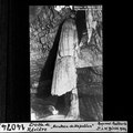
ETH-BIB-Grotte de Réclaire, "Manteau de Napoléon"-Dia 247-14074.tif 3,056 × 3,067; 9.01 MB
-
ETH-BIB-Grotte de Réclère, "Dôme de Milan"-Dia 247-14073.tif 3,195 × 3,054; 9.41 MB
-
ETH-BIB-Grotte de Réclère, "Les Stalagmites"-Dia 247-14075.tif 3,660 × 2,645; 9.34 MB
-
ETH-BIB-Grotte de Réclère, Entrée-Dia 247-14070.tif 2,967 × 3,320; 9.5 MB
-
ETH-BIB-Grottes de Milandre "Montagne des Aiguilles"-Dia 247-12517.tif 3,681 × 2,722; 9.65 MB
-
ETH-BIB-Grottes de Milandre, Entré-Dia 247-09314.tif 3,746 × 2,751; 9.93 MB
-
ETH-BIB-Les Rangiers, "Sentinelle"-Dia 247-07800.tif 3,605 × 2,757; 9.56 MB
-
ETH-BIB-Mont Terri von Südwest, davor Derrière Mont Torri-Dia 247-15624.tif 3,598 × 2,734; 28.25 MB
-
ETH-BIB-Moulin Milandre, Allaine abwärts-Dia 247-09313.tif 3,711 × 2,669; 9.52 MB
-
ETH-BIB-Porrentruy Beuchire Quelle von Südwest, versiegend-Dia 247-15562.tif 3,615 × 2,626; 27.27 MB
-
ETH-BIB-Porrentruy Botanischer Garten-Dia 247-15568.tif 3,057 × 3,377; 29.67 MB
-
ETH-BIB-Porrentruy, Allaine aufwärts und Schloss-Dia 247-13869.tif 3,615 × 2,823; 29.31 MB
-
ETH-BIB-Porrentruy, Allaine Creugenat-Dia 247-15561.tif 3,586 × 2,626; 27.09 MB
-
ETH-BIB-Porrentruy, Creugenat aufwärts-Dia 247-13873.tif 3,079 × 3,346; 29.6 MB
-
ETH-BIB-Porrentruy, Creugenatmündung zur Allaine-Dia 247-13871.tif 3,616 × 2,813; 9.77 MB
-
ETH-BIB-Porrentruy, Porte de France-Dia 247-13870.tif 2,954 × 3,451; 29.26 MB
-
ETH-BIB-Porrentruy, Rue du Marché von Norden-Dia 247-13872.tif 3,617 × 2,852; 9.96 MB
-
ETH-BIB-Porrentruy, vergraste Atlaine abwärts von der Brücke Norden, Bhf.-Dia 247-15560.tif 3,609 × 2,690; 27.91 MB
-
ETH-BIB-Pruntrut, Gasse mit Thor von Süden-Dia 247-09848.tif 3,126 × 3,456; 10.41 MB
-
ETH-BIB-Pruntrut, Schloss von Süden-Dia 247-09847.tif 3,840 × 2,808; 10.37 MB
-
ETH-BIB-Ruine, Milandre bei Buix-Dia 247-09312.tif 3,758 × 2,692; 9.72 MB
-
ETH-BIB-Sobey, von der Doubs-Brücke aufwärts (nach W)-Dia 247-08447.tif 3,704 × 2,836; 10.11 MB
-
ETH-BIB-Sorne-Klus, abwärts-Dia 247-14521.tif 3,128 × 3,446; 30.97 MB
-
ETH-BIB-Sorne-Klus, abwärts-Dia 247-14522.tif 3,104 × 3,446; 30.75 MB
-
ETH-BIB-St. Ursanne von Norden-Dia 247-09849.tif 3,648 × 2,454; 8.61 MB
-
ETH-BIB-St. Ursanne, Bahnviadukt Loreto-Dia 247-15570.tif 3,604 × 2,729; 28.27 MB
-
ETH-BIB-St. Ursanne, Doubs-Brücke vom linken Ufer, aufwärts-Dia 247-09853.tif 3,666 × 2,760; 9.74 MB
-
ETH-BIB-St. Ursanne, Kreuzgang (Ecke)-Dia 247-09851.tif 3,654 × 2,784; 9.78 MB
-
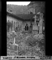
ETH-BIB-St. Ursanne, Kreuzgang mit Friedhof-Dia 247-09850.tif 3,600 × 2,790; 9.66 MB
-
ETH-BIB-St. Ursanne, Kreuzgang-Dia 247-15571.tif 3,616 × 2,685; 9.34 MB
-
ETH-BIB-St. Ursanne, Kreuzgang-Dia 247-15572.tif 2,938 × 3,386; 9.58 MB
-
ETH-BIB-St. Ursanne, Nepomuk-Dia 247-15573.tif 3,026 × 3,458; 30.05 MB
-
ETH-BIB-St. Ursanne, Ost-Thor von Westen-Dia 247-09855.tif 3,666 × 2,748; 9.7 MB
-
ETH-BIB-St. Ursanne, vom Bahnhof, Doubs abwärts-Dia 247-09308.tif 3,699 × 2,739; 9.74 MB
-
ETH-BIB-St. Ursanne, von Süden (Doubs)-Dia 247-08445.tif 3,600 × 2,812; 9.74 MB
-
ETH-BIB-St. Ursanne,südliches Seitenportal der Kirche-Dia 247-09854.tif 3,102 × 3,648; 10.87 MB
-
ETH-BIB-St.Ursanne vom Bahnhof Doubs abwärts-Dia 247-15569.tif 3,677 × 2,744; 28.98 MB
-
ETH-BIB-Trou du Creugenat auf 250m Distanz, vom Strassenwinkel-Dia 247-15194.tif 3,600 × 2,625; 27.14 MB
-
ETH-BIB-Trou du Creugenat aus halber Tiefe von Westen abwärts-Dia 247-15627.tif 3,620 × 2,739; 28.51 MB
-
ETH-BIB-Trou du Creugenat mit VHS Zürich-Dia 247-15922.tif 3,629 × 2,621; 27.34 MB
-
ETH-BIB-Trou du Creugenat, Situation von Nordost-Dia 247-13886.tif 3,655 × 2,833; 29.73 MB
-
ETH-BIB-Trou du Creugenat, von Norden-Dia 247-13885.tif 3,630 × 2,823; 29.43 MB
-
ETH-BIB-Trou du Creugenat, von Nordwest-Dia 247-13882.tif 3,644 × 2,798; 29.27 MB
-
ETH-BIB-Trou du Creugenat, zur Tiefe-Dia 247-13884.tif 3,026 × 3,482; 30.24 MB
-
ETH-BIB-Undervelier Forges, altes Birs Barrage, abwärts-Dia 247-14517.tif 3,664 × 2,798; 29.45 MB
-
ETH-BIB-Undervelier, Forges, Vergraster, Kanal Rest Auslauf-Dia 247-14516.tif 3,634 × 2,781; 29.02 MB
-
ETH-BIB-Undervelier, Forges, von Norden-Dia 247-14515.tif 3,708 × 2,778; 29.58 MB
-
ETH-BIB-Undervelier, Grotte de Ste Colombe, Crucifix-Dia 247-14519.tif 3,010 × 3,452; 9.99 MB
-
ETH-BIB-Undervelier, Grotte de Ste Colombe, von der Strasse-Dia 247-14518.tif 3,664 × 2,781; 29.27 MB
-
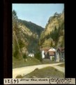
ETH-BIB-Undervelier, Sorne-Schlucht Eingang, aufwärts-Dia 247-14520.tif 3,193 × 3,440; 31.52 MB
-
ETH-BIB-Von Côte 643 sür Courtemautruy gegen 672 nach Ost-Südost-Dia 247-15626.tif 3,624 × 2,685; 27.96 MB


