Category:Dutch-language maps showing history
Jump to navigation
Jump to search
Subcategories
This category has the following 2 subcategories, out of 2 total.
E
Media in category "Dutch-language maps showing history"
The following 35 files are in this category, out of 35 total.
-
1729 Schryver Map of Israel showing 12 Tribes - Geographicus - Israel-schryver-1729.jpg 1,667 × 3,000; 1.09 MB
-
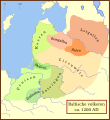
Balten 1200.svg 1,003 × 1,096; 338 KB
-
De Levant.PNG 922 × 991; 210 KB
-
Filistijnse pentapolis.png 601 × 488; 43 KB
-
Groot-Bulgaarse Rijk (650-922).PNG 752 × 591; 37 KB
-
Hannibal route of invasion-nl.png 762 × 476; 177 KB
-
Harta Ocean Indian Quake-nl.png 795 × 640; 47 KB
-
Igala.jpeg 579 × 374; 165 KB
-
Kaart Oude Egypte.jpg 336 × 599; 34 KB
-
Kaart van de diadochenrijken (300 v. Chr.).PNG 2,000 × 961; 1.71 MB
-
Kwararafa.jpeg 425 × 334; 131 KB
-
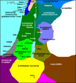
Levant 830-nl.PNG 544 × 593; 26 KB
-
Levant close.PNG 1,049 × 725; 272 KB
-
Levant midden waterwegen.JPG 2,666 × 2,895; 1.2 MB
-
Levant Neolithicum.JPG 3,476 × 1,865; 1,000 KB
-
Levant Situeringskaart.JPG 2,691 × 3,089; 1.27 MB
-
Lohn kaartje.png 799 × 396; 114 KB
-
Map Crusader states 1190-nl.svg 978 × 1,330; 1.04 MB
-
Map of Rome and Carthage at the start of the Second Punic War-nl.png 1,920 × 1,382; 584 KB
-
Middenrijk.png 398 × 599; 148 KB
-
Nederlanden 1593-1595 VIE-ERK.PNG 639 × 880; 369 KB
-
Nederlanden 1593-1595.PNG 639 × 880; 422 KB
-
Nieuwe Rijk.PNG 432 × 646; 68 KB
-
NriEnIgbo.jpeg 626 × 401; 179 KB
-
Nupe.jpeg 649 × 537; 250 KB
-
Ordensland-1410.svg 660 × 626; 401 KB
-
Oude Rijk.PNG 438 × 670; 54 KB
-
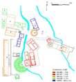
Plattegrond Heiligdom Samothrace.PNG 764 × 833; 505 KB
-
Pontic-650-nl.PNG 406 × 448; 15 KB
-
Ptolemaeïsch Egypte.PNG 436 × 653; 71 KB
-
Slag bij Ipsos.PNG 493 × 462; 61 KB
-
Staatkundige kaart van de wereld 1984-1985 Nederlands.jpg 1,970 × 1,080; 287 KB
-
Vruchtbare sikkel.PNG 1,201 × 1,474; 395 KB


