Category:Dunan
Jump to navigation
Jump to search
settlement on the Isle of Skye, in Highland, Scotland, UK  | |||||
| Upload media | |||||
| Instance of | |||||
|---|---|---|---|---|---|
| Location | Highland, Scottish Highlands, Scotland | ||||
 | |||||
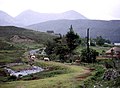
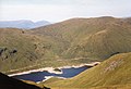
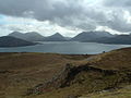
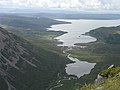
English: Dunan is a fishing village on the south shore of the sea loch, Loch Na Cairidh in Broadford, Isle of Skye, Scottish Highlands and is in the Scottish council area of Highland.
Media in category "Dunan"
The following 137 files are in this category, out of 137 total.
-
 A87 crosses the Allt na Luibe - geograph.org.uk - 1409977.jpg 640 × 480; 110 KB
-
 Allt Chalder - geograph.org.uk - 380186.jpg 640 × 480; 100 KB
-
 Allt Chalder - geograph.org.uk - 380188.jpg 640 × 480; 137 KB
-
 Allt Eigeach - geograph.org.uk - 29131.jpg 640 × 377; 57 KB
-
 Allt Eigeach - geograph.org.uk - 29134.jpg 640 × 421; 63 KB
-
 Allt Eigeach - geograph.org.uk - 29137.jpg 640 × 412; 53 KB
-
 Allt Mheuran - geograph.org.uk - 662292.jpg 640 × 480; 137 KB
-
 Boat on Caolas Scalpay - geograph.org.uk - 2335886.jpg 640 × 480; 74 KB
-

-
 Caolas Scalpay - geograph.org.uk - 2018407.jpg 1,024 × 768; 675 KB
-
 Carn Dearg - geograph.org.uk - 370405.jpg 640 × 394; 51 KB
-
 Erosion - geograph.org.uk - 84072.jpg 640 × 389; 92 KB
-
 Gaur Dam - geograph.org.uk - 279794.jpg 640 × 480; 89 KB
-
 Gaur Dam - geograph.org.uk - 279800.jpg 640 × 480; 107 KB
-
 Gaur Power Station and Fish Ladder - geograph.org.uk - 279797.jpg 640 × 480; 95 KB
-
 Glas Bheinn Mhor summit - geograph.org.uk - 680004.jpg 640 × 480; 259 KB
-
 Grazings by Rubha Garbh - geograph.org.uk - 25460.jpg 640 × 480; 67 KB
-
 Jetty on Caolas Scalpay - geograph.org.uk - 2335873.jpg 640 × 480; 57 KB
-
 Just above Mam Ban, Carn Dearg beyond - geograph.org.uk - 466806.jpg 640 × 480; 93 KB
-
 Loch na Cairidh - geograph.org.uk - 2335896.jpg 640 × 480; 75 KB
-
 Loch na Cairidh at Strollamus - geograph.org.uk - 2555148.jpg 2,464 × 1,632; 3.68 MB
-
 Meall Buidhe (Glen Lyon) - geograph.org.uk - 689747.jpg 640 × 480; 65 KB
-
 Meall Chomraidh - geograph.org.uk - 378071.jpg 640 × 480; 94 KB
-

-
 Ob Apoldoire - geograph.org.uk - 2078052.jpg 640 × 480; 59 KB
-
 Roe buck - geograph.org.uk - 219973.jpg 640 × 481; 75 KB
-
 Shore of Loch na Cairidh at Strollamus - geograph.org.uk - 2555152.jpg 2,464 × 1,632; 3.11 MB
-
 Skye Boat Centre - geograph.org.uk - 2375071.jpg 1,024 × 756; 283 KB
-
 Stony hillside - geograph.org.uk - 377905.jpg 480 × 640; 115 KB
-
 Strollamus - geograph.org.uk - 2375063.jpg 3,332 × 2,056; 4.17 MB
-
 Stuchd an Lochain - geograph.org.uk - 297228.jpg 640 × 449; 62 KB
-
 Summit of Glas Bheinn Mhor - geograph.org.uk - 680013.jpg 480 × 640; 234 KB
-
 The Allt Mheuran - geograph.org.uk - 705569.jpg 1,000 × 663; 376 KB
-
 The Cuillin from Glas Bheinn Mhor - geograph.org.uk - 680025.jpg 640 × 295; 113 KB
-
 The pier at Strollamus - geograph.org.uk - 6740806.jpg 4,032 × 3,024; 1.79 MB
-
 The shoreline at Strollamus - geograph.org.uk - 6740809.jpg 4,032 × 3,024; 2.88 MB
-
 The wall on Glas Bheinn Mhor - geograph.org.uk - 679981.jpg 640 × 480; 189 KB
-
 Wall on Glas Bheinn Mhor - geograph.org.uk - 183517.jpg 640 × 480; 47 KB
-
 A87 in Strollamus - geograph.org.uk - 991223.jpg 640 × 480; 96 KB
-
 A87 in Strollamus - geograph.org.uk - 991235.jpg 640 × 478; 101 KB
-
 Abandoned Crofthouse - geograph.org.uk - 135516.jpg 640 × 480; 87 KB
-
 Allt a choire Chreagaich - geograph.org.uk - 1016364.jpg 640 × 480; 95 KB
-
 Allt Chomraidh - geograph.org.uk - 377876.jpg 640 × 480; 93 KB
-
 Allt na Teangaidh - geograph.org.uk - 1146590.jpg 640 × 480; 173 KB
-
 Allt Strollamus - geograph.org.uk - 439432.jpg 640 × 480; 346 KB
-
 An Slugan - geograph.org.uk - 1146500.jpg 640 × 480; 180 KB
-
 Another burn^ - geograph.org.uk - 236335.jpg 480 × 640; 103 KB
-
 Bad hair day^ - geograph.org.uk - 1409991.jpg 640 × 475; 128 KB
-
 Barracks - geograph.org.uk - 379066.jpg 640 × 462; 91 KB
-
 Barracks - geograph.org.uk - 379068.jpg 640 × 480; 90 KB
-
 Barracks Forest, Meall Chomraidh - geograph.org.uk - 379034.jpg 640 × 480; 86 KB
-
 Bay on Loch na Cairidh - geograph.org.uk - 1400065.jpg 640 × 480; 73 KB
-
 Beinn na Caillich - geograph.org.uk - 458606.jpg 640 × 480; 141 KB
-
 Boulders - geograph.org.uk - 379491.jpg 640 × 480; 85 KB
-

-
 Bridge over the Allt Chomraidh - geograph.org.uk - 377893.jpg 640 × 480; 130 KB
-
 Bungalow on croft at Strollamus - geograph.org.uk - 1454730.jpg 640 × 480; 76 KB
-
 Carn Dearg - Southern Ridge - geograph.org.uk - 380308.jpg 640 × 504; 99 KB
-
 Ceann Garbh - geograph.org.uk - 379058.jpg 640 × 480; 113 KB
-
 Coille Bhienie - geograph.org.uk - 380199.jpg 640 × 480; 140 KB
-
 Coille Dhùnain - geograph.org.uk - 379490.jpg 640 × 480; 80 KB
-
 Coire Mor Track - geograph.org.uk - 144253.jpg 640 × 480; 101 KB
-
 Corrie Reidh Ridge - geograph.org.uk - 126127.jpg 640 × 480; 75 KB
-
 Cottages at Luib - geograph.org.uk - 1409970.jpg 640 × 480; 123 KB
-
 Doire na h-Innes - geograph.org.uk - 630023.jpg 640 × 426; 45 KB
-
 Dry bed of the Allt Strollamus - geograph.org.uk - 469740.jpg 640 × 480; 379 KB
-
 Dunan - geograph.org.uk - 379021.jpg 640 × 480; 97 KB
-
 Dunan - geograph.org.uk - 380194.jpg 640 × 480; 99 KB
-
 Fish Farm buildings at Luib na Moil - geograph.org.uk - 124578.jpg 640 × 480; 78 KB
-
 Fissure on Glas Bheinn Mhòr - geograph.org.uk - 528411.jpg 640 × 371; 58 KB
-
 Forest on Meall Chomraidh - geograph.org.uk - 379042.jpg 640 × 452; 71 KB
-

-
 Garbh Mheall - geograph.org.uk - 496764.jpg 640 × 347; 39 KB
-
 Gleann Chomraidh - geograph.org.uk - 377882.jpg 640 × 480; 83 KB
-
 Head of Loch Ainort from Glas Bheinn Mhor - geograph.org.uk - 680068.jpg 640 × 480; 214 KB
-
 Homestead on Isle of Skye - geograph.org.uk - 10480.jpg 640 × 436; 84 KB
-
 Isolated grave - geograph.org.uk - 377901.jpg 640 × 480; 134 KB
-

-
 Loch Ainort at Luib - geograph.org.uk - 328514.jpg 640 × 454; 65 KB
-
 Loch Eigheach from the north - geograph.org.uk - 11887.jpg 640 × 480; 85 KB
-
 Loch na Cairidh - geograph.org.uk - 348150.jpg 640 × 482; 65 KB
-
 Lochain Stratha Mhoir - geograph.org.uk - 235700.jpg 640 × 480; 78 KB
-
 Lochain Stratha Mhoir - geograph.org.uk - 551698.jpg 640 × 480; 49 KB
-
 Lochain Stratha Mhoir - geograph.org.uk - 551701.jpg 640 × 480; 56 KB
-
 Lochan Sratha Mhor - geograph.org.uk - 180873.jpg 640 × 480; 112 KB
-
 Lochan Sratha Mhor - geograph.org.uk - 235692.jpg 640 × 480; 90 KB
-
 Long lochain . - geograph.org.uk - 27605.jpg 640 × 363; 34 KB
-

-
 Looking down from Leacann nan Giomach - geograph.org.uk - 218805.jpg 640 × 480; 96 KB
-

-

-

-
 Luib and the Red Cuillin - geograph.org.uk - 2777.jpg 528 × 309; 131 KB
-
 Luib Folk Museum - geograph.org.uk - 215491.jpg 640 × 480; 200 KB
-
 Luib from the south-west - geograph.org.uk - 235677.jpg 480 × 640; 78 KB
-
 Luib, Skye - geograph.org.uk - 19034.jpg 640 × 472; 73 KB
-
 Meall Buidhe - geograph.org.uk - 273885.jpg 640 × 435; 53 KB
-
 Meall Chomraidh - geograph.org.uk - 379018.jpg 640 × 480; 78 KB
-
 Meall Chomraidh - geograph.org.uk - 379025.jpg 480 × 640; 126 KB
-
 Meall Chomraidh - geograph.org.uk - 380203.jpg 640 × 480; 111 KB
-

-

-
 North east ridge of Carn Dearg - geograph.org.uk - 218796.jpg 640 × 480; 91 KB
-
 North of Rannoch Moor - geograph.org.uk - 59508.jpg 640 × 368; 76 KB
-
 North ridge of Beinn na Cro - geograph.org.uk - 551722.jpg 640 × 480; 53 KB
-
 North ridge of Beinn na Cro - geograph.org.uk - 551726.jpg 640 × 480; 86 KB
-
 North ridge of Beinn na Cro - geograph.org.uk - 551730.jpg 640 × 480; 71 KB
-
 Old Farm Machinery - geograph.org.uk - 137127.jpg 640 × 480; 80 KB
-

-
 Rannoch Station road. - geograph.org.uk - 379497.jpg 640 × 440; 70 KB
-

-
 River Gaur at Dunan - geograph.org.uk - 380192.jpg 640 × 480; 88 KB
-
 Rock frog - geograph.org.uk - 88678.jpg 640 × 449; 132 KB
-
 Ruined Croft House - geograph.org.uk - 390965.jpg 640 × 480; 121 KB
-
 Ruined wall - geograph.org.uk - 180860.jpg 640 × 480; 101 KB
-
 Shieling, Gleann Chomraidh - geograph.org.uk - 379061.jpg 640 × 480; 150 KB
-
 Skye Boat Centre - geograph.org.uk - 135522.jpg 640 × 480; 69 KB
-
 Slopes of Glas Bheinn Bheag - geograph.org.uk - 180779.jpg 640 × 480; 141 KB
-
 Strath Mor - geograph.org.uk - 551717.jpg 640 × 480; 64 KB
-
 Strollamus Granite Quarry - geograph.org.uk - 319920.jpg 640 × 425; 168 KB
-
 Summit Cairn - geograph.org.uk - 307675.jpg 640 × 480; 105 KB
-
 Summit Cairn - Sgor Choinnich - geograph.org.uk - 370403.jpg 640 × 377; 53 KB
-
 The Allt Strollamus - geograph.org.uk - 236348.jpg 480 × 640; 93 KB
-
-

-
 The path to Strollamus - An Slugan - geograph.org.uk - 236345.jpg 640 × 480; 82 KB
-
 The path to Strollamus - geograph.org.uk - 236343.jpg 640 × 480; 68 KB
-
 The Rannoch Station road - geograph.org.uk - 218797.jpg 640 × 480; 64 KB
-
 The Red Hills from Glas Bheinn Mhor - geograph.org.uk - 680041.jpg 640 × 321; 92 KB
-
 The road to the Isles track - geograph.org.uk - 218799.jpg 640 × 480; 68 KB
-
 The road to the Isles track - geograph.org.uk - 218803.jpg 640 × 480; 82 KB
-
 The road to the Isles track - geograph.org.uk - 218804.jpg 640 × 480; 68 KB
-
 Torr Chille - geograph.org.uk - 377890.jpg 640 × 480; 92 KB
-

-
 Very old road signs at Luib - geograph.org.uk - 183521.jpg 640 × 480; 77 KB
-
 View from Glas Bheinn Mhor - geograph.org.uk - 20907.jpg 640 × 480; 103 KB
-
 Waterfall, Allt Strollamus - geograph.org.uk - 180786.jpg 640 × 480; 126 KB


_-_geograph.org.uk_-_689747.jpg)


_-_geograph.org.uk_-_683499.jpg)


