Category:Dry stone walls in Greater Manchester
Jump to navigation
Jump to search
Media in category "Dry stone walls in Greater Manchester"
The following 17 files are in this category, out of 17 total.
-
 A wall and several trees - geograph.org.uk - 713292.jpg 425 × 640; 92 KB
-
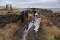 A wet part of the bridleway - geograph.org.uk - 1775009.jpg 3,872 × 2,592; 4.41 MB
-
 Cobbled Path - geograph.org.uk - 797069.jpg 640 × 480; 155 KB
-
 Damaged stone wall - geograph.org.uk - 4164381.jpg 1,024 × 768; 199 KB
-
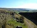
 Dry stone wall near The Height - geograph.org.uk - 3367924.jpg 1,024 × 682; 555 KB
-
 Dry stone wall under repair - geograph.org.uk - 705236.jpg 640 × 474; 85 KB
-
 Dry-stone Walling - geograph.org.uk - 1493539.jpg 640 × 480; 178 KB
-
 Drystone Wall on Rape Hill (2) - geograph.org.uk - 729722.jpg 640 × 427; 318 KB
-
 Drystone Wall on Rape Hill - geograph.org.uk - 729720.jpg 640 × 390; 253 KB
-
 Exercise Bars - geograph.org.uk - 1013086.jpg 640 × 480; 128 KB
-
 Footpath to Green Hill, High Crompton - geograph.org.uk - 705333.jpg 640 × 484; 115 KB
-
 Geese in a field - geograph.org.uk - 1231073.jpg 640 × 486; 130 KB
-
 Heap Brow - geograph.org.uk - 1244295.jpg 640 × 457; 422 KB
-
 Ox Hey Top, Castleshaw - geograph.org.uk - 387985.jpg 640 × 473; 117 KB
-
 Pennine Bridleway, Low Gate Lane - geograph.org.uk - 576217.jpg 640 × 480; 88 KB
-
 RUPP above Ogden - geograph.org.uk - 717017.jpg 640 × 463; 93 KB
-
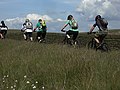 Single file on the Pennine Bridleway - geograph.org.uk - 1354828.jpg 640 × 480; 113 KB


_-_geograph.org.uk_-_729722.jpg)


