Category:Draycot Foliat
Jump to navigation
Jump to search
hamlet in Wiltshire, England, UK  | |||||
| Upload media | |||||
| Instance of | |||||
|---|---|---|---|---|---|
| Location | Chiseldon, Swindon, Wiltshire, South West England, England | ||||
 | |||||
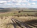
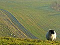
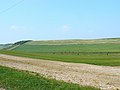
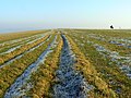
English: Draycot Foliat is an hamlet in Wiltshire, England, on the back road between Chiseldon to the north and Ogbourne St. George to the south. The nearest major town is Swindon which is about north. The most notable feature is probably the small Airstrip with its model helicopter instruction centre. There is one smallholding, called Draycot Farm, and a larger farm, Sheppard's Farm which comprises some 750 acres (300 hectares). Attached to Sheppard's farm is a tiny set of industrial buildings. In addition to this there are between ten and twenty other houses. The Og, a tributary to the Thames flows, for about half of the year, down the centre of the hamlet forcing the road into a sharp hairpin bend.
Media in category "Draycot Foliat"
The following 88 files are in this category, out of 88 total.
-
 Barbury Castle - geograph.org.uk - 701655.jpg 640 × 480; 117 KB
-

-
 Barbury point to point, Wiltshire - geograph.org.uk - 838095.jpg 640 × 480; 125 KB
-
 Bean field, near Draycot Foliat - geograph.org.uk - 859443.jpg 640 × 480; 174 KB
-
 Burderop Down, Swindon - geograph.org.uk - 837754.jpg 480 × 640; 89 KB
-
 Burderop Down, Swindon - geograph.org.uk - 838238.jpg 640 × 480; 120 KB
-

-
 Camera shy - geograph.org.uk - 326919.jpg 640 × 480; 175 KB
-
 Dairy cattle, near Draycot Foliat - geograph.org.uk - 859467.jpg 640 × 480; 140 KB
-
 Draycot Foliat Flooded.jpg 240 × 320; 16 KB
-
-
 Farm Track with Stuff - geograph.org.uk - 1803196.jpg 3,352 × 2,384; 2.26 MB
-
 Farmland, Chiseldon - geograph.org.uk - 700661.jpg 640 × 480; 139 KB
-
 Field by Old Ridgeway, Draycot Foliat - geograph.org.uk - 133600.jpg 640 × 480; 165 KB
-
 Field south of Draycot Foliat - geograph.org.uk - 133627.jpg 640 × 480; 169 KB
-
 Gallop, near Barbury, Wiltshire - geograph.org.uk - 960414.jpg 640 × 480; 75 KB
-
 Gallop, near the Ogbournes, Wiltshire - geograph.org.uk - 960362.jpg 640 × 480; 129 KB
-

-
 Gypsy Lane, near Draycot Foliat - geograph.org.uk - 859455.jpg 640 × 480; 140 KB
-
 Gypsy Lane, near Draycot Foliat - geograph.org.uk - 859456.jpg 640 × 480; 172 KB
-

-
 More sheep at Barbury - geograph.org.uk - 326906.jpg 640 × 480; 113 KB
-
 Poor Old Gate - geograph.org.uk - 1803262.jpg 1,858 × 1,382; 695 KB
-
 Quebec Road, Draycot Foliat - geograph.org.uk - 133867.jpg 640 × 480; 329 KB
-

-
 Ridgeway on Smeathe's Ridge - geograph.org.uk - 1021013.jpg 640 × 480; 65 KB
-

-
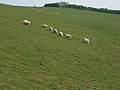
 Sheep near Barbury Castle - geograph.org.uk - 297558.jpg 640 × 480; 58 KB
-
 Sheep on Smeathe's Ridge, near Barbury - geograph.org.uk - 637183.jpg 640 × 479; 101 KB
-

-

-

-
-
 A view towards Burderop Down, Swindon - geograph.org.uk - 838231.jpg 640 × 480; 129 KB
-
 Access road to Ogbourne Pumping Station - geograph.org.uk - 1803392.jpg 3,484 × 2,424; 3.63 MB
-
 Barbury Hill - geograph.org.uk - 701088.jpg 640 × 480; 132 KB
-
 Barbury Hill - geograph.org.uk - 701877.jpg 640 × 480; 123 KB
-
 Barn and farmland below Burderop Down - geograph.org.uk - 701344.jpg 640 × 480; 115 KB
-
 Burderop Down - geograph.org.uk - 701319.jpg 640 × 480; 116 KB
-
 Burderop Down - geograph.org.uk - 701326.jpg 640 × 480; 124 KB
-
 Burderop Down - geograph.org.uk - 701391.jpg 640 × 480; 114 KB
-
 Burderop Down - geograph.org.uk - 701428.jpg 640 × 480; 125 KB
-
 Burderop Down - geograph.org.uk - 701448.jpg 640 × 480; 130 KB
-
 Burderop Down - geograph.org.uk - 701452.jpg 640 × 480; 113 KB
-
 Byway, Burderop Down - geograph.org.uk - 701370.jpg 640 × 480; 161 KB
-
 Byways junction, The Ridgeway, Barbury - geograph.org.uk - 637160.jpg 640 × 480; 127 KB
-
 Chalky byway off Burderop Down - geograph.org.uk - 133624.jpg 640 × 480; 218 KB
-

-
-
 Farmland below Burderop Down - geograph.org.uk - 133607.jpg 640 × 480; 178 KB
-
-
 Farmland, Sharpridge, near Marlborough - geograph.org.uk - 385398.jpg 640 × 480; 103 KB
-
 Four Mile Clump - geograph.org.uk - 412188.jpg 640 × 480; 160 KB
-
-
 Gallops, Barbury Castle Estate - geograph.org.uk - 1435983.jpg 640 × 480; 174 KB
-
 Gateway on track to Smeathe's Ridge - geograph.org.uk - 239580.jpg 640 × 480; 116 KB
-
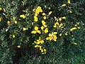 Gorse bush, Barbury - geograph.org.uk - 326925.jpg 640 × 480; 131 KB
-
 Harvested wheat field south of Wroughton - geograph.org.uk - 533738.jpg 640 × 479; 385 KB
-
 Horsebox in a lane, Draycot Foliat - geograph.org.uk - 133598.jpg 480 × 640; 355 KB
-
 Horses on Smeathe's Ridge, Barbury - geograph.org.uk - 637172.jpg 640 × 480; 86 KB
-
 Illegal 4x4 on Smeathe's Ridge - geograph.org.uk - 239570.jpg 640 × 480; 101 KB
-

-

-
 Marlborough Downs south of Wroughton - geograph.org.uk - 533737.jpg 640 × 480; 271 KB
-

-
 Ogbourne Down - geograph.org.uk - 412161.jpg 640 × 480; 146 KB
-
 Ogbourne Maizey Down - geograph.org.uk - 408886.jpg 640 × 480; 151 KB
-
 Ogbourne Maizey Down - geograph.org.uk - 412158.jpg 640 × 480; 139 KB
-
 Ploughed field, near Draycot Foliat - geograph.org.uk - 133602.jpg 640 × 480; 258 KB
-

-
 Replica iron age roundhouse, Barbury - geograph.org.uk - 637208.jpg 640 × 480; 75 KB
-

-

-
 Rider on Smeathe's Ridge, Barbury - geograph.org.uk - 637171.jpg 640 × 480; 88 KB
-
 Road north from Burderop Down - geograph.org.uk - 133613.jpg 640 × 480; 176 KB
-
 Sheppards Farm Dairy, Draycot Foliat - geograph.org.uk - 133629.jpg 640 × 480; 221 KB
-
 Sheppards Farm, Draycot Foliat - geograph.org.uk - 133868.jpg 640 × 480; 180 KB
-
 Smeathe's Plantation - geograph.org.uk - 408889.jpg 640 × 480; 133 KB
-
 Smeathe's Ridge - geograph.org.uk - 31196.jpg 640 × 480; 70 KB
-
 Smeathe's Ridge - geograph.org.uk - 701466.jpg 640 × 480; 121 KB
-
 Smeathe's Ridge - geograph.org.uk - 701479.jpg 640 × 480; 121 KB
-
 Smeathe's Ridge - geograph.org.uk - 701533.jpg 640 × 480; 156 KB
-
 Talavera Road, Draycot Foliat - geograph.org.uk - 133631.jpg 640 × 480; 203 KB
-
 The Ridgeway along Smeathe's Ridge - geograph.org.uk - 239575.jpg 640 × 480; 108 KB
-

-
 The Ridgeway, Smeathe's Ridge, Barbury - geograph.org.uk - 637161.jpg 640 × 480; 130 KB
-
 The Road to Hackpen II - geograph.org.uk - 230305.jpg 640 × 480; 72 KB
-
 View north from Barbury - geograph.org.uk - 326929.jpg 640 × 480; 90 KB


_-_geograph.org.uk_-_385409.jpg)


