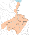
Category:Drainage basin maps of Switzerland
Jump to navigation
Jump to search
Media in category "Drainage basin maps of Switzerland"
The following 12 files are in this category, out of 12 total.
-
Aar bassin 1.svg 870 × 562; 473 KB
-
Aar bassin.svg 800 × 450; 474 KB
-
Aare basin simple.png 1,602 × 898; 494 KB
-
ETH-BIB-Maloja-Wasserscheide-Dia 247-Z-00113.tif 2,899 × 3,445; 28.71 MB
-
Po bacino idrografico.png 788 × 600; 935 KB
-
Po Einzugsgebiet.png 1,033 × 786; 1.03 MB
-
Rhin alpestre bassin.svg 343 × 401; 453 KB
-
Rhône supérieur bassin 1.svg 570 × 395; 452 KB
-
Rhône supérieur bassin 2.svg 380 × 240; 452 KB
-
Rhône supérieur bassin.svg 379 × 240; 452 KB
-
Wassereinzugsgebiet Kraftwerke Oberhasli.svg 726 × 908; 4.4 MB
-
Wassereinzugsgebiet-der-kwo.pdf 1,200 × 1,639; 1.4 MB


