Category:Drainage basin maps of Madagascar
Jump to navigation
Jump to search
Countries of Africa: Eswatini · Liberia · Madagascar · Mozambique · South Africa · Zambia · Zimbabwe
Subcategories
This category has the following 2 subcategories, out of 2 total.
M
T
Media in category "Drainage basin maps of Madagascar"
The following 13 files are in this category, out of 13 total.
-
 Carte bassin Manambolo.svg 1,275 × 850; 12.81 MB
-
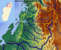
 Carte bassin Mangoro.svg 906 × 1,359; 22.41 MB
-
 Carte bassin Namorona.svg 939 × 649; 7.5 MB
-
 Koppen-Geiger Madagascar Basins.png 803 × 1,298; 325 KB
-
 Loza Basin OSM.png 1,512 × 1,247; 3.53 MB
-
 Mahavavy south Basin OSM.png 2,117 × 2,003; 7.79 MB
-
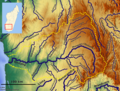
 Manambolo Basin OSM.png 2,117 × 1,247; 4.52 MB
-
 Mananara Basin OSM.png 1,550 × 2,003; 5.6 MB
-
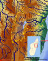
 Mangoro Basin OSM.png 1,814 × 1,852; 6.53 MB
-
 Maningory Basin OSM.png 1,323 × 1,663; 4.59 MB
-
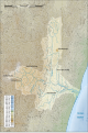
 Onilahy Basin OSM.png 2,192 × 1,663; 6.63 MB
-
 Rianila Basin OSM.png 1,247 × 1,247; 2.49 MB
-
 Sofia Basin OSM.png 1,512 × 2,003; 6.05 MB


