Category:Drainage basin maps of Asia
Jump to navigation
Jump to search
English: This category includes files about rivers (represented as watersheds/drainage basins/drainage divides) focused on geographic boundaries of the whole body of water.
See also:
- Category:Maps of rivers by country for files about rivers focusing on political national or subnational (states, counties and so on) boundaries.
- Category:Maps of rivers of Asia for files about rivers (represented as paths) focused on geographic boundaries of the whole body of water.
Subcategories
This category has the following 5 subcategories, out of 5 total.
Media in category "Drainage basin maps of Asia"
The following 200 files are in this category, out of 202 total.
(previous page) (next page)-
Arabian Peninsula - Drainage.png 7,013 × 6,231; 51.26 MB
-
Basin regions with numbers.jpg 753 × 420; 265 KB
-
Brockhaus and Efron Encyclopedic Dictionary b54 018-1.jpg 2,552 × 3,101; 2.47 MB
-
Carte-des-bassins-versants-de-la-Chine.jpg 2,800 × 1,869; 1.63 MB
-
China River Basins.png 380 × 295; 6 KB
-
CHN povodi rek.PNG 380 × 295; 10 KB
-
India River basins.png 1,272 × 896; 1.08 MB
-
PEF Survey of Western Palestine composite showing Natural Drainage and Mountain Ranges.jpg 7,230 × 13,385; 16.14 MB
-
Pamir drainage basin map-fr.svg 3,543 × 2,271; 4.59 MB
-
Major River Basins of Panay Island, Philippines.png 1,080 × 1,080; 182 KB
-
Agno river watershed.png 1,542 × 1,517; 214 KB
-
Agusan river watershed.png 1,536 × 1,152; 382 KB
-
Map of basin of Alazeya RU.svg 219 × 359; 36 KB
-
Amgun.png 634 × 464; 10 KB
-
Amgun hu.svg 845 × 619; 19 KB
-
Amur watershed rus.png 500 × 500; 37 KB
-
Amur watershed.png 500 × 500; 88 KB
-
Amurrivermap.png 989 × 779; 298 KB
-
Amurriversourcesmap.jpg 400 × 300; 74 KB
-
동북아시아 지도.png 500 × 500; 158 KB
-
Amur hu.svg 1,861 × 1,278; 458 KB
-
Anadyrrivermap.png 500 × 500; 79 KB
-
Angara watershed.png 300 × 300; 20 KB
-
Asi, Orontes River.png 301 × 840; 365 KB
-
Lakebalkhashbasinmap hu.svg 1,955 × 1,333; 2.05 MB
-
Lakebalkhashbasinmap.png 1,466 × 1,000; 1.52 MB
-
Barak River Basin.png 1,272 × 896; 1.21 MB
-
Bassin Tigre Euphrate.jpg 715 × 768; 203 KB
-
Bassin-du-fleuve-jaune.png 2,239 × 1,183; 112 KB
-
Bassin-versant-de-l'Amour-fr.png 989 × 779; 69 KB
-
Bicol river watershed.png 1,651 × 1,230; 195 KB
-
Bolshaya Chukochya.png 359 × 401; 5 KB
-
Brahmaputra river basin.png 1,272 × 896; 1.37 MB
-
Bureya hu.svg 787 × 689; 22 KB
-
Bureya.png 590 × 517; 10 KB
-
Cagayan river watershed.png 1,175 × 1,437; 247 KB
-
Cagayan de oro river watershed.png 944 × 1,109; 150 KB
-
Caucasus hydro map-fr.svg 1,155 × 898; 5.42 MB
-
Cauvery River Basin.png 1,272 × 896; 1.72 MB
-
Chambal Basin.png 1,003 × 896; 1.04 MB
-
Chaophrayarivermap.png 1,000 × 1,000; 391 KB
-
Chaophrayarivermap-ar.png 1,000 × 1,000; 340 KB
-
Chulym.png 906 × 768; 47 KB
-
Chulym hu.svg 1,208 × 1,024; 66 KB
-
Dongtingriversmap.png 1,200 × 1,042; 488 KB
-
Drainage network of Banas River bain.png 1,040 × 755; 785 KB
-
Enisey hu.svg 840 × 1,335; 98 KB
-
געתון 3.png 2,000 × 845; 1.22 MB
-
Ganrivermap.png 1,000 × 869; 333 KB
-
Ganga Yamuna River Basin.png 1,272 × 896; 1.63 MB
-
Ganges-Brahmaputra-Meghna basins.jpg 1,403 × 777; 1.09 MB
-
Generalized Geological Map of Godavari Drainage Basin.jpg 3,507 × 2,480; 513 KB
-
Godavari River Basin.png 1,272 × 896; 1.91 MB
-
Godavari- river basin.gif 400 × 281; 26 KB
-
Hai River Basin EN.svg 715 × 883; 66 KB
-
Hai River Basin ES.svg 715 × 883; 49 KB
-
Hai River Basin ZH.svg 715 × 883; 44 KB
-
HaiheBasin.png 500 × 613; 143 KB
-
HaiheBasinEn.png 500 × 613; 110 KB
-
Hainan - Haikou - Nandu rivermap.png 852 × 667; 286 KB
-
Hanshuirivermap.png 1,000 × 682; 298 KB
-
Helmand River Basin Sub.png 1,056 × 816; 86 KB
-
Helmand River Basin Topo.png 1,056 × 816; 590 KB
-
Helmandrivermap.png 1,000 × 754; 1.49 MB
-
Huairivermap.jpg 721 × 462; 220 KB
-
Yellowrivermap-2.jpg 1,100 × 544; 140 KB
-
Yellowrivermap-fr.png 2,497 × 1,293; 994 KB
-
Yellowrivermap-zh-hans.jpg 1,100 × 544; 554 KB
-
Yellowrivermap-zh-hant.jpg 1,100 × 544; 554 KB
-
Yellowrivermap.jpg 2,497 × 1,571; 1.19 MB
-
Ib watershed.jpg 796 × 552; 246 KB
-
Indigirka.png 489 × 922; 17 KB
-
Indigirkarivermap.png 500 × 500; 93 KB
-
Indigirka hu.svg 652 × 1,229; 30 KB
-
Indus River basin map de.svg 603 × 472; 17.76 MB
-
Indus River basin map.svg 603 × 472; 17.76 MB
-
Indus Sutlej River Basin.png 1,272 × 896; 1.61 MB
-
Bacino della Inya.png 474 × 768; 73 KB
-
Irrawaddy Watershed.gif 602 × 444; 49 KB
-
Irrawaddy watershed.png 162 × 200; 10 KB
-
Irrawaddyrivermap.jpg 862 × 1,227; 208 KB
-
Irtysh basin-bg.PNG 975 × 768; 79 KB
-
Irtysh basin.png 975 × 768; 67 KB
-
Irtyshrivermap.jpg 828 × 704; 292 KB
-
Irtysh basin hu.svg 1,300 × 1,024; 100 KB
-
Jialingrivermap.png 971 × 798; 273 KB
-
Jinsharivermap.jpg 434 × 383; 166 KB
-
Kanchalan.png 421 × 486; 6 KB
-
Drainage basin of Kaoping River.svg 750 × 1,375; 321 KB
-
Kaopingrivermap.png 774 × 823; 830 KB
-
Katun-Biya.png 768 × 880; 28 KB
-
Katun-Biya hu.svg 1,024 × 1,173; 52 KB
-
Ket basin.png 1,024 × 533; 30 KB
-
Ket' basin IT.png 1,199 × 621; 129 KB
-
Povodí Keti.png 1,024 × 533; 25 KB
-
Kherlenrivermap.png 1,000 × 899; 249 KB
-
Kolyma hu.svg 1,849 × 1,343; 87 KB
-
Kolyma.png 1,387 × 1,007; 103 KB
-
Krabi Rivers Andaman.svg 2,126 × 1,493; 138 KB
-
Krishna Basin.png 1,272 × 896; 1.63 MB
-
Kurarivermap.jpg 1,484 × 866; 1.57 MB
-
Lena mk.svg 1,306 × 1,269; 1.15 MB
-
Lena watershed highres.png 2,550 × 2,550; 474 KB
-
Lena watershed.png 500 × 500; 138 KB
-
Lena.svg 1,306 × 1,269; 529 KB
-
نهر لينا.png 501 × 500; 154 KB
-
Lena es.svg 1,306 × 1,269; 931 KB
-
Lena hu.svg 1,306 × 1,269; 522 KB
-
Lena nl.svg 1,306 × 1,269; 521 KB
-
Lena pl.svg 1,306 × 1,269; 528 KB
-
Liaorivermap.png 1,000 × 793; 300 KB
-
Luni Riber Basin India.png 1,003 × 896; 877 KB
-
Mahanadi River basin.png 1,272 × 896; 1.69 MB
-
Manasrivermap.png 1,000 × 1,000; 924 KB
-
Mekong River watershed.png 300 × 258; 52 KB
-
Mekong watershed.png 163 × 200; 10 KB
-
Mekong river basin.png 1,200 × 1,604; 2.4 MB
-
Mekongbasin.jpg 2,886 × 3,306; 4.94 MB
-
Min sichuan rivermap.png 1,000 × 826; 304 KB
-
Mindanao river drainage map.png 976 × 815; 108 KB
-
Munrivermap.jpg 850 × 773; 513 KB
-
Nakdong River Drainage system.png 434 × 470; 217 KB
-
Narmada Basin.png 1,003 × 896; 1.06 MB
-
Narmadarivermap.jpg 1,600 × 822; 629 KB
-
Ob river basin map.png 2,125 × 2,423; 1.94 MB
-
Ob river basin.png 768 × 876; 71 KB
-
Ob watershed ru.png 300 × 300; 46 KB
-
Ob river basin hu.svg 1,360 × 1,552; 601 KB
-
Okhota river.png 270 × 464; 6 KB
-
Olenyok.png 721 × 569; 11 KB
-
Olenyokrivermap.png 500 × 500; 127 KB
-
Olenyok hu.svg 961 × 759; 22 KB
-
Olyokmarivermap.png 500 × 500; 132 KB
-
Omoloy hu.svg 377 × 688; 52 KB
-
Omoloy.png 195 × 355; 8 KB
-
Map of Panj river.png 632 × 404; 592 KB
-
Pasig-marikina river drainagebasin.png 1,060 × 967; 173 KB
-
Zhujiangrivermap-et.png 989 × 670; 292 KB
-
Zhujiangrivermap.png 988 × 669; 308 KB
-
Pyasina hu.svg 991 × 1,224; 29 KB
-
Pyasina.png 743 × 918; 16 KB
-
Rejang drainage basin.png 800 × 542; 54 KB
-
Red hong rivermap VI.svg 1,000 × 827; 516 KB
-
Red hong rivermap DE.png 1,000 × 827; 212 KB
-
Red hong rivermap FR.png 1,000 × 827; 212 KB
-
Red hong rivermap PL.png 1,000 × 827; 213 KB
-
Red hong rivermap VI.png 1,000 × 827; 213 KB
-
Red hong rivermap.png 1,000 × 827; 259 KB
-
Redriverasiamap.png 1,214 × 1,000; 2.25 MB
-
Sabarmati Mahi River Basin.png 1,272 × 896; 1.34 MB
-
Sakaryarivermapfinal.jpg 610 × 587; 264 KB
-
Salween watershed.png 500 × 618; 113 KB
-
Salween River basin map.svg 317 × 518; 12.94 MB
-
Selengerivermap.png 500 × 500; 118 KB
-
Tigr-euph de.png 1,000 × 1,005; 301 KB
-
Tigr-euph highres.png 2,550 × 2,550; 398 KB
-
Tigr-euph hr.png 1,000 × 1,005; 230 KB
-
Tigr-euph sl.png 300 × 300; 45 KB
-
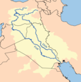
Tigr-euph-el.png 300 × 300; 20 KB
-
Tigr-euph-es.png 1,000 × 1,005; 257 KB
-
Tigr-euph-HE.png 300 × 300; 41 KB
-
Tigr-euph-no.png 1,000 × 1,005; 245 KB
-
Tigr-euph-sv.png 300 × 300; 46 KB
-
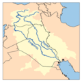
Tigr-euph.png 1,000 × 1,005; 264 KB
-
Shilka.png 1,100 × 953; 36 KB
-
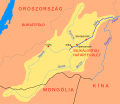
Shilka hu.svg 1,467 × 1,271; 41 KB
-
Shulerivermap.jpg 827 × 496; 288 KB
-
Simav basin map.png 2,386 × 2,387; 1,000 KB
-
Sông Cái Nha Trang.GIF 1,137 × 1,138; 47 KB
-
Tapi River Basin.png 1,272 × 896; 1.62 MB
-
Tarimrivermap.png 1,449 × 983; 2.09 MB
-
Taz river.png 574 × 804; 15 KB
-
Taz river hu.svg 765 × 1,072; 27 KB
-
Greattenasserimrivermap.png 1,000 × 1,476; 1.27 MB
-
Tigr-euph ku.png 1,000 × 1,005; 254 KB
-
Tigr-euph-ar.png 1,000 × 1,005; 229 KB
-
Fırat-Dicle.png 507 × 513; 228 KB
-
Tigris and Euphrates Persian.png 1,080 × 1,074; 571 KB
-
TonleSapMap.png 650 × 480; 76 KB
-
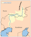
Tura river.png 1,008 × 643; 47 KB
-
Ural river.png 500 × 585; 115 KB
-
Vilyuyrivermap.png 500 × 500; 133 KB
-
Vitimrivermap.png 500 × 500; 132 KB
-
Vitimrivermap hu.svg 667 × 667; 165 KB
-
Location and natural drainage network of the Wadi Al Jizzi catchment - Oman.jpg 1,141 × 519; 106 KB
-
Wakal River basin in Rajasthan and Gujarat states of India.jpg 2,937 × 4,057; 2.13 MB
-
Weirivermap.png 1,000 × 825; 666 KB
-
Wujiangrivermap.png 1,000 × 826; 281 KB
-
Yalongrivermap.png 1,000 × 823; 262 KB
-
Yalurivermap.png 1,000 × 1,000; 275 KB
-
Yamunarivermap.jpg 1,000 × 1,000; 447 KB
-
Map of the Yangtze River.gif 8,977 × 4,136; 2.98 MB
-
Yangtze River drainage basin map.svg 943 × 498; 9.6 MB
-
Enisey.png 630 × 1,001; 56 KB
-
Yeniseirivermap-es.svg 876 × 693; 4.96 MB
-
Yeniseirivermap.png 988 × 986; 325 KB
-
Yeniseirivermap hu.png 800 × 798; 357 KB
-
Zarqa.gif 468 × 451; 15 KB
-
Zeya hu.svg 1,209 × 1,044; 193 KB
-
Zeya.png 1,187 × 1,025; 68 KB
