Category:Dormansland
Jump to navigation
Jump to search
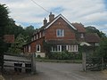
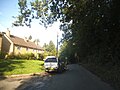
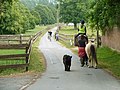
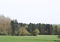
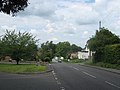
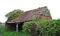
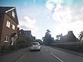
English: Dormansland is a village and civil parish approximately one mile south of Lingfield in Surrey, southern England. It is bordered on the east by the county of Kent and on the south by West Sussex.
village and civil parish in Tandridge, Surrey, England, UK  | |||||
| Upload media | |||||
| Instance of | |||||
|---|---|---|---|---|---|
| Location | Tandridge, Surrey, South East England, England | ||||
| Population |
| ||||
| Area |
| ||||
 | |||||
Subcategories
This category has the following 11 subcategories, out of 11 total.
C
- Cooks Pond Viaduct (10 F)
D
- Dormans Park (1 F)
- Dormans railway station (20 F)
- Dormansland Baptist Church (10 F)
- Dormansland War Memorial (3 F)
H
P
- Puttenden Manor (1 F)
S
- Starborough Castle (2 F)
Media in category "Dormansland"
The following 200 files are in this category, out of 1,032 total.
(previous page) (next page)-
 A field of brassicas - geograph.org.uk - 6904609.jpg 1,024 × 684; 263 KB
-
 A field of turf - geograph.org.uk - 6911495.jpg 1,024 × 684; 169 KB
-
 A line of Poplars, Dry Hill Farm - geograph.org.uk - 1710497.jpg 640 × 427; 61 KB
-
 A small ditch - geograph.org.uk - 4034332.jpg 640 × 430; 75 KB
-
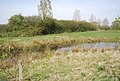 A small pond - geograph.org.uk - 4009589.jpg 640 × 430; 100 KB
-
 A very young crop - geograph.org.uk - 3989011.jpg 640 × 430; 81 KB
-
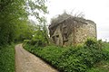
 Abandoned House - geograph.org.uk - 1860992.jpg 1,024 × 768; 338 KB
-
 Abandoned House near Hooper's Farm - geograph.org.uk - 1860995.jpg 1,024 × 683; 267 KB
-
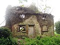 Abandoned House near Hooper's Farm - geograph.org.uk - 1861018.jpg 1,024 × 768; 324 KB
-
 Access lane towards Park Farm - geograph.org.uk - 2506697.jpg 3,072 × 2,304; 1.45 MB
-
 Access road to Old Surrey Hall - geograph.org.uk - 2509587.jpg 3,072 × 2,304; 1.65 MB
-
 Access road to Starborough Castle - geograph.org.uk - 2509844.jpg 3,072 × 2,304; 3.28 MB
-
 An old Oak tree, Jules Wood - geograph.org.uk - 1711294.jpg 427 × 640; 112 KB
-
 Arable farmland - geograph.org.uk - 6724053.jpg 1,024 × 684; 136 KB
-
 Arable field - geograph.org.uk - 6911483.jpg 1,024 × 684; 146 KB
-
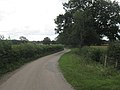
 B2028 - geograph.org.uk - 4481054.jpg 640 × 572; 130 KB
-
 B2028, Dormansland - geograph.org.uk - 4480742.jpg 640 × 426; 85 KB
-
 B2028, Dormansland - geograph.org.uk - 4480745.jpg 640 × 426; 83 KB
-
 Bales of hay - geograph.org.uk - 6723777.jpg 1,024 × 684; 168 KB
-
 Bankside Cottage - geograph.org.uk - 5268964.jpg 640 × 426; 128 KB
-
 Bankside Cottage - geograph.org.uk - 6833172.jpg 1,024 × 684; 277 KB
-
 Barberry - geograph.org.uk - 5160071.jpg 1,000 × 662; 836 KB
-
 Barley Field near Greathed Manor - geograph.org.uk - 1947132.jpg 1,024 × 683; 221 KB
-
 Barn - geograph.org.uk - 6717477.jpg 1,024 × 657; 181 KB
-
 Barn at Starborough Castle - geograph.org.uk - 4026801.jpg 640 × 430; 75 KB
-
 Barn by Tandridge Border Path - geograph.org.uk - 5268968.jpg 640 × 425; 86 KB
-
 Barn, Beeches Farm - geograph.org.uk - 1711205.jpg 640 × 427; 68 KB
-
 Barn, Burnt Pit Farm - geograph.org.uk - 6717406.jpg 1,024 × 684; 232 KB
-
 Barn, Cerne Farm - geograph.org.uk - 6911221.jpg 1,024 × 684; 284 KB
-
 Barn, Dairy Farm House - geograph.org.uk - 6717386.jpg 1,024 × 684; 294 KB
-
 Barn, Dry Hill Farm - geograph.org.uk - 1710493.jpg 640 × 427; 58 KB
-
 Barn, Dwelly Farm - geograph.org.uk - 4040806.jpg 640 × 430; 73 KB
-
 Barn, Haxted House - geograph.org.uk - 4001334.jpg 640 × 430; 50 KB
-
 Barn, Haxted House - geograph.org.uk - 4001379.jpg 640 × 430; 77 KB
-
 Barn, Wilderwick Farm - geograph.org.uk - 5258245.jpg 640 × 426; 76 KB
-
 Barrow Green Farm - geograph.org.uk - 6911776.jpg 1,024 × 684; 216 KB
-
 Barrow Green Farm - geograph.org.uk - 6911785.jpg 1,024 × 684; 341 KB
-
 Barrow Green Farm - geograph.org.uk - 6911787.jpg 1,024 × 684; 228 KB
-
 Beeches Farm - geograph.org.uk - 1711201.jpg 640 × 427; 104 KB
-
 Beeches Farmhouse - geograph.org.uk - 1952492.jpg 3,072 × 2,304; 1.46 MB
-
 Beeches Mead on Hollow Lane - geograph.org.uk - 4667632.jpg 2,304 × 1,728; 838 KB
-
 Beeches Mead on Hollow Lane - geograph.org.uk - 4667676.jpg 2,304 × 1,728; 822 KB
-
 Bend in path - geograph.org.uk - 6723783.jpg 1,024 × 684; 210 KB
-
 Bend, Hollow Lane - geograph.org.uk - 4480789.jpg 640 × 426; 102 KB
-
 Blackberry Lane - geograph.org.uk - 5268963.jpg 640 × 426; 104 KB
-
 Blackberry Lane - geograph.org.uk - 5268970.jpg 640 × 426; 100 KB
-
 Blackberry Lane - geograph.org.uk - 5268971.jpg 640 × 426; 98 KB
-
 Blackberry Lane - geograph.org.uk - 6833167.jpg 1,024 × 684; 271 KB
-
 Blackberry Lane - geograph.org.uk - 6833173.jpg 1,024 × 684; 315 KB
-
 Blackberry Lane - geograph.org.uk - 6833185.jpg 1,024 × 684; 192 KB
-
 Blackberry Lane, Dormansland - geograph.org.uk - 4672586.jpg 2,170 × 1,532; 1.61 MB
-
 Blacksmiths Cottage - geograph.org.uk - 6717338.jpg 1,024 × 684; 186 KB
-
 Border Paths beside Blackhatch Wood - geograph.org.uk - 2509544.jpg 3,072 × 2,304; 1.57 MB
-
 Bottoms Wood - geograph.org.uk - 6904628.jpg 1,024 × 684; 165 KB
-
 Bowerland Lane - geograph.org.uk - 6911813.jpg 1,024 × 684; 290 KB
-
 Bowerland Lane - geograph.org.uk - 6911824.jpg 1,024 × 684; 296 KB
-
 Boxin Wood - geograph.org.uk - 5258261.jpg 640 × 426; 131 KB
-
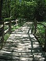
 Bridge on Shepherdsgrove Lane - geograph.org.uk - 1951305.jpg 3,072 × 2,304; 1.78 MB
-
 Bridge over a drain near Lingfield - geograph.org.uk - 6352000.jpg 1,024 × 768; 278 KB
-
 Bridge over Eden Brook - geograph.org.uk - 6903218.jpg 1,024 × 684; 330 KB
-
 Bridge over footpath near Dormansland - geograph.org.uk - 6351051.jpg 1,024 × 768; 225 KB
-
 Bridge over the River Eden - geograph.org.uk - 4001421.jpg 640 × 430; 120 KB
-
 Bridge to Surrey - geograph.org.uk - 3988992.jpg 640 × 430; 134 KB
-
 Bridge Wall - geograph.org.uk - 5077896.jpg 1,200 × 1,600; 593 KB
-
 Bridge Wall, Barrier and path - geograph.org.uk - 4184159.jpg 1,200 × 1,600; 646 KB
-
 Bridge, Water Lane - geograph.org.uk - 4034368.jpg 640 × 430; 66 KB
-
 Bridleway between Woodlands Farm and Beeches Farm - geograph.org.uk - 1951348.jpg 3,072 × 2,304; 2.45 MB
-
 Bridleway blocked by railway work - geograph.org.uk - 6401614.jpg 1,024 × 768; 599 KB
-
 Bridleway in Bog Wood - geograph.org.uk - 2509606.jpg 3,072 × 2,304; 3.44 MB
-
 Bridleway junction at Beeches Farm - geograph.org.uk - 1952490.jpg 3,072 × 2,304; 1.72 MB
-
 Bridleway junction near Beeches Farm - geograph.org.uk - 1952496.jpg 3,072 × 2,304; 1.86 MB
-
 Bridleway junction near Burnpit Farm - geograph.org.uk - 2509601.jpg 3,072 × 2,304; 2.78 MB
-
 Bridleway junction on Sussex Border Path in Jules Wood - geograph.org.uk - 1952516.jpg 3,072 × 2,304; 2.33 MB
-

-
 Bridleway near Beeches Farm - geograph.org.uk - 1711266.jpg 640 × 427; 109 KB
-
 Bridleway on the edge of Jules Wood - geograph.org.uk - 1711282.jpg 640 × 427; 120 KB
-

-
 Bridleway to Beeches Farm - geograph.org.uk - 1952397.jpg 3,072 × 2,304; 2.61 MB
-
 Bridleway to Woodlands Farm - geograph.org.uk - 1951337.jpg 2,304 × 3,072; 2.44 MB
-
 Bridleway towards Lingfield Road - geograph.org.uk - 6400210.jpg 1,024 × 768; 717 KB
-
 Bridleway towards Lingfield Road - geograph.org.uk - 6401715.jpg 1,024 × 768; 652 KB
-
 Bridleway towards Lingfield Road - geograph.org.uk - 6401796.jpg 1,024 × 768; 674 KB
-
 Bridleway towards Wilderwick Road - geograph.org.uk - 6401795.jpg 1,024 × 768; 635 KB
-
 Bridleway traffic, Old Lodge Farm - geograph.org.uk - 2434355.jpg 640 × 480; 120 KB
-
 Bridleway, Dairy Wood - geograph.org.uk - 6717390.jpg 1,024 × 684; 300 KB
-
 Bridleway, Dairy Wood - geograph.org.uk - 6717393.jpg 1,024 × 684; 312 KB
-
 Bridleway, Dairy Wood - geograph.org.uk - 6717398.jpg 1,024 × 684; 278 KB
-
 Bridleway, Dairy Wood - geograph.org.uk - 6717400.jpg 1,024 × 684; 300 KB
-
 Bridleway, Jules Wood - geograph.org.uk - 1711286.jpg 640 × 478; 95 KB
-
 Bridleway, Jules Wood - geograph.org.uk - 1711292.jpg 640 × 427; 100 KB
-
 Brook Cottage - geograph.org.uk - 3989016.jpg 640 × 401; 72 KB
-
 Brook Cottage - geograph.org.uk - 3989032.jpg 640 × 430; 86 KB
-
 Building on St Pier's Lane - geograph.org.uk - 1947142.jpg 1,024 × 768; 206 KB
-
 Burnt Pit Farm - geograph.org.uk - 6603870.jpg 4,000 × 3,000; 4.8 MB
-
 Burnt Pit Farm - geograph.org.uk - 6717405.jpg 1,024 × 684; 199 KB
-
 By Starborough Rd - geograph.org.uk - 4034359.jpg 640 × 430; 46 KB
-
 By the Eden Valley Walk - geograph.org.uk - 4009593.jpg 640 × 430; 78 KB
-
 By The Oxted Line - geograph.org.uk - 5263332.jpg 640 × 426; 113 KB
-
 By the Tandridge Border Path - geograph.org.uk - 5263336.jpg 640 × 426; 97 KB
-
 Carewell Farm - geograph.org.uk - 6903231.jpg 1,024 × 684; 148 KB
-
 Cattle feeder - geograph.org.uk - 4034385.jpg 640 × 430; 54 KB
-
 Cattle grazing by Jules Wood - geograph.org.uk - 1711143.jpg 640 × 427; 46 KB
-
 Cattle grazing near Dry Hill Fort - geograph.org.uk - 1711139.jpg 640 × 427; 74 KB
-
 Cernes Farm - geograph.org.uk - 4001487.jpg 640 × 352; 55 KB
-
 Cernes Farm - geograph.org.uk - 4026949.jpg 640 × 430; 72 KB
-
 Cernes Farm - geograph.org.uk - 4026958.jpg 640 × 430; 48 KB
-
 Cernes Farmhouse - geograph.org.uk - 4001496.jpg 640 × 430; 78 KB
-
 Cernes Farmhouse - geograph.org.uk - 4009580.jpg 640 × 430; 104 KB
-
 Cernes Farmhouse - geograph.org.uk - 6911218.jpg 1,024 × 684; 203 KB
-
 Chapel at College of St Barnabas, Dormans Station Road, Dormansland (May 2013) (1).JPG 2,400 × 1,600; 952 KB
-
 Chapel at College of St Barnabas, Dormans Station Road, Dormansland (May 2013) (2).JPG 1,900 × 2,500; 1.06 MB
-
 Chapel, St Pier's School - geograph.org.uk - 6903245.jpg 1,024 × 655; 147 KB
-
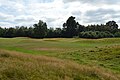
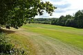
 Chartham Park Golf Course - geograph.org.uk - 5274878.jpg 640 × 426; 65 KB
-
 Chartham Park Golf Course - geograph.org.uk - 5274896.jpg 640 × 426; 66 KB
-
 Chartham Park Golf Course - geograph.org.uk - 5274897.jpg 640 × 426; 58 KB
-
 Chartham Park Golf Course - geograph.org.uk - 5274899.jpg 640 × 426; 102 KB
-
 Chartham Park Golf Course - geograph.org.uk - 5274900.jpg 640 × 426; 55 KB
-
 Chartham Park Golf Course - geograph.org.uk - 6833412.jpg 1,024 × 684; 120 KB
-
 Chartham Park Golf Course - geograph.org.uk - 6833419.jpg 1,024 × 684; 113 KB
-
 Chartham Park Golf Course - geograph.org.uk - 6833423.jpg 1,024 × 684; 213 KB
-
 Cherry Cottage, Quaker's Platt - geograph.org.uk - 6832841.jpg 1,024 × 690; 176 KB
-
 Cleared woodland under power line - geograph.org.uk - 6401405.jpg 1,024 × 685; 453 KB
-
 Clock House, Dormans Park near East Grinstead - geograph.org.uk - 6351008.jpg 1,024 × 768; 158 KB
-
 Colour in Jules Wood - geograph.org.uk - 2434402.jpg 640 × 480; 186 KB
-
 Conifer stands, Jules Wood - geograph.org.uk - 1711289.jpg 640 × 427; 104 KB
-
 Conifers, Jules Wood - geograph.org.uk - 1710335.jpg 640 × 427; 120 KB
-
 Conifers, Jules Wood - geograph.org.uk - 1710368.jpg 640 × 427; 131 KB
-
 Conifers, Jules Wood - geograph.org.uk - 1711295.jpg 640 × 427; 108 KB
-
 Cook's Pond Viaduct - geograph.org.uk - 6399918.jpg 1,024 × 768; 393 KB
-
 Cook's Pond Viaduct - geograph.org.uk - 6399927.jpg 1,024 × 768; 402 KB
-
 Cook's Pond Viaduct - geograph.org.uk - 6401705.jpg 1,024 × 684; 305 KB
-
 Corduroy Road at Dormans Park - geograph.org.uk - 2265179.jpg 1,944 × 2,592; 2.44 MB
-
 Cottage, Dry Hill Farm - geograph.org.uk - 6717484.jpg 1,024 × 684; 246 KB
-
 Cottages on West Street, Dormansland - geograph.org.uk - 6351055.jpg 1,024 × 768; 205 KB
-
 Countryside to the east of Dormansland - geograph.org.uk - 788294.jpg 640 × 451; 137 KB
-
 Crossing the county boundary - geograph.org.uk - 6604645.jpg 4,000 × 3,000; 4.76 MB
-
 Crossroads in Dormansland - geograph.org.uk - 2506818.jpg 3,072 × 2,304; 1.67 MB
-
 Crossroads near Dormansland - geograph.org.uk - 2506844.jpg 3,072 × 2,304; 2.6 MB
-
 Crossroads on Dormans High Street - geograph.org.uk - 4667777.jpg 2,304 × 1,728; 807 KB
-
 Dairy Farm - geograph.org.uk - 6603874.jpg 4,000 × 3,000; 4.54 MB
-
 Dairy Farm - geograph.org.uk - 6603876.jpg 3,767 × 2,825; 1.48 MB
-
 Dairy Farm House - geograph.org.uk - 6717388.jpg 1,024 × 684; 215 KB
-
 Dairy Wood - geograph.org.uk - 6717394.jpg 1,024 × 684; 313 KB
-
 Dairy Wood - geograph.org.uk - 6717395.jpg 1,024 × 684; 319 KB
-
 Derelict building, Dwelly Farm - geograph.org.uk - 4040807.jpg 640 × 388; 76 KB
-
 Derelict house - geograph.org.uk - 6603878.jpg 3,728 × 2,767; 1.53 MB
-
 Dormans High Street - geograph.org.uk - 4670855.jpg 2,304 × 1,728; 1,020 KB
-
 Dormans Park Entrance - geograph.org.uk - 5268972.jpg 640 × 426; 85 KB
-
 Dormans Park Telephone Exchange (1) - geograph.org.uk - 3056752.jpg 3,072 × 2,304; 1.78 MB
-
 Dormans Park Telephone Exchange (2) - geograph.org.uk - 3057058.jpg 3,072 × 2,304; 1.79 MB
-
 Dormans Station - geograph.org.uk - 6833162.jpg 1,024 × 684; 237 KB
-
 Dormans Station - geograph.org.uk - 6833164.jpg 1,024 × 684; 215 KB
-
 Dormans Station Rd - geograph.org.uk - 6833161.jpg 1,024 × 684; 226 KB
-
 Dormansland Recreation Ground - geograph.org.uk - 3823420.jpg 1,024 × 768; 215 KB
-
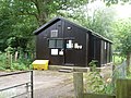
 Dormansland Rockets F.C. - geograph.org.uk - 2434306.jpg 640 × 480; 99 KB
-
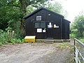
 Dormansland Rockets FC Club House - geograph.org.uk - 3787559.jpg 1,024 × 768; 137 KB
-
 Dormansland Rockets Football Club - geograph.org.uk - 2506847.jpg 3,072 × 2,304; 1.9 MB
-
 Dormansland Village Sign - geograph.org.uk - 2506826.jpg 2,304 × 3,072; 1.83 MB
-
 Dormansland, postbox No. RH7 62 - geograph.org.uk - 1778918.jpg 640 × 480; 76 KB
-

-
 Drain near Lingfield - geograph.org.uk - 6351993.jpg 1,024 × 768; 233 KB
-
 Drive to Greathed Manor - geograph.org.uk - 1947121.jpg 1,024 × 768; 303 KB
-
 Drive to Lower Barn Cottage - geograph.org.uk - 6400945.jpg 1,024 × 685; 472 KB
-
 Driveway from Starborough Farm - geograph.org.uk - 6904624.jpg 1,024 × 684; 283 KB
-

-

-
 Driveway to Greathed Manor - geograph.org.uk - 6717382.jpg 1,024 × 684; 284 KB
-
 Driveway to Greathed Manor, Dormansland - geograph.org.uk - 6351899.jpg 1,024 × 768; 362 KB
-
 Driveway to Starborough Castle - geograph.org.uk - 6904636.jpg 1,024 × 684; 275 KB
-
 Driveway to Starborough Castle - geograph.org.uk - 6904639.jpg 1,024 × 684; 296 KB
-
 Dry Hill Farm - geograph.org.uk - 1860953.jpg 1,024 × 768; 137 KB
-
 Dry Hill Fort - geograph.org.uk - 1711133.jpg 640 × 427; 96 KB
-
 Dry Hill Fort - geograph.org.uk - 1711278.jpg 640 × 427; 44 KB
-
 Dry Hill Fort - geograph.org.uk - 6717500.jpg 1,024 × 684; 334 KB
-
 Dry Hill Fort - geograph.org.uk - 6717524.jpg 1,024 × 684; 302 KB
-
 Dry Hill Fort - geograph.org.uk - 6717527.jpg 1,024 × 684; 262 KB
-
 Dry Hill Reservoir - geograph.org.uk - 1711117.jpg 640 × 427; 62 KB
-
 Dry Hill Reservoir - geograph.org.uk - 1711122.jpg 640 × 427; 55 KB
-
 Dryhill Farm - geograph.org.uk - 1952524.jpg 3,072 × 2,304; 1.6 MB
-
 Dwelly Farm - geograph.org.uk - 4040800.jpg 640 × 430; 82 KB
-
 Dwelly Farm Cottage - geograph.org.uk - 4040802.jpg 640 × 430; 89 KB
-
 Dwelly Farmhouse - geograph.org.uk - 4040804.jpg 640 × 430; 90 KB
-
 Dwelly Lane - geograph.org.uk - 1949559.jpg 3,072 × 2,304; 2.03 MB
-
 Dwelly Lane - geograph.org.uk - 4040786.jpg 640 × 430; 80 KB
-
 Dwelly Lane - geograph.org.uk - 4040787.jpg 640 × 430; 85 KB
-
 Dwelly Lane - geograph.org.uk - 4040791.jpg 640 × 430; 57 KB
-
 Dwelly Lane - geograph.org.uk - 4040793.jpg 640 × 430; 75 KB
-
 Dwelly Lane - geograph.org.uk - 4040795.jpg 640 × 410; 73 KB
-
 Dwelly Lane - geograph.org.uk - 4040810.jpg 640 × 430; 73 KB
-
 Dwelly Lane - geograph.org.uk - 4040816.jpg 640 × 430; 73 KB
-
 Dwelly Lane - geograph.org.uk - 6911371.jpg 1,024 × 684; 178 KB
-
 Dwelly Lane - geograph.org.uk - 6911377.jpg 1,024 × 684; 290 KB
-
 Dwelly Lane off Haxted Rd - geograph.org.uk - 6911374.jpg 1,024 × 684; 306 KB
-
 East Haxted Farm - geograph.org.uk - 1864516.jpg 3,072 × 2,304; 1.74 MB
-
 East Haxted Farm - geograph.org.uk - 4001424.jpg 640 × 430; 58 KB
-
 East Haxted Farm - geograph.org.uk - 6911243.jpg 1,024 × 685; 141 KB
-
 East Haxted Farm - geograph.org.uk - 6911327.jpg 1,024 × 685; 223 KB
-
 East Haxted Farm Cottage - geograph.org.uk - 4001383.jpg 640 × 430; 113 KB
-
 East Haxted Farm Grass Airstrip - geograph.org.uk - 4001415.jpg 640 × 430; 59 KB
-
 East Haxted Farm Grass Airstrip - geograph.org.uk - 4001416.jpg 640 × 430; 67 KB


_(1).JPG)
_(2).JPG)


_-_geograph.org.uk_-_3056752.jpg)
_-_geograph.org.uk_-_3057058.jpg)


