Category:Dolores River
Jump to navigation
Jump to search
river in Colorado and Utah in the United States | |||||
| Upload media | |||||
| Instance of | |||||
|---|---|---|---|---|---|
| Location | |||||
| Length |
| ||||
| Elevation above sea level |
| ||||
| Origin of the watercourse | |||||
| Mouth of the watercourse | |||||
| Drainage basin |
| ||||
| Basin country | |||||
| Tributary |
| ||||
| Lake on watercourse | |||||
 | |||||
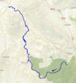
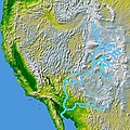
English: The Dolores River is a tributary of the Colorado River, approximately 250 mi (402 km) long, in the U.S. states of Colorado and Utah.
Español: El río Dolores (originalmente: río de Nuestra Señora de los Dolores) es un importante afluente del río Colorado, de 402 kilómetros de largo, que discurre por los estados de Colorado y Utah, en los Estados Unidos.
Subcategories
This category has the following 6 subcategories, out of 6 total.
Media in category "Dolores River"
The following 27 files are in this category, out of 27 total.
-
Colorado State Highway 90 at Dolores River bridge, January 2019.jpg 6,000 × 4,000; 22.31 MB
-
Colorado's Dolores River Valley in autumn LCCN2011631846.tiff 6,941 × 5,312; 211 MB
-
Confluence Of The San Miguel And Dolores Rivers, Sept 2012.jpg 2,560 × 1,920; 999 KB
-
Diversion Dam Rapid.jpg 2,100 × 1,400; 2.29 MB
-
Dolores (rivière) OSM.png 1,130 × 1,232; 2.3 MB
-
Dolores Canyon, Colorado from the air in winter.jpg 3,264 × 1,836; 1.66 MB
-
Dolores River (2008).jpg 500 × 375; 179 KB
-
Dolores River at Gateway Colorado.JPG 5,950 × 3,634; 20.76 MB
-
Dolores River at Low Water.jpg 800 × 600; 100 KB
-
Dolores river basin map.png 1,200 × 1,211; 2.43 MB
-
Dolores River Bridge.jpg 501 × 334; 78 KB
-
Dolores River Canyon, Colorado (101354598).jpg 1,600 × 1,200; 779 KB
-
Dolores River in Dolores, Colorado.JPG 6,000 × 4,000; 15.55 MB
-
Dolores River near Rico Colorado.jpg 3,888 × 2,592; 4.42 MB
-
Dolores River, Colorado - the river of sorrows (IA doloresrivercolo00unse).pdf 1,339 × 1,810, 352 pages; 18.41 MB
-
Doloresrivermap.png 1,600 × 1,680; 2.86 MB
-
Hanging Flume along Dolores River.jpg 2,100 × 1,400; 2.2 MB
-
Hanging Flume Overlook, Colorado State Highway 141.jpg 4,032 × 3,024; 5.51 MB
-
Max Coll Dolores 1997 by Barry Massey.jpg 1,739 × 1,153; 2 MB
-
OldSpanishTrailUT.gif 765 × 600; 84 KB
-
Paradox Valley and Dolores River.jpg 3,072 × 1,728; 2.61 MB
-
Proposed Dolores National Wild and Scenic River - final environmental statement (IA proposeddoloresn00unit).pdf 1,479 × 2,047, 404 pages; 77.17 MB
-
Slick Rock Bridge and the Dolores River.JPG 5,612 × 3,449; 11.73 MB
-
Slick Rock Bridge.JPG 5,268 × 3,336; 12.17 MB
-
Timpanogos Valley BHoU-p13.png 2,870 × 4,082; 225 KB
-
Wpdms nasa topo dolores river.jpg 300 × 300; 60 KB
Categories:
- Tributaries of the Colorado River in Colorado
- Tributaries of the Colorado River in Utah
- Bodies of water in Grand County, Utah
- Geography of Mesa County, Colorado
- Geography of Montrose County, Colorado
- Geography of San Miguel County, Colorado
- Geography of Dolores County, Colorado
- Geography of Montezuma County, Colorado


