Category:Disused railway stations in Cumbria
Jump to navigation
Jump to search
Wikimedia category | |||||
| Upload media | |||||
| Instance of | |||||
|---|---|---|---|---|---|
| Category combines topics | |||||
| Cumbria | |||||
ceremonial county of England    | |||||
| Instance of |
| ||||
| Location |
| ||||
| Capital | |||||
| Legislative body |
| ||||
| Inception |
| ||||
| Highest point | |||||
| Population |
| ||||
| Area |
| ||||
| Replaces |
| ||||
| Different from | |||||
| official website | |||||
 | |||||
Subcategories
This category has the following 45 subcategories, out of 45 total.
A
- Appleby East railway station (7 F)
B
- Barras railway station (2 F)
- Beckermet railway station (1 F)
- Blencow railway station (2 F)
- Bowness railway station (3 F)
- Brampton Town railway station (11 F)
- Branthwaite railway station (1 F)
- Bullgill railway station (3 F)
C
- Cliburn railway station (3 F)
- Clifton Moor railway station (1 F)
- Cotehill railway station (5 F)
- Crosby Garrett railway station (17 F)
- Cumwhinton railway station (5 F)
- Curthwaite railway station (4 F)
D
E
- Embleton railway station (1 F)
F
- Floriston railway station (1 F)
H
- Heads Nook railway station (2 F)
- How Mill railway station (2 F)
K
- Kirkandrews railway station (1 F)
L
- Long Marton railway station (2 F)
- Longtown railway station (4 F)
- Low Row railway station (3 F)
- Lowca railway station (1 F)
P
- Papcastle railway station (1 F)
- Piel railway station (1 F)
R
S
- Scotch Dyke railway station (4 F)
- Shap railway station (1 F)
- Silloth railway station (2 F)
- Smardale railway station (2 F)
T
- Tebay railway station (2 F)
- Torver railway station (3 F)
Media in category "Disused railway stations in Cumbria"
The following 60 files are in this category, out of 60 total.
-
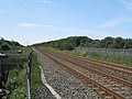
 Abbey Junction station (site-remains) geograph-3222246-by-Ben-Brooksbank.jpg 2,395 × 1,376; 2.49 MB
-
 Abbey Town station site geograph-3222645-by-Ben-Brooksbank.jpg 2,395 × 1,358; 3.17 MB
-
 Arlecdon station site geograph-3236426-by-Ben-Brooksbank.jpg 2,373 × 1,355; 2.74 MB
-
 Baggrow station site 1743587 1a5e3319.jpg 640 × 355; 105 KB
-
 Barbon railway station 1753683 35820027.jpg 640 × 369; 109 KB
-
 Bassenthwaite Lake Station geograph-2169541-by-Ben-Brooksbank.jpg 1,024 × 623; 329 KB
-
 Black Dyke Halt1812499 cd89a91d.jpg 3,528 × 1,918; 3.29 MB
-
 Braithwaite rail station1884432 77ef8496.jpg 640 × 386; 90 KB
-
 Brayton railway station 1891390 2e9eaec4.jpg 640 × 337; 72 KB
-
 Bridgefoot Station site of 1897030 6b6464a6.jpg 640 × 394; 82 KB
-
 Briery Halt (disused) (geograph 2478712).jpg 1,024 × 768; 562 KB
-
 Brigham (Cumberland) Station 1906983 1c110717.jpg 640 × 437; 81 KB
-
 Bromfield (Cumberland) Station site of 1917769 6f3975b2.jpg 640 × 383; 112 KB
-
 Broughton Cross Station (remains) - geograph.org.uk - 1924555.jpg 640 × 348; 91 KB
-
 Burgh-by-Sands Station 1939604 ceb64412.jpg 640 × 387; 117 KB
-
 Calthwaite station site geograph-3098874-by-Ben-Brooksbank.jpg 2,350 × 1,308; 2.64 MB
-
 Camerton station (remains) geograph-3099600-by-Ben-Brooksbank.jpg 2,279 × 1,447; 3.17 MB
-
 Cleator Moor West station trackbed geograph-3111383-by-Ben-Brooksbank.jpg 2,401 × 1,354; 2.38 MB
-
 Clifton & Lowther station site vicinity geograph-3111582-by-Ben-Brooksbank.jpg 2,348 × 1,382; 2.9 MB
-
 Cockermouth station site geograph-3112630-by-Ben-Brooksbank.jpg 2,394 × 1,419; 3.42 MB
-
 Cummersdale station site geograph-3117561-by-Ben-Brooksbank.jpg 2,325 × 1,365; 2.7 MB
-
 Dearham station site geograph-3405883-by-Ben-Brooksbank.jpg 2,235 × 1,394; 2.57 MB
-
 Distington (Joint) station, with train 1951 (geograph 5325623).jpg 2,399 × 1,450; 1.74 MB
-
 Disused railway, Harrington, West Cumbria - geograph.org.uk - 60239.jpg 640 × 427; 140 KB
-
 Drumburgh station site geograph-3420443-by-Ben-Brooksbank.jpg 2,351 × 1,287; 3.83 MB
-
 Egremont station site geograph-3453749-by-Ben-Brooksbank.jpg 2,290 × 1,431; 2.92 MB
-
 Former railway station, Troutbeck (geograph 6884771).jpg 1,600 × 1,035; 413 KB
-
 Gaisgill station site geograph-3555224-by-Ben-Brooksbank.jpg 2,396 × 1,460; 2.87 MB
-
 Greenodd geograph-3581461-by-Ben-Brooksbank.jpg 2,336 × 1,360; 2.45 MB
-
 Harker station (site remains) geograph-3613025-by-Ben-Brooksbank.jpg 2,440 × 1,580; 3.29 MB
-
 Heading South - geograph.org.uk - 628336.jpg 640 × 426; 96 KB
-
 Heversham geograph-3673271-by-Ben-Brooksbank.jpg 2,395 × 1,401; 2.48 MB
-
 High Harrington railway station (site), Cumbria (geograph 3566362).jpg 1,024 × 768; 322 KB
-
 Island Road Barrow Island - geograph.org.uk - 1406132.jpg 640 × 457; 273 KB
-
 Kershope Foot station site geograph-3719746-by-Ben-Brooksbank.jpg 2,338 × 1,364; 4.16 MB
-
 Kirkbride geograph-3725107-by-Ben-Brooksbank.jpg 2,378 × 1,531; 3.32 MB
-
 Kirkby Lonsdale railway station (site), Lancashire (geograph 3452821).jpg 1,024 × 768; 253 KB
-
 Kirkby Thore station site geograph-3726645-by-Ben-Brooksbank.jpg 2,375 × 1,498; 3.79 MB
-
 Leegate railway station (site), Cumbria (geograph 3565846).jpg 1,024 × 768; 230 KB
-
 Low Gill station site geograph-3764119-by-Ben-Brooksbank.jpg 2,390 × 1,451; 4.21 MB
-
 Middleton-in-Lune station site geograph-3786663-by-Ben-Brooksbank.jpg 2,391 × 1,436; 4.98 MB
-
 Moor Row station, ex-Whitehaven, Cleator & Egremont Railway 1952 (geograph 5395765).jpg 2,365 × 1,297; 1.38 MB
-
 Naworth railway station (site), Cumbria (geograph 6170014).jpg 1,600 × 1,200; 427 KB
-
 Old platform at Hallbankgate - geograph.org.uk - 1539486.jpg 640 × 480; 99 KB
-
 Old Station House beside Tebay Road - geograph.org.uk - 3649890.jpg 1,024 × 683; 283 KB
-
 Original railway station, Ulverston.jpg 1,024 × 768; 169 KB
-
 Parkhouse Halt - remains of platform (geograph 5689649).jpg 640 × 427; 468 KB
-
 PartonHaltWTT.jpg 1,207 × 1,894; 590 KB
-
 Port Carlisle railway station remnants.JPG 2,288 × 1,712; 2.08 MB
-
 Scotby railway station (site), Cumbria (geograph 4206477).jpg 1,024 × 768; 185 KB
-
 Sedbergh Station Building in 2019.jpg 2,000 × 1,023; 313 KB
-
 Siddick (Junction) railway station (site), Cumbria (geograph 3564300).jpg 1,024 × 768; 186 KB
-
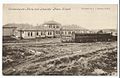 SillothConvalescentPostcard0001.jpg 1,126 × 736; 228 KB
-
 Southwaite - geograph-4055216-by-Richard-Webb.jpg 640 × 480; 271 KB
-
 St Helens Colliery - geograph-1849804-by-Rose-and-Trev-Clough.jpg 640 × 480; 310 KB
-
 Threlkeld railway station in 2008.jpg 640 × 426; 134 KB
-
 Upperby Station.jpg 1,572 × 2,128; 3.3 MB
-
 Whitehaven Bransty railway station (site), Cumbria (geograph 3564134).jpg 1,024 × 768; 152 KB
-
 Whitehaven Preston Street railway station (site), Cumbria (geograph 3563981).jpg 1,024 × 768; 175 KB
-
 Woodland railway station (site), Cumbria (geograph 3563639).jpg 1,024 × 768; 322 KB
_geograph-3222246-by-Ben-Brooksbank.jpg)


_(geograph_2478712).jpg)
_Station_1906983_1c110717.jpg)
_Station_site_of_1917769_6f3975b2.jpg)
_-_geograph.org.uk_-_1924555.jpg)


_geograph-3099600-by-Ben-Brooksbank.jpg)


_station,_with_train_1951_(geograph_5325623).jpg)


.jpg)


_geograph-3613025-by-Ben-Brooksbank.jpg)


,_Cumbria_(geograph_3566362).jpg)


,_Lancashire_(geograph_3452821).jpg)

,_Cumbria_(geograph_3565846).jpg)


.jpg)
,_Cumbria_(geograph_6170014).jpg)


.jpg)


,_Cumbria_(geograph_4206477).jpg)

_railway_station_(site),_Cumbria_(geograph_3564300).jpg)


,_Cumbria_(geograph_3564134).jpg)
,_Cumbria_(geograph_3563981).jpg)
,_Cumbria_(geograph_3563639).jpg)