Category:Disused canals in England
Jump to navigation
Jump to search
Subcategories
This category has the following 5 subcategories, out of 5 total.
Media in category "Disused canals in England"
The following 13 files are in this category, out of 13 total.
-
 Basingstoke Canal, Up Nately 01.jpg 4,128 × 3,096; 9.43 MB
-
 Basingstoke Canal, Up Nately 02.jpg 4,128 × 3,096; 8.24 MB
-
 Basingstoke Canal, Up Nately 03.jpg 4,128 × 3,096; 9.57 MB
-
 Basingstoke Canal, Up Nately 04.jpg 4,128 × 3,096; 6.43 MB
-
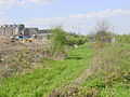
 Course of former canal - geograph.org.uk - 1275077.jpg 640 × 457; 190 KB
-
-
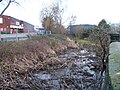
 Redundant canal - geograph.org.uk - 1155701.jpg 640 × 408; 281 KB
-
 Route of Former Canal - geograph.org.uk - 201480.jpg 640 × 480; 140 KB
-
 The line of the Old Cut, just west of Bottomboat - geograph.org.uk - 6479888.jpg 1,600 × 1,200; 510 KB
-
-
 The site of the first Lake Lock - geograph.org.uk - 6480643.jpg 1,600 × 1,200; 577 KB
-
 Three waterways in the Calder valley, near Bottomboat - geograph.org.uk - 6480663.jpg 1,600 × 1,200; 518 KB
-
 Where's the water^ - geograph.org.uk - 1155715.jpg 640 × 441; 287 KB


