Category:District maps of Mohlsdorf-Teichwolframsdorf
Jump to navigation
Jump to search
Media in category "District maps of Mohlsdorf-Teichwolframsdorf"
The following 12 files are in this category, out of 12 total.
-
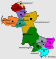
Gemeindegliederung Mohlsdorf-Teichwolframsdorf.png 1,078 × 1,129; 154 KB
-
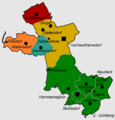
GemeindegliederungMohlsdorfTeichwolframsdorf1920-1.png 1,066 × 1,117; 204 KB
-
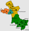
GemeindegliederungMohlsdorfTeichwolframsdorf1922-1.png 1,067 × 1,117; 201 KB
-
GemeindegliederungMohlsdorfTeichwolframsdorf1924-1.png 1,067 × 1,117; 203 KB
-
GemeindegliederungMohlsdorfTeichwolframsdorf1928-1.png 1,067 × 1,117; 202 KB
-
GemeindegliederungMohlsdorfTeichwolframsdorf1956-1.png 1,067 × 1,117; 208 KB
-
GemeindegliederungMohlsdorfTeichwolframsdorf1958-1.png 1,078 × 1,129; 157 KB
-
GemeindegliederungMohlsdorfTeichwolframsdorf1974-1.png 1,078 × 1,129; 157 KB
-
GemeindegliederungMohlsdorfTeichwolframsdorf1994-1.png 1,078 × 1,129; 155 KB
-
GemeindegliederungMohlsdorfTeichwolframsdorf1994-2.png 1,078 × 1,129; 156 KB
-
GemeindegliederungMohlsdorfTeichwolframsdorf1997-1.png 1,078 × 1,129; 154 KB
-
GemeindegliederungMohlsdorfTeichwolframsdorf2012-1.png 1,078 × 1,129; 156 KB


