Category:Distant views of Mount Battock
Jump to navigation
Jump to search
Media in category "Distant views of Mount Battock"
The following 16 files are in this category, out of 16 total.
-
 Blanket Bog in the Forest of Birse - geograph.org.uk - 1495246.jpg 640 × 480; 86 KB
-
 Electric fence on Mudlee Bracks - geograph.org.uk - 1323880.jpg 640 × 480; 78 KB
-
 Kettock Burn - geograph.org.uk - 1238844.jpg 640 × 428; 153 KB
-
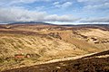
 Mount Battock - geograph.org.uk - 422334.jpg 640 × 480; 86 KB
-
 Mount Battock from trig point - geograph.org.uk - 1457139.jpg 640 × 427; 61 KB
-
 North Grain - geograph.org.uk - 1775753.jpg 640 × 359; 88 KB
-

-
 On Little Calf Hill - geograph.org.uk - 1238684.jpg 640 × 428; 164 KB
-
 Peter Hill and Finzean from Glack's Hill - geograph.org.uk - 882306.jpg 640 × 480; 112 KB
-
 Summit, Wester Cairn - geograph.org.uk - 422330.jpg 640 × 480; 91 KB
-
 Sunset over Clachnaben - geograph.org.uk - 274093.jpg 640 × 352; 29 KB
-
 Trig Point and Outcrop - geograph.org.uk - 298147.jpg 640 × 481; 67 KB
-
 Bogpool, Bennygray - geograph.org.uk - 420242.jpg 640 × 480; 104 KB
-
 Burn of Turret - geograph.org.uk - 422287.jpg 640 × 480; 115 KB
-
 Hill of Badymicks - geograph.org.uk - 132891.jpg 640 × 480; 55 KB
-
 View from Tillydrine - geograph.org.uk - 353379.jpg 640 × 480; 81 KB


