Category:Distance views of BP Saltend
Jump to navigation
Jump to search
Media in category "Distance views of BP Saltend"
The following 47 files are in this category, out of 47 total.
-
 'Mistified' Chemical Works - geograph.org.uk - 299937.jpg 640 × 362; 46 KB
-
 A Wet Morning near Saltend - geograph.org.uk - 913454.jpg 640 × 480; 97 KB
-
 Allotments at Paull - geograph.org.uk - 756884.jpg 640 × 480; 194 KB
-
 Behind the flood bank - geograph.org.uk - 323836.jpg 640 × 427; 72 KB
-
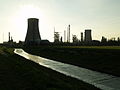
 BP Salt End chemical plant - geograph.org.uk - 160576.jpg 640 × 427; 49 KB
-
 Burstwick Drain - geograph.org.uk - 1052952.jpg 504 × 640; 90 KB
-
 Burstwick Drain - geograph.org.uk - 315842.jpg 640 × 480; 84 KB
-
 Burstwick Drain - geograph.org.uk - 561498.jpg 640 × 480; 92 KB
-
 Burstwick Drain - geograph.org.uk - 574776.jpg 640 × 482; 110 KB
-
 Burstwick Drain - geograph.org.uk - 807186.jpg 480 × 640; 122 KB
-
 Burstwick Drain-Hedon Haven - geograph.org.uk - 479970.jpg 640 × 482; 100 KB
-
 Drainside Path - geograph.org.uk - 278362.jpg 640 × 480; 106 KB
-
 East of Hull - geograph.org.uk - 303535.jpg 464 × 640; 118 KB
-
 Farmland towards Saltend - geograph.org.uk - 275114.jpg 640 × 480; 138 KB
-
 Field of Rapeseed - geograph.org.uk - 801037.jpg 640 × 480; 145 KB
-
 Flooded Burstwick Drain - geograph.org.uk - 479928.jpg 640 × 480; 120 KB
-
 Heading Upstream - geograph.org.uk - 504863.jpg 640 × 573; 127 KB
-
 Hedon Bypass from the Flyover - geograph.org.uk - 414496.jpg 640 × 463; 71 KB
-
 Hedon Bypassed - geograph.org.uk - 1518614.jpg 640 × 499; 67 KB
-

-
 Humber Bank Footpath - geograph.org.uk - 1577483.jpg 640 × 480; 231 KB
-
 Humber Bank Footpath - geograph.org.uk - 540714.jpg 640 × 480; 108 KB
-
 Humber Bank Footpath - geograph.org.uk - 540738.jpg 640 × 480; 111 KB
-
 Humber Foreshore - geograph.org.uk - 581008.jpg 640 × 426; 92 KB
-
 Humber Foreshore near Haven Farm - geograph.org.uk - 821925.jpg 640 × 421; 73 KB
-
 Humber River Bank near Paull - geograph.org.uk - 30360.jpg 640 × 480; 93 KB
-
 Humber River Defences north of Paull - geograph.org.uk - 793635.jpg 640 × 472; 95 KB
-
 Land drain - geograph.org.uk - 757556.jpg 480 × 640; 185 KB
-
 Looking towards Salt End - geograph.org.uk - 331271.jpg 427 × 640; 105 KB
-
 Looking towards Salt End - geograph.org.uk - 849750.jpg 640 × 424; 67 KB
-
 On the Bank of the River Humber - geograph.org.uk - 803336.jpg 640 × 571; 88 KB
-
 On the Humber River Bank - geograph.org.uk - 157676.jpg 640 × 480; 80 KB
-
 Paull Road, near Salt End - geograph.org.uk - 757534.jpg 640 × 459; 147 KB
-
 Ploughed Farmland - geograph.org.uk - 1045761.jpg 640 × 411; 86 KB
-
 Pollard Clough, near Salt End - geograph.org.uk - 757589.jpg 480 × 640; 171 KB
-
 Power Security - geograph.org.uk - 635242.jpg 640 × 480; 135 KB
-
 Sails Furled - geograph.org.uk - 773802.jpg 640 × 480; 141 KB
-
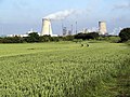
 Saltend Plume - geograph.org.uk - 1167036.jpg 640 × 480; 44 KB
-
 Saltend Power Station seen from Paull Haven.jpg 640 × 480; 73 KB
-
 Saltend Silhouette - geograph.org.uk - 394202.jpg 640 × 480; 67 KB
-
 The Foreshore at Goxhill Haven - geograph.org.uk - 770266.jpg 427 × 640; 96 KB
-
 The Road to Infinity - geograph.org.uk - 853694.jpg 508 × 640; 88 KB
-
 Twilight at Saltend - geograph.org.uk - 1166139.jpg 640 × 421; 43 KB
-
 Twin towers on the New York skyline - geograph.org.uk - 765472.jpg 640 × 362; 29 KB
-
 Webbed Field - geograph.org.uk - 588341.jpg 640 × 480; 124 KB
-
 Wheat Field - geograph.org.uk - 912198.jpg 640 × 480; 120 KB
-
 Wheat Field near Hedon - geograph.org.uk - 471728.jpg 640 × 478; 163 KB


