Category:Dirt roads in Castile and León
Jump to navigation
Jump to search
Autonomous communities of Spain: Andalusia · Aragon · Canary Islands · Castile and León · Castilla–La Mancha · Catalonia · Extremadura · Galicia · Community of Madrid · Valencian Community · Autonomous cities:
Media in category "Dirt roads in Castile and León"
The following 130 files are in this category, out of 130 total.
-
 "Deux guardias civiles (gendarmes), route de Salamanque a Zamora" (19314369924).jpg 2,754 × 3,582; 2.38 MB
-
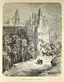 "Ségovie- l'Alcazar et la Cathédrale" (19910796196).jpg 2,718 × 3,492; 2.78 MB
-
 01b Cogeces del Monte Lou 2.jpg 2,592 × 1,944; 1.85 MB
-
 070408sahornil02.jpg 320 × 240; 23 KB
-
 12 Aniago entrada despoblado Lou.JPG 3,264 × 2,448; 2.31 MB
-
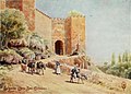 1906, Northern Spain, pp. 244-245, Segovia. Arco San Esteban.jpg 2,238 × 1,606; 2.11 MB
-
 1906, Northern Spain, pp. 252-253, Segovia. Arco Santiago.jpg 1,548 × 2,206; 2.02 MB
-

-

-

-
 2 Vistas desde el GR 10.3.JPG 5,184 × 3,888; 6.66 MB
-
 2011-09-17 Camino viejo del Paular - panoramio (1).jpg 2,272 × 1,704; 1.16 MB
-
 2011-09-17 Carril de Gallo - panoramio.jpg 1,704 × 2,272; 1.32 MB
-
 2011-09-17 Carril del Gallo - panoramio.jpg 2,272 × 1,704; 1.35 MB
-
 Adaja- vado el cordel.jpg 4,288 × 2,848; 4.43 MB
-
 Aguilar de Montuenga - 001 (33861644095).jpg 1,024 × 680; 103 KB
-
 Arapiles, battlefield 2015.09.05 01.jpg 5,312 × 2,988; 7.66 MB
-
 Arcones 02.jpg 3,872 × 2,592; 8.88 MB
-
 Aureliano Beruete y Moret Avila 1909.jpg 3,200 × 2,123; 2.69 MB
-
 Boca de Huérgano 08.jpg 4,000 × 3,000; 5.44 MB
-
 Boca de Huérgano 09.jpg 4,000 × 3,000; 4.56 MB
-
 Burgos (provincia) 1980 13.jpg 1,061 × 704; 176 KB
-
 Burgos (provincia) 1996 04.jpg 1,042 × 664; 960 KB
-
 Camino de los Pegueros.JPG 3,072 × 2,304; 1.39 MB
-
 Camino San Bartolome (ruta Daganzo-Narros) - panoramio.jpg 2,560 × 1,536; 1.16 MB
-
 Camino santiago.jpg 600 × 402; 154 KB
-
 Camino Torres. Etapa 04. Alba de Yeltes - Ciudad Rodrigo (9547625657).jpg 3,264 × 2,448; 3.59 MB
-
 Camino Torres. Etapa 05. Ciudad Rodrigo - Gallegos de Argañán (9558134715).jpg 3,264 × 2,448; 2.4 MB
-
 Camino Torres. Etapa 05. Ciudad Rodrigo - Gallegos de Argañán.jpg 1,513 × 1,137; 634 KB
-
 Camino Vadiniense - Riaño a Horcadas 13.jpg 4,000 × 3,000; 2.84 MB
-
 Camino Vadiniense entre Barniedo de la Reina y Villafrea de la Reina 01.jpg 4,000 × 3,000; 5.28 MB
-
 Camino Vadiniense entre Barniedo de la Reina y Villafrea de la Reina 05.jpg 4,000 × 3,000; 6.7 MB
-
 Camino Vadiniense entre Barniedo de la Reina y Villafrea de la Reina 06.jpg 4,000 × 3,000; 5.49 MB
-
 Camino Vadiniense entre Barniedo de la Reina y Villafrea de la Reina 08.jpg 4,000 × 3,000; 4.29 MB
-
 Camino Vadiniense entre Barniedo de la Reina y Villafrea de la Reina 09.jpg 4,000 × 3,000; 4.35 MB
-
 Camino Vadiniense entre Barniedo de la Reina y Villafrea de la Reina 16.jpg 4,000 × 3,000; 5.19 MB
-
 Camino Vadiniense entre Boca de Huérgano y Riaño 01.jpg 4,000 × 3,000; 4.96 MB
-
 Camino Vadiniense entre Boca de Huérgano y Riaño 04.jpg 4,000 × 3,000; 4.06 MB
-
 Camino Vadiniense entre Boca de Huérgano y Riaño 10.jpg 4,000 × 3,000; 5.07 MB
-
 Camino Vadiniense entre Boca de Huérgano y Riaño 11.jpg 4,000 × 3,000; 5.45 MB
-
 Camino Vadiniense entre Boca de Huérgano y Riaño 12.jpg 4,000 × 3,000; 4.9 MB
-
 Camino Vadiniense entre Boca de Huérgano y Riaño 15.jpg 4,000 × 3,000; 4.61 MB
-
 Camino Vadiniense entre Crémenes y Verdiago 02.jpg 4,000 × 3,000; 5.93 MB
-
 Camino Vadiniense entre Crémenes y Verdiago 19.jpg 4,000 × 3,000; 6.98 MB
-
 Camino Vadiniense entre Crémenes y Verdiago 20.jpg 4,000 × 3,000; 5.33 MB
-
 Camino Vadiniense entre Crémenes y Verdiago 26.jpg 4,000 × 3,000; 4.2 MB
-
 Camino Vadiniense entre Crémenes y Verdiago 27.jpg 4,000 × 3,000; 3.57 MB
-
 Camino Vadiniense entre Crémenes y Verdiago 28.jpg 4,000 × 3,000; 3.82 MB
-
 Camino Vadiniense entre Crémenes y Verdiago 29.jpg 4,000 × 3,000; 4.23 MB
-
 Camino Vadiniense entre Horcadas y Las Salas 29.jpg 4,000 × 3,000; 4.03 MB
-
 Camino Vadiniense entre Horcadas y Las Salas 33.jpg 4,000 × 3,000; 7.13 MB
-
 Camino Vadiniense entre Horcadas y Las Salas 35.jpg 4,000 × 3,000; 6.16 MB
-
 Camino Vadiniense entre Horcadas y Las Salas 40.jpg 4,000 × 3,000; 5.51 MB
-
 Camino Vadiniense entre Horcadas y Las Salas 43.jpg 4,000 × 3,000; 6.03 MB
-
 Camino Vadiniense entre Verdiago y Alejico 01.jpg 4,000 × 3,000; 5.4 MB
-
 Campos de Cereal. (4442805145).jpg 3,888 × 2,592; 6.5 MB
-
 Castañar2 - panoramio.jpg 2,592 × 1,944; 2.19 MB
-
 Cebada en Valle de Amblés.jpg 4,128 × 2,322; 4.03 MB
-
 Countryside in Spain.jpg 2,113 × 1,112; 850 KB
-
 Cuneta trabajada.jpg 640 × 480; 77 KB
-
 Desde el GR 10.3.JPG 5,184 × 3,888; 6.33 MB
-
 El Cordel.JPG 1,632 × 1,224; 874 KB
-
 Ermita de la Virgen de la Mencalilla, Almazul, Soria, España, 2015-12-29, DD 31.JPG 8,688 × 5,792; 9.51 MB
-
 Hoyos del Tozo 05.JPG 2,048 × 1,536; 347 KB
-
 Hoyos del Tozo 06.JPG 2,048 × 1,536; 437 KB
-
 La Serrota desde Sierra Yemas.JPG 4,288 × 2,848; 2.96 MB
-
 Las Tuerces (Villaescusa de las Torres) - 022 (43082199820).jpg 4,288 × 2,848; 6.66 MB
-
 León (provincia) 1996 06.jpg 1,006 × 670; 1.49 MB
-
 Llanuras nevadas en la provincia de Ávila.jpg 2,000 × 1,321; 622 KB
-
 LosPinosMDR.jpg 2,592 × 1,944; 1.17 MB
-
 Madrigal de las Altas Torres - 019 (30065303843).jpg 3,072 × 2,304; 2.61 MB
-
 Madrigal de las Altas Torres convento SAgustin.jpg 3,264 × 2,448; 1.82 MB
-
 Mironcillo Ávila.JPG 4,288 × 2,848; 3 MB
-
 Mota del Marques - 010 (40947359045).jpg 4,288 × 2,848; 5.86 MB
-
 Museo Salaguti (Sasamon) - 013 (30406357700).jpg 4,288 × 2,848; 4.87 MB
-
 Muñochas y Padiernos.JPG 4,288 × 2,848; 3 MB
-
 Navafría 1976 16.jpg 1,060 × 709; 859 KB
-
 Navafría 1976 21.jpg 647 × 924; 743 KB
-
 Naveros de Pisuerga 2.jpg 3,264 × 2,145; 5.93 MB
-
 Neila 1977 16.jpg 1,003 × 670; 892 KB
-
 Neila 1977 22.jpg 696 × 1,056; 847 KB
-
 Neila 1977 23.jpg 1,056 × 705; 892 KB
-
 Noviercas, amapolas 7.jpg 4,288 × 2,584; 15.65 MB
-
 Olmos de Ojeda - Iglesia de Santa Eufemia de Cozollos - 006 (33940352055).jpg 2,848 × 4,288; 6.34 MB
-
 Ontalvilla de Almazán 1991.jpg 1,000 × 694; 839 KB
-
 Oteruelo de la Valduerna 02.jpg 2,560 × 1,920; 896 KB
-
 P3140649canalduero.JPG 480 × 640; 162 KB
-
 Panorama de Támara (8352057893).jpg 4,032 × 2,272; 2.19 MB
-
 Panorámica de Frades de la Sierra.jpg 6,240 × 2,080; 12.43 MB
-
 Pedraza20120602180629SAM 0546.jpg 3,648 × 2,736; 3.05 MB
-
 Peguerinos 1975 01.jpg 984 × 637; 615 KB
-
 Peregrinos llegando a Salamanca.jpg 800 × 525; 107 KB
-
 Peña de Francia desde Las Cavenes.jpg 4,288 × 2,848; 10.5 MB
-
 Pinilla de Toro x.jpg 3,648 × 2,736; 4.79 MB
-
 Pinilla de Toro z.jpg 3,648 × 2,736; 4.75 MB
-
 Puente sobre el Canal de Castilla - panoramio.jpg 2,288 × 1,712; 1.43 MB
-
 Puentedey - panoramio (1).jpg 3,648 × 2,736; 2.83 MB
-
 Retuerta01.jpg 1,024 × 683; 161 KB
-
 Revellinos, camino de las bodegas, 01.jpg 5,434 × 3,622; 10.08 MB
-
 Revellinos, camino de las bodegas, 02.jpg 5,396 × 3,597; 11.82 MB
-
 Revellinos, camino de las bodegas, 04.jpg 5,472 × 3,648; 11.23 MB
-
 Revellinos, camino de las bodegas, 07.jpg 5,396 × 3,597; 11.62 MB
-
 Río de la Hija 1.JPG 4,288 × 2,848; 3.03 MB
-
 San Ildefonso, monte 1974 01.jpg 1,031 × 679; 808 KB
-
 San Ildefonso, monte 1974 13.jpg 693 × 1,050; 879 KB
-
 Santibañez del Val - 001 (36569163112).jpg 4,288 × 2,848; 5.06 MB
-
 Santibañez del Val - 002 (36691876026).jpg 4,288 × 2,848; 5.73 MB
-
 Senda Escultor Ursi - 029 (41066076892).jpg 2,848 × 4,288; 6.55 MB
-
 Senda Escultor Ursi - 077 (41065960412).jpg 4,288 × 2,848; 6.59 MB
-
 Sierra de Ayllón, 1973 05.jpg 699 × 1,028; 819 KB
-
 Sierra de Francia, Salamanca 03.JPG 3,568 × 2,368; 6.94 MB
-
 Sierra de la Paramera 6.JPG 4,288 × 2,848; 3.02 MB
-
 Sierra de Ávila.jpg 4,288 × 2,848; 2.92 MB
-
 Sobarriba2.JPG 5,184 × 3,456; 7.22 MB
-
 Subida al Cabeza de la Parra.jpg 2,048 × 1,280; 959 KB
-
 Subida Cildá.JPG 3,648 × 2,736; 1.61 MB
-
 Tanarro2.jpg 2,560 × 1,920; 2.91 MB
-
 Treviño - Cerro de Treviño - Camino 04.jpg 4,592 × 3,448; 9.12 MB
-
 Valle del Rio Rituerto 2 (4551740593).jpg 2,604 × 3,900; 7.02 MB
-
 Villacibio-SanPelayo.jpg 2,458 × 1,843; 1.21 MB
-
 Villafranca Montes de Oca, Burgos, Spain - panoramio.jpg 3,888 × 2,592; 6.68 MB
-
 Villalba de los Alcores - 006 (41846266681).jpg 4,288 × 2,848; 6.54 MB
-
 Villavendimio k.jpg 3,648 × 2,736; 4.75 MB
-
 Villavendimio qw.jpg 4,608 × 3,456; 3.15 MB
-
 Vista de Narros desde el camino de Salvadios - panoramio.jpg 5,472 × 3,648; 6.71 MB
-
 VistaDeMaderuelo.jpg 6,038 × 1,473; 2.33 MB
-
 Vistas desde la Fuente del mojón.JPG 5,184 × 3,888; 6.82 MB
-
 Ávila (provincia) 1976 03.jpg 1,060 × 707; 801 KB
-
 Ávila (provincia) 1982 07.jpg 1,060 × 704; 660 KB
-
 Ávila from the North-west.jpg 1,152 × 805; 510 KB
,_route_de_Salamanque_a_Zamora%22_(19314369924).jpg)
.jpg)


.jpg)


.jpg)


.jpg)


_1980_13.jpg)
_1996_04.jpg)

_-_panoramio.jpg)

.jpg)
.jpg)


.jpg)


_-_022_(43082199820).jpg)
_1996_06.jpg)


.jpg)


.jpg)
_-_013_(30406357700).jpg)


.jpg)


.jpg)


.jpg)


.jpg)
.jpg)
.jpg)
.jpg)


.jpg)


.jpg)


_1976_03.jpg)
_1982_07.jpg)
