Category:Dinnet
Jump to navigation
Jump to search
village in Aberdeenshire, Scotland, UK  | |||||
| Upload media | |||||
| Instance of | |||||
|---|---|---|---|---|---|
| Location |
| ||||
 | |||||
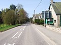
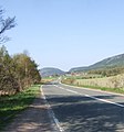
English: Dinnet is a village in the Marr area of Aberdeenshire, Scotland. Approximately equidistant from Deeside towns Aboyne and Ballater and situated on the main A93 road in the valley of the River Dee, it is said to be the gateway to both the Highlands (despite the fact that it is well within the boundaries of present-day Aberdeenshire) and the Cairngorms National Park.
Subcategories
This category has the following 4 subcategories, out of 4 total.
Media in category "Dinnet"
The following 200 files are in this category, out of 270 total.
(previous page) (next page)-
 A house near the old Dinnet Station - geograph.org.uk - 1352475.jpg 640 × 480; 163 KB
-

-
 A track leading to the fishing beat - geograph.org.uk - 1372289.jpg 640 × 428; 177 KB
-
 A track towards Loch Kinord - geograph.org.uk - 1352463.jpg 640 × 480; 139 KB
-
 A tributary of the Pollagach Burn - geograph.org.uk - 632076.jpg 480 × 640; 99 KB
-
 A93 across Muir of Dinnet - geograph.org.uk - 791988.jpg 640 × 480; 116 KB
-
 Aboyne Station platform sign - geograph.org.uk - 791497.jpg 640 × 480; 118 KB
-
 Access point for Monaltrie Monument - geograph.org.uk - 792884.jpg 640 × 480; 116 KB
-
 Access to Deecastle (July) - geograph.org.uk - 868666.jpg 640 × 480; 95 KB
-
 Access to Newton farmhouse (July) - geograph.org.uk - 868622.jpg 640 × 480; 108 KB
-
 B9158 at Dinnet - geograph.org.uk - 631970.jpg 640 × 480; 85 KB
-

-
 Braeroddach Loch - geograph.org.uk - 545917.jpg 640 × 427; 94 KB
-
 Bridle path - geograph.org.uk - 364411.jpg 640 × 480; 166 KB
-
 Bridle way - geograph.org.uk - 364462.jpg 480 × 640; 128 KB
-
 Burnroot Sawmill - geograph.org.uk - 237184.jpg 640 × 366; 205 KB
-
 Burnroot Sawmill - geograph.org.uk - 237190.jpg 640 × 377; 197 KB
-
 Cairngorms National Park - geograph.org.uk - 377217.jpg 640 × 480; 129 KB
-
 Cambus o'May - geograph.org.uk - 269436.jpg 640 × 480; 166 KB
-
 Chapel of St Lesmo in Glen Tanar - geograph.org.uk - 150553.jpg 640 × 427; 163 KB
-
 Clarack - geograph.org.uk - 791944.jpg 640 × 480; 116 KB
-
 Clarack - geograph.org.uk - 792826.jpg 640 × 480; 118 KB
-
 Clarack Cottage - geograph.org.uk - 791959.jpg 640 × 480; 113 KB
-
 Corner shop, Dinnet - geograph.org.uk - 868524.jpg 640 × 480; 78 KB
-
 Cottages by A97 in Dinnet - geograph.org.uk - 1352472.jpg 577 × 401; 80 KB
-
 Culvert crossing on old Deeside Railway - geograph.org.uk - 797243.jpg 480 × 640; 115 KB
-
 Dee Valley from Tillycairn Farm - geograph.org.uk - 13822.jpg 640 × 426; 250 KB
-

-
 Dinnet carpark and Village Hall - geograph.org.uk - 791741.jpg 640 × 480; 115 KB
-
 Dinnet crossroads - geograph.org.uk - 791947.jpg 640 × 480; 116 KB
-
 Dinnet village Hall - geograph.org.uk - 791750.jpg 640 × 480; 114 KB
-
 Dinnet War Memorial - geograph.org.uk - 868532.jpg 511 × 640; 96 KB
-
 Dinnet's former Railway Station - geograph.org.uk - 791730.jpg 640 × 480; 119 KB
-
 Down-line old Deeside Railway - geograph.org.uk - 791748.jpg 640 × 480; 116 KB
-

-
 Downstream face of Inchmarnoch Bridge - geograph.org.uk - 632106.jpg 640 × 480; 101 KB
-
 East Lodge, Dinnet House - geograph.org.uk - 868572.jpg 640 × 480; 110 KB
-
 Entering Dinnet from the north - geograph.org.uk - 1352470.jpg 640 × 480; 190 KB
-
 Forest of Birse - geograph.org.uk - 586288.jpg 640 × 480; 103 KB
-
 Gate to Dinnet Manse garden - geograph.org.uk - 868605.jpg 640 × 480; 135 KB
-
 Get off - geograph.org.uk - 364482.jpg 480 × 640; 79 KB
-
 Gilderoy's Cave in the Burn O'Vat pothole, Dinnet, Aberdeenshire.jpg 1,920 × 1,080; 1.17 MB
-
 Hawkweed - geograph.org.uk - 550917.jpg 457 × 640; 232 KB
-

-
 Isolated tree on the Firmounth Road - geograph.org.uk - 640936.jpg 480 × 640; 65 KB
-
 Knockie Viewpoint - geograph.org.uk - 1477750.jpg 480 × 640; 98 KB
-
 Loch Kinnord Hotel.jpg 640 × 480; 115 KB
-
 Loch Kinord Hotel, Dinnet - geograph.org.uk - 791753.jpg 640 × 480; 115 KB
-
 Loch Kinord Hotel, Dinnet - geograph.org.uk - 791945.jpg 640 × 480; 118 KB
-
 Millfield - geograph.org.uk - 237115.jpg 640 × 427; 266 KB
-
 No swimming. Deep Water. - geograph.org.uk - 144538.jpg 640 × 480; 185 KB
-
 North Lodge entrance - geograph.org.uk - 791978.jpg 532 × 384; 95 KB
-
 On Slai na Gour above Deecastle - geograph.org.uk - 1203190.jpg 640 × 421; 117 KB
-
 Path to river bank - geograph.org.uk - 868596.jpg 640 × 480; 116 KB
-
 Pronie Loch - geograph.org.uk - 269444.jpg 640 × 480; 70 KB
-

-

-
 Second-hand bookshop, Dinnet - geograph.org.uk - 2099240.jpg 776 × 1,024; 230 KB
-
 Siding near Dinnet Station - geograph.org.uk - 797193.jpg 640 × 480; 116 KB
-
 Slabs of rock in the Water of Tanar - geograph.org.uk - 697885.jpg 533 × 400; 180 KB
-
 Slabs of rock in the Water of Tanar - geograph.org.uk - 697952.jpg 2,272 × 1,704; 5.43 MB
-
 String course, Cambus o' May - geograph.org.uk - 269408.jpg 480 × 640; 146 KB
-
 The Auld Kirk - geograph.org.uk - 791733.jpg 480 × 640; 112 KB
-
 The Auld Kirk notice - geograph.org.uk - 791736.jpg 640 × 480; 116 KB
-
 The Burn O'Vat pothole exit, Dinnet, Aberdeenshire.jpg 1,920 × 1,080; 688 KB
-
 The Burn O'Vat pothole, Dinnet, Aberdeenshire - north-west side.jpg 1,920 × 1,080; 1.14 MB
-
 The entrance to the Burn O'Vat pothole, Dinnet, Aberdeenshire.jpg 1,920 × 1,080; 1.17 MB
-
 The waterfall in the Burn O'Vat pothole, Dinnet, Aberdeenshire.jpg 1,920 × 1,080; 1.11 MB
-
 Tillycairn - geograph.org.uk - 237148.jpg 640 × 427; 304 KB
-
 Tomdubh Burn - geograph.org.uk - 237425.jpg 640 × 369; 223 KB
-

-
 Up-line approach to Dinnet Station - geograph.org.uk - 797315.jpg 640 × 480; 115 KB
-
 Victoria Restaurant, Dinnet - geograph.org.uk - 2283126.jpg 1,600 × 1,200; 311 KB
-

-
 View upstream River Dee near Dinnet - geograph.org.uk - 632202.jpg 640 × 480; 125 KB
-
 Village Shop and postbox - geograph.org.uk - 791743.jpg 640 × 480; 118 KB
-
 War Memorial inscription - geograph.org.uk - 259897.jpg 640 × 480; 144 KB
-
 Water pump - geograph.org.uk - 868538.jpg 480 × 640; 98 KB
-

-
 Woodland boundary - geograph.org.uk - 791956.jpg 640 × 480; 117 KB
-
 'Cunliffe Brooks' motif on schoolhouse - geograph.org.uk - 614069.jpg 640 × 480; 169 KB
-
 A backwater of the River Dee - geograph.org.uk - 632434.jpg 480 × 640; 110 KB
-
 A culvert beneath the old Deeside Railway - geograph.org.uk - 797258.jpg 640 × 480; 117 KB
-
 A culvert crossing - geograph.org.uk - 793024.jpg 640 × 480; 119 KB
-

-
 A new broom - geograph.org.uk - 833004.jpg 480 × 640; 170 KB
-
 A roadside marker - geograph.org.uk - 831984.jpg 640 × 480; 114 KB
-
 A track junction on the Fungle Road - geograph.org.uk - 832215.jpg 480 × 640; 135 KB
-
 A tributary joining the Pollagach Burn - geograph.org.uk - 632070.jpg 640 × 480; 126 KB
-
 A view of Birse Church - geograph.org.uk - 356896.jpg 640 × 480; 85 KB
-
 A view of River Dee - geograph.org.uk - 614065.jpg 640 × 480; 93 KB
-
 A93 crossing - geograph.org.uk - 793098.jpg 640 × 480; 117 KB
-
 A93 through Dinnet - geograph.org.uk - 791950.jpg 640 × 480; 117 KB
-
 Aboyne Airfield - geograph.org.uk - 254741.jpg 640 × 480; 76 KB
-
 Aboyne sewage treatment plant - geograph.org.uk - 363104.jpg 640 × 480; 74 KB
-
 Access gates to Craigendinnie House - geograph.org.uk - 831997.jpg 640 × 480; 101 KB
-
 Access road to Ferrar - geograph.org.uk - 377147.jpg 640 × 480; 77 KB
-
 Access to Corntulloch - geograph.org.uk - 632179.jpg 640 × 634; 122 KB
-
 Access to Cutaway Cottage - geograph.org.uk - 792242.jpg 640 × 480; 115 KB
-
 Access to Deecastle (December) - geograph.org.uk - 632154.jpg 640 × 480; 96 KB
-
 Access to Drylea - geograph.org.uk - 792951.jpg 640 × 480; 115 KB
-
 Access to Firmounth path - geograph.org.uk - 632461.jpg 640 × 480; 109 KB
-
 Access to Inchmarnoch - geograph.org.uk - 631997.jpg 640 × 480; 93 KB
-
 Access to Newton Farmhouse (December) - geograph.org.uk - 632198.jpg 640 × 480; 108 KB
-
 Access to old Deeside Railway - geograph.org.uk - 792979.jpg 640 × 480; 118 KB
-

-
 Access to Tullich old kirk - geograph.org.uk - 793135.jpg 640 × 480; 119 KB
-
 Access to Upper Deecastle - geograph.org.uk - 632151.jpg 640 × 480; 66 KB
-
 Allancreich Farm - geograph.org.uk - 356815.jpg 640 × 343; 52 KB
-
 Allt Dinnie Burn - geograph.org.uk - 306888.jpg 640 × 480; 140 KB
-

-
 Another view of the 'Hexagon' - geograph.org.uk - 364528.jpg 640 × 480; 76 KB
-
 Approach to Cambus O'May Hotel - geograph.org.uk - 792269.jpg 640 × 480; 115 KB
-
 Approach to Dinnet Crossroads - geograph.org.uk - 591407.jpg 640 × 480; 76 KB
-
 Approach to Tullich - geograph.org.uk - 792945.jpg 476 × 510; 59 KB
-
 Badenhall burn from Glaspits - geograph.org.uk - 826524.jpg 640 × 480; 121 KB
-
 Balfour House - geograph.org.uk - 490390.jpg 640 × 480; 120 KB
-
 Balfour trig - geograph.org.uk - 696940.jpg 640 × 480; 121 KB
-
 Ballaterach - geograph.org.uk - 632100.jpg 640 × 480; 61 KB
-
 Balnacraig - geograph.org.uk - 545662.jpg 640 × 427; 87 KB
-
 Balnacraig - geograph.org.uk - 545668.jpg 640 × 427; 102 KB
-
 Balnacraig - geograph.org.uk - 550834.jpg 640 × 427; 250 KB
-
 Barn at the Haugh - geograph.org.uk - 562211.jpg 640 × 480; 97 KB
-
 Belrorie - geograph.org.uk - 237130.jpg 640 × 364; 252 KB
-
 Belrorie Hill - geograph.org.uk - 237119.jpg 427 × 640; 287 KB
-
 Bend of River Dee - geograph.org.uk - 791513.jpg 640 × 480; 124 KB
-
 Birch and bracken, side of B976. - geograph.org.uk - 445036.jpg 640 × 480; 147 KB
-
 Birch catkins - geograph.org.uk - 793132.jpg 640 × 480; 113 KB
-
 Birch trees, beside the B976 - geograph.org.uk - 445049.jpg 640 × 480; 149 KB
-
 Birches on Dinnet Muir - geograph.org.uk - 797222.jpg 640 × 480; 119 KB
-
 Birse near Birse - geograph.org.uk - 741962.jpg 640 × 480; 139 KB
-
 Birsemohr Farm - geograph.org.uk - 307001.jpg 640 × 480; 98 KB
-
 Boat House on Trout Loch - geograph.org.uk - 1477727.jpg 640 × 480; 91 KB
-
 Boundary Dyke - geograph.org.uk - 516135.jpg 640 × 479; 78 KB
-
 Braeroddach - geograph.org.uk - 545675.jpg 640 × 427; 117 KB
-
 Braeroddach Loch - geograph.org.uk - 545884.jpg 640 × 427; 114 KB
-
 Braeroddach Loch - geograph.org.uk - 545906.jpg 640 × 427; 121 KB
-
 Braeroddach Loch - geograph.org.uk - 545937.jpg 640 × 427; 80 KB
-
 Braeside - geograph.org.uk - 356902.jpg 640 × 480; 149 KB
-
 Brareroddach - geograph.org.uk - 545927.jpg 640 × 427; 109 KB
-
 Bridge of Tanar - geograph.org.uk - 259018.jpg 640 × 480; 136 KB
-
 Bridge over Burn of Birse - geograph.org.uk - 356908.jpg 640 × 480; 91 KB
-
 Bridge over the Queel Burn - geograph.org.uk - 1467474.jpg 640 × 480; 145 KB
-
 Burn 'O' Vat - geograph.org.uk - 402623.jpg 640 × 480; 195 KB
-
 Burn of Birse - geograph.org.uk - 356915.jpg 480 × 640; 142 KB
-
 Burn of Bogturk - geograph.org.uk - 720194.jpg 640 × 428; 162 KB
-
 Burnroot - geograph.org.uk - 632319.jpg 640 × 480; 69 KB
-
 Cambus o' May Hotel - geograph.org.uk - 767799.jpg 640 × 354; 62 KB
-
 Carlochy - geograph.org.uk - 377255.jpg 640 × 480; 113 KB
-
 Clarack - geograph.org.uk - 476269.jpg 640 × 294; 58 KB
-
 Cobbleheugh farm - geograph.org.uk - 632308.jpg 640 × 480; 60 KB
-
 Cottage by Dinnet crossroads - geograph.org.uk - 591400.jpg 640 × 480; 73 KB
-
 Cottages by Deecastle - geograph.org.uk - 632144.jpg 640 × 480; 79 KB
-
 Creag Glas - geograph.org.uk - 269447.jpg 640 × 480; 110 KB
-
 Deeside Gliding Club - geograph.org.uk - 236671.jpg 640 × 427; 251 KB
-
 Dinnet - geograph.org.uk - 377234.jpg 640 × 480; 84 KB
-
 Dinnet House (2007) - geograph.org.uk - 632188.jpg 640 × 480; 90 KB
-
 Dinnet Manse from the east - geograph.org.uk - 631974.jpg 640 × 480; 110 KB
-
 Dinnet Manse from the south - geograph.org.uk - 632205.jpg 640 × 480; 95 KB
-
 Ditch - geograph.org.uk - 490381.jpg 640 × 480; 114 KB
-
 Downstream face of Bridge o'Ess - geograph.org.uk - 632454.jpg 480 × 640; 114 KB
-
 Downstream Pollagach Burn - geograph.org.uk - 632000.jpg 640 × 480; 111 KB
-
 Downstream River Dee - geograph.org.uk - 632332.jpg 640 × 480; 64 KB
-
 Downstream River Dee - geograph.org.uk - 632443.jpg 640 × 480; 64 KB
-
 Drumneachie from Newmill road. - geograph.org.uk - 490344.jpg 640 × 480; 115 KB
-
 Dykehead - geograph.org.uk - 364386.jpg 640 × 480; 90 KB
-
 East Lodge, Dinnet House - geograph.org.uk - 631952.jpg 640 × 480; 98 KB
-
 Entrance to a wood by Balfour - geograph.org.uk - 490399.jpg 640 × 480; 117 KB
-
 Entrance to Cambus O'May Hotel - geograph.org.uk - 377756.jpg 640 × 480; 125 KB
-
 Entrance to Cambus O'May Woods - geograph.org.uk - 377775.jpg 640 × 480; 136 KB
-
 Entrance to Kinminity - geograph.org.uk - 488028.jpg 640 × 480; 117 KB
-
 Entrance to wood near Balfour - geograph.org.uk - 490351.jpg 480 × 640; 110 KB
-
 Ferrar - geograph.org.uk - 545679.jpg 640 × 427; 86 KB
-
 Fields by shore of Loch Kinnord - geograph.org.uk - 377278.jpg 640 × 480; 122 KB
-

-

-
 Fir Mounth - geograph.org.uk - 237135.jpg 640 × 427; 290 KB
-
 Fir Mounth Memorial - geograph.org.uk - 237142.jpg 640 × 427; 301 KB
-
 Fisherman's bothy by the River Dee - geograph.org.uk - 632436.jpg 640 × 480; 77 KB
-
 Fishing the Dee - geograph.org.uk - 356867.jpg 640 × 480; 103 KB
-
 Footbridge over the Tanar - geograph.org.uk - 115939.jpg 640 × 438; 184 KB
-
 Ford and footbridge - geograph.org.uk - 632091.jpg 640 × 480; 114 KB
-
 Foresters in the Forest - geograph.org.uk - 274117.jpg 640 × 427; 127 KB
-
 Forestry Commission sign - geograph.org.uk - 377777.jpg 640 × 480; 123 KB
-

-

-
 Forgotten Cottage - geograph.org.uk - 550844.jpg 640 × 427; 272 KB
-
 Fork on the Firmounth Road - geograph.org.uk - 640944.jpg 640 × 480; 76 KB
-
 Gateway, Tillypronie - geograph.org.uk - 269441.jpg 480 × 640; 117 KB
-
 Glasscorrie Croft - geograph.org.uk - 300573.jpg 640 × 481; 100 KB
-
 Glen Tanar - geograph.org.uk - 237109.jpg 640 × 395; 287 KB
-
 Glen Tanar - geograph.org.uk - 321540.jpg 640 × 417; 55 KB
-
 Glen Tanar Church - geograph.org.uk - 259058.jpg 640 × 480; 146 KB
-
 Glen Tanar House - geograph.org.uk - 33294.jpg 640 × 480; 83 KB
-
 Glen Tanar school - geograph.org.uk - 259070.jpg 640 × 480; 106 KB
-
 Glen Tanar School - geograph.org.uk - 259080.jpg 640 × 480; 105 KB
-
 Glencat - geograph.org.uk - 516133.jpg 640 × 479; 71 KB
-
 Glencolstane - geograph.org.uk - 377786.jpg 640 × 480; 104 KB
-
 Glentanar, Stone Slabs in the River. - geograph.org.uk - 115930.jpg 640 × 437; 142 KB
-
 Glentanar. - geograph.org.uk - 115935.jpg 640 × 434; 159 KB


_-_geograph.org.uk_-_868666.jpg)
_-_geograph.org.uk_-_868622.jpg)


_near_Heugh-head_-_geograph.org.uk_-_364499.jpg)


_-_geograph.org.uk_-_632154.jpg)


_-_geograph.org.uk_-_632198.jpg)

_-_geograph.org.uk_-_632123.jpg)


_-_geograph.org.uk_-_632188.jpg)


