Category:Devil's Path (hiking trail)
Jump to navigation
Jump to search
Mountainous hiking trail in New York State's Catskill region  | |||||
| Upload media | |||||
| Instance of | |||||
|---|---|---|---|---|---|
| Location | Hunter, Greene County, New York | ||||
| Highest point | |||||
 | |||||
Subcategories
This category has the following 2 subcategories, out of 2 total.
D
- Diamond Notch Falls (4 F)
S
- Stony Clove Notch (4 F)
Media in category "Devil's Path (hiking trail)"
The following 15 files are in this category, out of 15 total.
-
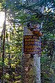 3500-foot sign on West Kill Mountain, Spruceton, NY.jpg 4,032 × 6,048; 17.89 MB
-
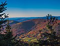
 Blackhead Range from Buck Ridge Lookout in autumn.jpg 6,048 × 3,468; 19.91 MB
-
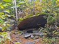 Cave on Devil's Path, West Kill Mountain, Spruceton, NY.jpg 5,328 × 4,032; 16.94 MB
-
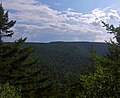
 Central Catskills from Twin south summit.jpg 2,576 × 1,932; 3.83 MB
-
 Dense balsam fir near West Kill Mountain summit, Spruceton, NY.jpg 5,688 × 4,032; 20.76 MB
-
 Devil's Path cleft on Twin.jpg 806 × 1,075; 491 KB
-
 Devil's Path in boreal forest near summit of West Kill Mountain, Spruceton, NY.jpg 3,776 × 6,048; 22.95 MB
-
 Devil's Path in spruce understory climbing West Kill Mountain, Spruceton, NY.jpg 4,032 × 5,328; 19.25 MB
-
 Devilspathchimney.jpg 655 × 873; 213 KB
-
 Diamond Notch Falls footbridge, Spruceton, NY.jpg 5,412 × 3,804; 20.1 MB
-
 Evergreen Mountain in autumn from Buck Ridge Lookout, Catskills.jpg 4,992 × 3,846; 17.2 MB
-
 Snowshoe track in woods.jpg 1,272 × 2,052; 394 KB
-
 Southwest Hunter Mountain from Geiger Point, Hunter, NY.jpg 2,730 × 2,226; 1.5 MB
-
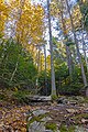 Steep, rocky section of Devil's Path on West Kill Mountain, Spruceton, NY.jpg 4,032 × 6,048; 24.57 MB
-
 Twin North Summit View.jpg 1,508 × 1,131; 298 KB


