Category:Details of old maps of the Caucasus
Jump to navigation
Jump to search
Subcategories
This category has the following 2 subcategories, out of 2 total.
A
L
Media in category "Details of old maps of the Caucasus"
The following 108 files are in this category, out of 108 total.
-
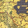
Al-Idrisi-Azerbaijan.JPG 577 × 576; 129 KB
-
1450 ¿ Carta Catalana jpeg copy.J.jpg 526 × 496; 87 KB
-
Map Diego Ribero 1529.I.jpg 902 × 811; 119 KB
-
Map Diego Ribero 1539.A.jpg 1,200 × 1,200; 164 KB
-
Atlas Cosmographicae (Mercator) 035 cropped.JPG 1,200 × 693; 271 KB
-
ARMENIÆ IRANIÆ et ADIRBEITAN Provinciæ Iraniæ.jpg 720 × 810; 316 KB
-
Кумыки на карте 1684 года.jpg 750 × 941; 763 KB
-
Кумыки на карте 1701 года.jpg 750 × 1,089; 720 KB
-
Buffier-Georgia3n.jpg 400 × 274; 99 KB
-
Herman Moll. Persia, Caspian Sea, part of Independent Tartary. 1736. Caucasua.jpg 1,680 × 1,467; 604 KB
-
Bowen, Emanuel. Anatolia, Syria. 1747. (C).jpg 1,302 × 1,215; 477 KB
-
Bowen, Emanuel. Persia, adjacent countries. 1747 (B).jpg 1,865 × 1,279; 658 KB
-
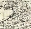
Bowen, Emanuel. Persia, adjacent countries. 1747 (BA).jpg 1,120 × 756; 292 KB
-
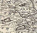
Bowen, Emanuel. Persia, adjacent countries. 1747 (BB).jpg 761 × 691; 191 KB
-
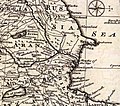
Bowen, Emanuel. Persia, adjacent countries. 1747 (BC).jpg 986 × 870; 281 KB
-
Persian and Ottoman Armenia. 1753 Vaugondy Map.jpg 1,264 × 560; 533 KB
-
Атаги и река Аргун на карте Я. Я. Штелина 1771 год.jpg 713 × 917; 461 KB
-
Dido (1780-Guldenstadt-Caucasus-map).png 365 × 441; 277 KB
-
Кистетия на карте.png 544 × 416; 477 KB
-
1794 d'Anville Map of Turkey - Georgia.jpg 1,263 × 1,129; 323 KB
-
Кумыки на карте 1796 года.png 750 × 1,334; 1.79 MB
-
Persarmenia XVIII century.webp 547 × 403; 100 KB
-
Кумыки на карте 18 века.jpg 647 × 790; 443 KB
-
ARTAZ-AMATUNIK ARMENIA ADERBIJAN.jpg 693 × 1,262; 503 KB
-
~ PERSIAN ARMINIA ~ ADERBIGIAN ~ GHILAN ~ SHIRVAN~.jpg 706 × 569; 175 KB
-
IYRAN ~ Royaume de Perse - XIX century.jpg 704 × 1,342; 442 KB
-
Pinkerton, John. Turkey in Asia. 1813 (L).jpg 1,537 × 1,684; 689 KB
-
Остров Чечень на карте 1813 года.jpg 647 × 924; 143 KB
-
О. Чеченъ, автор Колодкин, А.Е., 1826 г.jpg 715 × 956; 237 KB
-
Colchis and Iberia, VI-III centuries B.C..jpg 1,280 × 992; 937 KB
-
Caucasus map 1835.jpg 1,561 × 1,045; 419 KB
-
August von Haxthausen. Transcaucasia. The Caucasus map. A.jpg 1,582 × 3,105; 510 KB
-
August von Haxthausen. Transcaucasia. The Caucasus map. D.jpg 1,523 × 2,650; 489 KB
-
Colton, G.W. Turkey In Asia And The Caucasian Provinces Of Russia. 1856 (B).jpg 2,153 × 1,366; 1.02 MB
-
Colton, G.W. Turkey In Asia And The Caucasian Provinces Of Russia. 1856 (BA).jpg 1,621 × 993; 565 KB
-
Colton, G.W. Turkey In Asia And The Caucasian Provinces Of Russia. 1856 (BB).jpg 1,233 × 993; 456 KB
-
Colton, G.W. Turkey In Asia And The Caucasian Provinces Of Russia. 1856 (BC).jpg 1,124 × 542; 239 KB
-
Colton, G.W. Turkey In Asia And The Caucasian Provinces Of Russia. 1856 (BK).jpg 1,251 × 741; 396 KB
-
Бенджамин П. Уорд И Элвин Джуэтт Джонсон.jpg 657 × 654; 146 KB
-
The Asian Turkey map (Asiatische Türkei) 1872.jpg 1,000 × 781; 314 KB
-
Legae Caucasian Albania.jpg 1,022 × 666; 145 KB
-
Adrabigan on the map of Spruner and Menke.png 516 × 518; 583 KB
-
Этнографическая карта Тифлисского уезда (1880 г.).jpg 1,529 × 1,249; 657 KB
-
Jouvet et Cie. Grece. Caucase et Crimee. 1882. (D).jpg 783 × 701; 163 KB
-
Russia Caucusus 1882.jpg 1,420 × 1,232; 238 KB
-
Armenian population map 1896 cropped 3.jpg 787 × 539; 279 KB
-
Azerbajan in Abbasid Caliphate.jpg 457 × 474; 63 KB
-
Moughan in Abbasid Caliphate.jpg 260 × 283; 23 KB
-
Stanford, Edward. Asia Minor, Caucasus, Black Sea. 1901 (E).jpg 562 × 580; 144 KB
-
Ethnographic map of the Akhalkalaki uyezd-1902.jpg 1,031 × 937; 186 KB
-
Ethnographic map of the Akhaltsikhe uyezd-1902.jpg 1,153 × 915; 174 KB
-
Ethnographic map of the Kaghizman Okrug-1902.png 1,450 × 812; 1.61 MB
-
Ethnographic map of the Kars Okrug-1902.png 1,350 × 1,173; 2.35 MB
-
Ethnographic map of the Oltu Okrug-1902.png 829 × 843; 985 KB
-
Ethnographic map of the Tiflis uyezd-1902.jpg 1,617 × 962; 334 KB
-
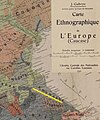
Ethnographic map of Europe - by J Gabrys published in Lausanne city.png 923 × 851; 2.03 MB
-
Кумыки на карте 20-го века.jpg 750 × 897; 541 KB
-
Armenia ~ Persia 1921 ~1923.jpg 2,491 × 1,622; 1.17 MB
-
CAUCASIA~Vegetation Land Cover with ethnic borders~2.jpg 1,080 × 1,799; 1.14 MB
-
Baku Derbant and Shemakha on Hessel Gerritsz's map of Russia.jpg 355 × 180; 71 KB
-
Cumuc City.jpg 749 × 580; 354 KB
-
Johnston, Alexander Keith. Turkey in Asia, Transcaucasia. Karabakh.png 1,047 × 737; 1.35 MB
-
Kumuk City.jpg 750 × 935; 603 KB
-
Kumyk City.jpg 716 × 635; 215 KB
-
Kumyk City.png 750 × 1,334; 1.77 MB
-
Kumyk people.jpg 750 × 1,087; 865 KB
-
Kumyk.jpg 566 × 831; 501 KB
-
Kumyks people.jpg 708 × 1,119; 758 KB
-
Kumyks.jpg 750 × 1,093; 883 KB
-
Атлас Российской империи 1871 г., карта Кавказского края (1869 г.).jpg 9,764 × 7,251; 14.02 MB
-
Генеральная Карта Кавказского края в 1834 году.jpg 1,898 × 904; 354 KB
-
Ирригационная карта Закавказского края, 1887 г.jpg 12,540 × 7,229; 19.03 MB
-
Карта Армении, Закавказья и С. Азербейджана.png 7,752 × 5,860; 32 MB
-
Карта Закавказской железной дороги 1937 года.png 3,080 × 2,111; 7.05 MB
-
Карта Кавказа, Азиатской Турции и Персии, 1917.png 7,563 × 5,810; 91.37 MB
-
Карта Кавказского края с показателем густоты армянского населения.png 4,954 × 4,440; 16.28 MB
-
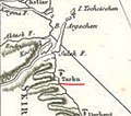
Кумыкский город Таргу.jpg 514 × 840; 373 KB
-
Этнографическая карта Сигнахского уезда (1880 г.).jpg 1,326 × 1,198; 516 KB
