Category:Details of old maps of New York (state)
Jump to navigation
Jump to search
Subcategories
This category has only the following subcategory.
Media in category "Details of old maps of New York (state)"
The following 27 files are in this category, out of 27 total.
-
FortTiconderogaLayout1758.png 1,327 × 859; 2.42 MB
-
British at Frogs Neck (1776).jpg 1,362 × 884; 349 KB
-
Sauthier Albany County.jpg 600 × 523; 85 KB
-
HudsonValley1777.jpg 360 × 1,470; 249 KB
-
Tryon County 1777.png 1,290 × 1,803; 3.05 MB
-
MapNewtown1852LargeDetail-NYPLfromRiker.jpg 1,536 × 1,536; 904 KB
-
Sacketsharborellisburghrailroad.gif 504 × 392; 215 KB
-
1872 Atlas view of Cooperage.jpg 1,600 × 1,200; 1.13 MB
-
Freeport NY-1873.jpg 798 × 1,282; 514 KB
-
1873 Beers Map of Pearsalls, Long Island, New York.jpg 1,033 × 1,033; 509 KB
-
Indian Church Ground-Erie County 1880 atlas-z3.JPG 1,988 × 1,504; 545 KB
-
HurstvilleNY.jpg 420 × 400; 39 KB
-
NormansvilleNY.jpg 420 × 400; 29 KB
-
NorthAlbany1891.jpg 420 × 400; 50 KB
-
Cohoes1891.jpg 420 × 400; 47 KB
-
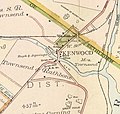
KenwoodNYmap.jpg 420 × 400; 37 KB
-
Indian Church Road - 1894 (Winchester Ave.) Buffalo city atlas.JPG 1,096 × 1,106; 176 KB
-
American Revolutionary War Cobleskill and Cherry Valley.jpg 2,086 × 1,384; 543 KB
-
154-155BriarcliffManor2.jpg 647 × 332; 56 KB
-
1908- Ossining, Briarcliff Manor 2.jpg 3,253 × 3,475; 1.64 MB
-
Rockwood Hall map 01.jpg 1,922 × 1,539; 1.5 MB
-
Rockwood Hall map 02.jpg 5,057 × 4,190; 9.75 MB
-
154-155BriarcliffManor3.jpg 723 × 580; 102 KB
-
Health and pleasure on America's greatest railroad.. (1890) (14574174830).jpg 2,904 × 1,444; 633 KB


