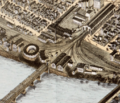
Category:Details of maps by O. H. Bailey
Jump to navigation
Jump to search
Media in category "Details of maps by O. H. Bailey"
The following 85 files are in this category, out of 85 total.
-
1840 Putnam station and roundhouse on 1877 bird's eye view map.jpg 841 × 570; 117 KB
-
1848 New London station in 1876.jpg 548 × 390; 158 KB
-
1861 New London station in 1876.jpg 1,055 × 690; 454 KB
-
1864 New London station in 1876.jpg 1,152 × 1,103; 795 KB
-
1866 Mystic station on 1879 aerial map.png 747 × 493; 830 KB
-
1872 Birds Eye View of Columbus Ohio by Bailey LC (cropped).jpg 1,990 × 1,147; 304 KB
-
1875 Agawam bank Springfield Massachusetts byBailey BPL 10183 map detail.png 959 × 717; 1.36 MB
-
1875 Springfield Massachusetts byBailey BPL 10183 map detail.png 983 × 723; 1.36 MB
-
1875 UnionBlock Springfield Massachusetts byBailey BPL 10183 map detail.png 1,082 × 621; 1.3 MB
-
1875 Wason Springfield Massachusetts byBailey BPL 10183 map detail.png 1,038 × 597; 1.23 MB
-
1882 Emery Plymouth Massachusetts byBailey BPL 10175 map detail.png 1,029 × 510; 1.01 MB
-
1882 RobinsonIron Plymouth Massachusetts byBailey BPL 10175 map detail.png 941 × 553; 1,003 KB
-
1882 WoolenCo Plymouth Massachusetts byBailey BPL 10175 map detail.png 1,027 × 516; 998 KB
-
1884 Old St. Vincent's Church.jpg 487 × 487; 129 KB
-
1884 Smith's Opera House.jpg 695 × 793; 315 KB
-
Beverly station on 1879 bird's eye view map.jpg 501 × 349; 60 KB
-
BirdsEyeViewSpringfieldUnionStation1875.png 691 × 593; 910 KB
-
D&H No. 5 Colliery Plymouth PA 1884.jpg 893 × 892; 566 KB
-
Fall River station on 1877 bird's eye map.jpg 605 × 446; 73 KB
-
Fall River Wharf on 1877 bird's eye map.jpg 1,315 × 1,062; 307 KB
-
Ferry Street station on 1877 bird's eye map.jpg 785 × 587; 119 KB
-
Grafton Centre station from 1887 map.jpg 878 × 788; 213 KB
-
Haverhill Bridge and station on 1893 bird's eye view map.jpg 1,630 × 1,211; 459 KB
-
Haverhill station on 1893 bird's eye view map.jpg 1,241 × 838; 285 KB
-
Highlandville station on 1887 bird's eye view map.jpg 471 × 366; 54 KB
-
Hyde Park (B&P) station on 1879 bird's eye view map.jpg 489 × 331; 39 KB
-
Hyde Park (NY&NE) station on 1879 bird's eye view map.jpg 350 × 272; 25 KB
-
Hyde Park (NY&NE) station on 1890 bird's eye view map.jpg 577 × 445; 67 KB
-
Hyde Park station on 1890 bird's eye view map.jpg 787 × 565; 117 KB
-
Lance Coal Breaker 1884 Plymouth PA.jpg 591 × 791; 367 KB
-
Madison station 1881.JPG 428 × 311; 44 KB
-
Middleborough freight house on 1889 bird's eye view map.jpg 775 × 530; 113 KB
-
Middleborough station on 1889 bird's eye view map.jpg 1,204 × 713; 242 KB
-
Middleborough station, 1889.jpg 1,772 × 645; 233 KB
-
Newton Lower Falls Branch terminal from 1880 bird's eye view map.jpg 2,322 × 1,366; 719 KB
-
Parrish House 1884 Plymouth PA.jpg 2,985 × 1,973; 1.82 MB
-
Plymouth station on 1882 bird's-eye view map.jpg 1,223 × 885; 262 KB
-
Putnam station on 1877 bird's eye view map.jpg 670 × 470; 75 KB
-
Readville stations on 1879 bird's eye view map.jpg 674 × 454; 80 KB
-
Second Windsor Locks station on 1877 aerial map.jpg 727 × 488; 446 KB
-
Stonington railroad wharf on 1879 bird's-eye map.jpg 2,343 × 1,468; 732 KB
-
Stonington station on 1879 bird's-eye map .jpg 1,146 × 770; 152 KB
-
Taunton station and roundhouse on 1875 bird's eye view map.jpg 1,168 × 780; 237 KB
-
Walpole Union Station on 1882 birds-eye map.jpg 736 × 576; 146 KB
-
Watuppa station on 1877 bird's eye map.jpg 483 × 378; 43 KB
-
Wickford Landing on 1888 birds-eye map.jpg 653 × 1,120; 156 KB
-
Wickford station on 1888 birds-eye map.jpg 502 × 326; 40 KB


