Category:Derelict buildings in Falkirk council area
Jump to navigation
Jump to search
Subcategories
This category has the following 10 subcategories, out of 10 total.
B
- Bottomhead Farm, Falkirk (6 F)
J
- Jawhills Farm (8 F)
L
- Lathallan House (6 F)
- Little Mill, Linlithgow (2 F)
- Loanfoot Farm, Falkirk (2 F)
M
- Masonfield Farm (2 F)
- Muirhead Farm, Falkirk (4 F)
R
- Righead Farm (3 F)
W
- Wester Barnego Farm (2 F)
- Whitehill Farm, Falkirk (3 F)
Media in category "Derelict buildings in Falkirk council area"
The following 20 files are in this category, out of 20 total.
-
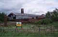
 Binniegreen - geograph.org.uk - 1225595.jpg 640 × 427; 301 KB
-
 Buckieside - geograph.org.uk - 1126580.jpg 640 × 359; 76 KB
-
 Burned out CO-OP Bakery - geograph.org.uk - 551849.jpg 640 × 480; 83 KB
-

-
 Derelict Weighbridge - geograph.org.uk - 416237.jpg 640 × 480; 94 KB
-
 Green fields south of Muirhead. - geograph.org.uk - 1763018.jpg 1,024 × 768; 643 KB
-
 Greencraig - geograph.org.uk - 85222.jpg 640 × 460; 73 KB
-
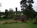
 Industrial ruin, Blackrig - geograph.org.uk - 90400.jpg 640 × 480; 158 KB
-
 Larbert Old Bellsdyke Hospital.JPG 3,072 × 2,304; 1.7 MB
-
 Old colliery buildings. - geograph.org.uk - 189608.jpg 640 × 413; 60 KB
-
 Old Flax Kiln - geograph.org.uk - 1746316.jpg 968 × 648; 254 KB
-
-
 Old St Mary's - weather damage - geograph.org.uk - 552447.jpg 640 × 480; 92 KB
-

-
 Ruin near California. - geograph.org.uk - 85328.jpg 640 × 389; 39 KB
-
 Ruin off Newton Road - geograph.org.uk - 1724253.jpg 640 × 480; 102 KB
-
 Ruin, Limerigg - geograph.org.uk - 1525939.jpg 640 × 480; 139 KB
-
 Ruined Building - geograph.org.uk - 142960.jpg 640 × 480; 106 KB
-
 Stoneyinch Farm (Ruin) - geograph.org.uk - 418864.jpg 640 × 480; 137 KB
-
 Tappetknowe ruin - geograph.org.uk - 281429.jpg 640 × 480; 100 KB


_-_geograph.org.uk_-_526885.jpg)


_-_geograph.org.uk_-_418864.jpg)
