Category:Demographic maps of Finland
Jump to navigation
Jump to search
Subcategories
This category has the following 3 subcategories, out of 3 total.
I
L
- Linguistic maps of Finland (36 F)
Media in category "Demographic maps of Finland"
The following 14 files are in this category, out of 14 total.
-
 Finland - municipalities, Kurdish speakers 2017.svg 1,850 × 3,220; 223 KB
-
 Finland pop.jpg 648 × 894; 113 KB
-
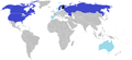 Finnish ancestry by country updated.png 1,357 × 617; 39 KB
-
 Maakaup7.png 1,941 × 3,405; 356 KB
-
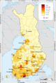
 Population density of Finland regions.png 3,309 × 5,174; 647 KB
-
 Population map of Finland.svg 1,371 × 2,007; 307 KB
-
 Regions of Finland, 2017 statistics Kurdish speakers.svg 1,850 × 3,220; 75 KB
-
 Saamelaisalue Suomessa ja Saamen lippu.svg 776 × 897; 359 KB
-
 Suomi.seutukunnat.2019 yli 65-vuotiaat.svg 800 × 1,392; 6.51 MB
-
 Suomi.vaestotiheys.2011.svg 1,850 × 3,220; 268 KB
-
 Sámi local community Siida.jpg 2,700 × 1,709; 1.69 MB
-
 Sámi local community Siida.svg 2,700 × 1,709; 458 KB
-
 Tabula populositatis Finniae.png 800 × 1,171; 372 KB
-
 Vaestonkeskittyminen suomessa.png 229 × 398; 3 KB


