Category:Demographic maps of Cambodia
Jump to navigation
Jump to search
Subcategories
This category has only the following subcategory.
E
Media in category "Demographic maps of Cambodia"
The following 10 files are in this category, out of 10 total.
-
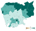
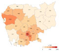
Cambodia demographic map-provinces-density-2019-en.svg 512 × 450; 567 KB
-
Cambodia demographic map-provinces-fertilityrate-2014-en.svg 512 × 450; 567 KB
-
Cambodia demographic map-provinces-percentualdistribution-2019-en.svg 512 × 450; 567 KB
-
Cambodia demographic map-provinces-population growth-1998-2008-en.svg 512 × 450; 567 KB
-
Cambodia demographic map-provinces-population growth-2008-2019-en.svg 512 × 450; 567 KB
-
Cambodia demographic map-provinces-population-2008-en.svg 512 × 450; 567 KB
-
Cambodia demographic map-provinces-population-2019-en.svg 512 × 450; 567 KB
-
Cambodia demographic map-provinces-sexratio-2019-en.svg 512 × 450; 567 KB
-
Cambodia demography-test-en.png 908 × 795; 154 KB
-
Population density of Cambodia provinces.png 3,776 × 3,331; 599 KB


