Category:Delaware River in the 1770s
Jump to navigation
Jump to search
Subcategories
This category has the following 5 subcategories, out of 5 total.
Media in category "Delaware River in the 1770s"
The following 26 files are in this category, out of 26 total.
-
A chart of Delawar Bay, with soundings and nautical observations. LOC 77692984.jpg 6,525 × 8,980; 9.09 MB
-
A chart of Delawar Bay, with soundings and nautical observations. LOC 77692984.tif 6,525 × 8,980; 167.64 MB
-
A chart of Delaware Bay and River - from the original LOC 2013593289.jpg 3,130 × 2,479; 1.22 MB
-
A draught of Delaware Bay. LOC gm72003568.jpg 13,657 × 6,637; 9.71 MB
-
A Plan of the City and Environs of Philadelphia, 1777 WDL9563.png 1,024 × 1,387; 2.64 MB
-
British Operations on the Delaware in 1777.png 874 × 692; 267 KB
-
Map of Operations on the Delaware River at Philadelphia, PA Oct-Nov., 1777.jpeg 2,998 × 1,536; 1.56 MB
-
View of Philadelphia. 28 Nov. 1777 (NYPL Hades-1847075-ps prn cd13 190).jpg 6,534 × 4,527; 25.96 MB
-
Operations in the Delaware, Oct. and Nov., 1777. NYPL434580.tiff 4,963 × 4,603; 65.38 MB
-
Philadelphia - Howe Survey - 1777.jpg 1,346 × 2,263; 457 KB
-
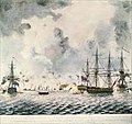
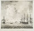
Representation of the action off Mud Fort in the River Delaware - (coloured).jpg 1,162 × 1,097; 229 KB
-
Robertson - View of Philadelphia.jpg 760 × 527; 203 KB
-
Susquehanna River to Schuylkill River, Chesapeake Bay to Delaware Bay. NYPL484199.tiff 4,991 × 4,117; 58.79 MB
-
The takeing of Miss Mud I'land (BM 1868,0808.4557 1).jpg 1,134 × 1,600; 393 KB


