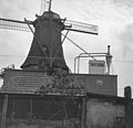
Category:De Vriendschap, Veenendaal
Jump to navigation
Jump to search
| Object location | | View all coordinates using: OpenStreetMap |
|---|
windmill in Veenendaal, Netherlands | |||||
| Upload media | |||||
| Instance of | |||||
|---|---|---|---|---|---|
| Location | Veenendaal, Utrecht, Netherlands | ||||
| Street address |
| ||||
| Located on street |
| ||||
| Has use | |||||
| Heritage designation |
| ||||
| Source of energy | |||||
 | |||||
|
This is a category about rijksmonument number 511611
|
| Address |
|
Media in category "De Vriendschap, Veenendaal"
The following 66 files are in this category, out of 66 total.
-
Aandrijving jacobsladder - Veenendaal - 20238897 - RCE.jpg 3,110 × 3,104; 2.04 MB
-
Aanzicht - Veenendaal - 20238901 - RCE.jpg 3,110 × 3,009; 1.43 MB
-
As en bovenwiel geblokkeerd - Veenendaal - 20238898 - RCE.jpg 3,069 × 3,102; 1.63 MB
-
Bedrijfsgebouw bij achtkante stellingmolen - AMR Molenfoto - 20539698 - RCE.jpg 1,200 × 900; 184 KB
-
Bedrijfsgebouw bij achtkante stellingmolen - AMR Molenfoto - 20539700 - RCE.jpg 1,200 × 900; 212 KB
-
Gebouw naast achtkante stellingmolen - AMR Molenfoto - 20539695 - RCE.jpg 1,200 × 900; 110 KB
-
Interieur achtkante stellingmolen - AMR Molenfoto - 20539705 - RCE.jpg 1,200 × 900; 163 KB
-
Interieur achtkante stellingmolen - AMR Molenfoto - 20539707 - RCE.jpg 1,200 × 900; 177 KB
-
Interieur achtkante stellingmolen - AMR Molenfoto - 20539709 - RCE.jpg 1,200 × 900; 190 KB
-
Interieur achtkante stellingmolen - AMR Molenfoto - 20539710 - RCE.jpg 1,200 × 900; 149 KB
-
Interieur achtkante stellingmolen - AMR Molenfoto - 20539711 - RCE.jpg 900 × 1,200; 212 KB
-
Interieur van achtkante stellingmolen - AMR Molenfoto - 20539708 - RCE.jpg 1,200 × 900; 177 KB
-
Jacobsladder in kap - Veenendaal - 20238896 - RCE.jpg 3,110 × 3,077; 2.22 MB
-
Korenmolen "de Vriendschap" overzicht - Veenendaal - 20238895 - RCE.jpg 2,102 × 2,063; 2 MB
-
Korenmolen "De Vriendschap", strijken van as en roeden - Veenendaal - 20238903 - RCE.jpg 3,113 × 3,078; 2.43 MB
-
Korenmolen "De Vriendschap", strijken van as en roeden - Veenendaal - 20238904 - RCE.jpg 3,106 × 2,622; 2.21 MB
-
Korenmolen "De Vriendschap", vanuit het noorden - Veenendaal - 20238907 - RCE.jpg 3,112 × 3,054; 2.37 MB
-
Korenmolen "De Vriendschap", vanuit het oosten - Veenendaal - 20238908 - RCE.jpg 3,130 × 3,059; 2.56 MB
-
Korenmolen "De Vriendschap", vanuit het westen - Veenendaal - 20238905 - RCE.jpg 3,130 × 3,077; 2.94 MB
-
Korenmolen "De Vriendschap", vanuit het westen - Veenendaal - 20238906 - RCE.jpg 3,130 × 3,089; 2.37 MB
-
Korenmolen - Veenendaal - 20238893 - RCE.jpg 2,124 × 3,226; 2.09 MB
-
Molen De Vriendschap Veenendaal achterkeuvelens (1).jpg 1,704 × 2,272; 735 KB
-
Molen De Vriendschap Veenendaal bolspil op pasbalk.jpg 1,630 × 2,178; 965 KB
-
Molen De Vriendschap Veenendaal bovenrondsel.jpg 1,704 × 2,272; 1.06 MB
-
Molen De Vriendschap Veenendaal bovenwiel.jpg 1,704 × 2,272; 1.31 MB
-
Molen De Vriendschap Veenendaal busdeur.jpg 1,704 × 2,272; 981 KB
-
Molen De Vriendschap Veenendaal busselneus.jpg 2,272 × 1,704; 484 KB
-
Molen De Vriendschap Veenendaal Engels kruiwerk.jpg 1,704 × 2,272; 1.24 MB
-
Molen De Vriendschap Veenendaal ezel.jpg 1,704 × 2,272; 799 KB
-
Molen De Vriendschap Veenendaal gaffelwiel.jpg 1,704 × 2,272; 1.04 MB
-
Molen De Vriendschap Veenendaal ijzerbalk steenspil.jpg 2,272 × 1,704; 988 KB
-
Molen De Vriendschap Veenendaal kap binnenzijde.jpg 1,704 × 2,272; 1.22 MB
-
Molen De Vriendschap Veenendaal kruirad.jpg 1,704 × 2,272; 873 KB
-
Molen De Vriendschap Veenendaal luitafel onderkant.jpg 2,272 × 1,704; 829 KB
-
Molen De Vriendschap Veenendaal maalkoppel.jpg 2,272 × 1,704; 987 KB
-
Molen De Vriendschap Veenendaal pal.jpg 1,704 × 2,272; 1.08 MB
-
Molen De Vriendschap Veenendaal penlager.jpg 1,704 × 2,272; 1.09 MB
-
Molen De Vriendschap Veenendaal regulateur.jpg 1,704 × 2,272; 974 KB
-
Molen De Vriendschap Veenendaal remklep busselneus.jpg 1,704 × 2,272; 927 KB
-
Molen De Vriendschap Veenendaal roosterhouten.jpg 1,704 × 2,272; 1.05 MB
-
Molen De Vriendschap Veenendaal sleepluiwerk.jpg 1,704 × 2,272; 1,023 KB
-
Molen De Vriendschap Veenendaal spoorwiel koningsspil.jpg 1,704 × 2,272; 1.08 MB
-
Molen De Vriendschap Veenendaal spoorwiel.jpg 2,272 × 1,704; 889 KB
-
Molen De Vriendschap Veenendaal staart.jpg 1,704 × 2,272; 782 KB
-
Molen De Vriendschap Veenendaal steenbed.jpg 1,704 × 2,272; 1.41 MB
-
Molen De Vriendschap Veenendaal tap koningsspil.jpg 1,704 × 2,272; 947 KB
-
Molen De Vriendschap Veenendaal vanaf De Nieuwe Molen.jpg 1,704 × 2,272; 957 KB
-
Molen De Vriendschap Veenendaal vangbalk verzwaard.jpg 1,704 × 2,272; 1.33 MB
-
Molen De Vriendschap Veenendaal.jpg 400 × 533; 53 KB
-
Molen, feestelijk versierde eetzaal - AMR Molenfoto - 20539706 - RCE.jpg 1,200 × 900; 167 KB
-
Onderbouw achtkante stellingmolen - AMR Molenfoto - 20539702 - RCE.jpg 1,200 × 900; 233 KB
-
Onderbouw achtkante stellingmolen - AMR Molenfoto - 20539703 - RCE.jpg 1,200 × 900; 191 KB
-
Onderbouw van achtkante stellingmolen - AMR Molenfoto - 20539694 - RCE.jpg 1,200 × 900; 156 KB
-
Solionietloop - Veenendaal - 20238900 - RCE.jpg 3,080 × 3,064; 1.87 MB
-
Veenendaal Molen De Vriendschap.jpg 2,495 × 3,523; 3.24 MB
-
Veenendaal, stellingmolen de Vriendschap RM511611 foto2 2012-05-27 10.51.JPG 3,312 × 4,416; 10.25 MB
-
Vervallen balie - Veenendaal - 20238902 - RCE.jpg 3,110 × 3,036; 1.48 MB
-
Vulleidingen silo's - Veenendaal - 20238899 - RCE.jpg 3,109 × 3,076; 2.05 MB
-
Woonhuis bij achtkante stellingmolen - AMR Molenfoto - 20539693 - RCE.jpg 1,200 × 900; 184 KB


