Category:Danube Bend
Jump to navigation
Jump to search
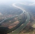
curve in the river Danube, close to Visegrád, 30km north of Budapest | |||||
| Upload media | |||||
| Instance of | |||||
|---|---|---|---|---|---|
| Part of | |||||
| Location |
| ||||
| Located in or next to body of water | |||||
 | |||||
English: Danube Bend
Magyar: Dunakanyar
Deutsch: Donauknie
Subcategories
This category has the following 2 subcategories, out of 2 total.
H
- Helemba Island (4 F)
P
Media in category "Danube Bend"
The following 45 files are in this category, out of 45 total.
-
A Dunakanyar Borfjúfőről nézve, Okt 24.jpg 600 × 800; 394 KB
-
A Felszabadulás oldalkerekes személyhajó Dömösnél. Fortepan 60358.jpg 5,222 × 3,636; 6.97 MB
-
Danube at Nagymaros.JPG 2,048 × 1,536; 1,022 KB
-
Danube bend (1503492806).jpg 1,280 × 960; 193 KB
-
Danube Bend (2).jpg 4,000 × 3,000; 4.61 MB
-
Danube Bend A.jpg 2,048 × 1,536; 553 KB
-
Danube Bend from the Zebegény beach.JPG 4,272 × 2,848; 3.13 MB
-
Danube Bend.jpg 4,000 × 3,000; 4.76 MB
-
Danube gorge near Visegrád.jpg 14,540 × 2,740; 5.34 MB
-
Dobogoko kilatas.jpg 900 × 675; 103 KB
-
Dobogó-kő Danube Band.jpg 2,308 × 709; 307 KB
-
Donauknie Luftbild.jpg 3,500 × 2,334; 5.02 MB
-
DonauKnie.JPG 2,304 × 1,704; 900 KB
-
DonauknieVisegrad 2 (cropped).jpg 6,569 × 3,866; 5.45 MB
-
DonauknieVisegrad 2.jpg 26,779 × 3,866; 24.54 MB
-
DonauknieVisegrad.jpg 800 × 600; 202 KB
-
Dunakanyar légifotó.jpg 480 × 340; 20 KB
-
Dunakanyar panorámakép.jpg 5,448 × 1,244; 2.69 MB
-
Dunakanyar télen a Prédikálószékről.JPG 2,816 × 1,872; 1.12 MB
-
Dunakanyar2007.06.25.IMG 4492.jpg 2,592 × 1,944; 1.08 MB
-
Excellence (ship, 2006) 005.jpg 1,280 × 811; 464 KB
-
A dömösi kanyar Visegrád-Gizellatelep felől nézve. Fortepan 572.jpg 6,605 × 4,697; 11.71 MB
-
Bikafürdetés, háttérben a Dunakanyar. Fortepan 2474.jpg 2,589 × 1,656; 1.9 MB
-
Lepence környéke a Dunáról nézve. Fortepan 5410.jpg 2,235 × 1,533; 1.98 MB
-
Kilátás Dobogókőről észak felé. A Duna túlpartján jobboldalt Zebegény. Fortepan 16055.jpg 3,330 × 2,606; 3.59 MB
-
Férfi portré, 1955. Fortepan 19138.jpg 2,962 × 1,933; 2.86 MB
-
Prédikálószék, látkép Nagymaros és Visegrád felé. Fortepan 21862.jpg 3,272 × 2,681; 4.98 MB
-
Prédikálószék, látkép Nagymaros és Visegrád felé. Fortepan 30989.jpg 4,721 × 3,035; 8.99 MB
-
Prédikálószék, látkép Nagymaros és Visegrád felé. Fortepan 30990.jpg 5,394 × 3,241; 8.49 MB
-
A dömösi kanyar. Fortepan 58336.jpg 2,784 × 1,904; 3.97 MB
-
A Bős-nagymarosi Vízlépcsőrendszer építése. Fortepan 77369.jpg 5,637 × 3,638; 11.2 MB
-
A dömösi kanyar Visegrád-Gizellatelep felől nézve. Fortepan 79653.jpg 6,450 × 4,589; 8.26 MB
-
Duna-part a város fölött, a túlparton Nagymaros. Fortepan 91716.jpg 5,292 × 3,635; 9.23 MB
-
HU microregion 6.1.11. Visegrádi-Dunakanyar.png 2,009 × 1,282; 56 KB
-
Hungary donau Visegrad bend IMG 0184.JPG 5,184 × 3,175; 7.92 MB
-
Hungary donau Visegrad bend IMG 0186.JPG 3,456 × 3,304; 4.91 MB
-
Hungary donau Visegrad bend IMG 0187.JPG 3,456 × 3,146; 5.18 MB
-
Kerekparut.dunamente9.jpg 2,272 × 1,704; 908 KB
-
Kisoroszi, pohled na údolí Dunaje.JPG 2,848 × 2,136; 1.47 MB
-
Predikaloszek01.jpg 4,576 × 992; 1.08 MB
-
RedBio Treffen Ungarn 35.JPG 3,008 × 2,000; 2.99 MB
-
RedBio Treffen Ungarn Visegrad 01.JPG 3,008 × 2,000; 2.79 MB
-
Visegrad danube.jpg 2,272 × 1,712; 760 KB
-
Visegrádi vár.jpg 1,280 × 960; 79 KB
-
Wv Ansa del Danubio banner.jpg 4,854 × 692; 1.72 MB


