
Category:Dalton Town with Newton
civil parish in Barrow-in-Furness, Cumbria, England  | |||||
| Upload media | |||||
| Instance of | |||||
|---|---|---|---|---|---|
| Location | Barrow-in-Furness, Cumbria, North West England, England | ||||
| Population |
| ||||
 | |||||
Subcategories
This category has the following 2 subcategories, out of 2 total.
D
N
- Newton-in-Furness (7 F)
Media in category "Dalton Town with Newton"
The following 97 files are in this category, out of 97 total.
-
 "Bodrum Continental" in Dalton - geograph.org.uk - 7286659.jpg 4,781 × 3,488; 3.82 MB
-
 A590 approaching roundabout, Elliscale - geograph.org.uk - 6890638.jpg 800 × 600; 119 KB
-
 A590 near Lindal in Furness - geograph.org.uk - 6584323.jpg 1,024 × 683; 406 KB
-
 A590 nears A595 roundabout - geograph.org.uk - 5687246.jpg 640 × 481; 52 KB
-
 A590 towards Ulverston - geograph.org.uk - 6890656.jpg 800 × 600; 103 KB
-
 A590 towards Ulverston - geograph.org.uk - 6890666.jpg 640 × 480; 80 KB
-
 Bear Grills Snack Bar - Layby on the A590 - geograph.org.uk - 6584324.jpg 1,024 × 768; 501 KB
-
 Broughton Road bridge over the A590 - geograph.org.uk - 6890660.jpg 640 × 480; 66 KB
-
 Crest on the Former Police Station - geograph.org.uk - 6587903.jpg 1,024 × 768; 487 KB
-
 Dalton Castle - geograph.org.uk - 6588066.jpg 1,024 × 768; 515 KB
-
 Dalton Castle - geograph.org.uk - 7246005.jpg 3,872 × 2,592; 3.93 MB
-
 Dalton in Furness station - geograph.org.uk - 6970756.jpg 1,024 × 768; 220 KB
-
 Dalton Junction - geograph.org.uk - 6953001.jpg 6,000 × 4,000; 1.7 MB
-
 Dalton Town with Newton , A590 - geograph.org.uk - 6352597.jpg 4,288 × 2,848; 2.47 MB
-
 Dalton Town with Newton , A590 - geograph.org.uk - 6352598.jpg 6,000 × 4,000; 4.12 MB
-
 Dalton Town with Newton , A590 - geograph.org.uk - 6352599.jpg 4,288 × 2,848; 2.6 MB
-
 Dalton Town with Newton , A590 - geograph.org.uk - 6352600.jpg 6,000 × 4,000; 3.88 MB
-
 Dalton Town with Newton , A590 - geograph.org.uk - 6352602.jpg 6,000 × 4,000; 4.01 MB
-
 Dalton Tunnel - geograph.org.uk - 6953948.jpg 3,965 × 5,359; 1.68 MB
-
 Dalton-in- Furness, Skelgate - geograph.org.uk - 6587737.jpg 1,024 × 769; 439 KB
-
 Dalton-in-Furness - geograph.org.uk - 6953002.jpg 5,527 × 3,527; 1.46 MB
-
 Dalton-In-Furness URC Church - geograph.org.uk - 6587928.jpg 1,024 × 769; 1.15 MB
-
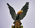 Eagle over the Police Station - geograph.org.uk - 6587913.jpg 1,000 × 800; 290 KB
-

-
 Farm buildings near the A590 - geograph.org.uk - 7004052.jpg 3,024 × 3,024; 2.23 MB
-
 Footbridge near Millwood Manor - geograph.org.uk - 6971449.jpg 1,024 × 768; 343 KB
-
 Footpath to Dalton-in-Furness - geograph.org.uk - 6890655.jpg 1,024 × 768; 247 KB
-
 Former County Police Station, Dalton-in-Furness - geograph.org.uk - 6587790.jpg 1,024 × 682; 254 KB
-
 Grazing west of Stainton - geograph.org.uk - 6893929.jpg 1,024 × 768; 113 KB
-
 Grazing, Dalton-in-Furness - geograph.org.uk - 6890650.jpg 800 × 600; 84 KB
-
 Hartley's Restaurant in Dalton - geograph.org.uk - 7286651.jpg 3,343 × 4,172; 3.01 MB
-
 Houses at Romney Park, Dalton - geograph.org.uk - 7286664.jpg 4,500 × 3,133; 2.73 MB
-
 Lindal and Marton , A590 - geograph.org.uk - 6352596.jpg 4,288 × 2,848; 2.49 MB
-
 Maize crop near North Stank Farm - geograph.org.uk - 6893697.jpg 1,024 × 768; 149 KB
-
 Market Street - geograph.org.uk - 6953935.jpg 6,000 × 3,422; 1.52 MB
-
 Market Street, Dalton-in-Furness - geograph.org.uk - 6587746.jpg 1,024 × 683; 383 KB
-
 Milestone - Kendal 31 - geograph.org.uk - 6298136.jpg 734 × 1,024; 238 KB
-

-
 National Cycle Route 70 - geograph.org.uk - 6893926.jpg 1,024 × 768; 140 KB
-
 National Cycle Route 70, Newton - geograph.org.uk - 6893696.jpg 1,024 × 768; 180 KB
-
 Newton Village Hall - geograph.org.uk - 6893692.jpg 1,024 × 582; 110 KB
-
 North Lodge - geograph.org.uk - 6953932.jpg 5,338 × 3,585; 1.88 MB
-
 Ordnance Survey Cut Mark - geograph.org.uk - 6296053.jpg 1,024 × 753; 165 KB
-
 Ordnance Survey Cut Mark - geograph.org.uk - 6297092.jpg 618 × 1,024; 110 KB
-
 Ordnance Survey Cut Mark - geograph.org.uk - 6297095.jpg 1,024 × 822; 141 KB
-
 Ordnance Survey Cut Mark - geograph.org.uk - 6297100.jpg 1,024 × 882; 321 KB
-
 Ordnance Survey Cut Mark - geograph.org.uk - 6297103.jpg 1,024 × 571; 160 KB
-
 Ordnance Survey Cut Mark - geograph.org.uk - 6297106.jpg 1,024 × 732; 172 KB
-
 Ordnance Survey Cut Mark - geograph.org.uk - 6297108.jpg 1,024 × 879; 206 KB
-
 Ordnance Survey Cut Mark - geograph.org.uk - 6297112.jpg 576 × 1,024; 144 KB
-
 Ordnance Survey Cut Mark - geograph.org.uk - 6297113.jpg 1,024 × 763; 198 KB
-
 Ordnance Survey Cut Mark - geograph.org.uk - 6297115.jpg 1,024 × 651; 136 KB
-
 Ordnance Survey Cut Mark - geograph.org.uk - 6297116.jpg 1,024 × 573; 146 KB
-
 Ordnance Survey Cut Mark - geograph.org.uk - 6297118.jpg 1,024 × 759; 265 KB
-
 Ordnance Survey Cut Mark - geograph.org.uk - 6297119.jpg 1,024 × 747; 169 KB
-
 Ordnance Survey Cut Mark - geograph.org.uk - 6297121.jpg 1,024 × 806; 171 KB
-
 Ordnance Survey Cut Mark - geograph.org.uk - 6297122.jpg 1,024 × 899; 226 KB
-
 Ordnance Survey Cut Mark - geograph.org.uk - 6297124.jpg 1,024 × 893; 350 KB
-
 Ordnance Survey Cut Mark - geograph.org.uk - 6297127.jpg 1,024 × 877; 263 KB
-
 Ordnance Survey Cut Mark - geograph.org.uk - 6297132.jpg 1,024 × 844; 307 KB
-
 Ordnance Survey Cut Mark - geograph.org.uk - 6297135.jpg 1,024 × 760; 236 KB
-
 Ordnance Survey Cut Mark - geograph.org.uk - 6297141.jpg 1,024 × 644; 210 KB
-
 Ordnance Survey Cut Mark - geograph.org.uk - 6297144.jpg 1,024 × 599; 269 KB
-
 Ordnance Survey Cut Mark - geograph.org.uk - 6297146.jpg 1,024 × 892; 351 KB
-
 Ordnance Survey Cut Mark - geograph.org.uk - 6297148.jpg 1,024 × 895; 309 KB
-
 Ordnance Survey Cut Mark - geograph.org.uk - 6297151.jpg 1,024 × 856; 399 KB
-
 Ordnance Survey Cut Mark - geograph.org.uk - 6297424.jpg 1,024 × 808; 198 KB
-
 Ordnance Survey Cut Mark - geograph.org.uk - 6297426.jpg 1,024 × 811; 99 KB
-
 Ordnance Survey Cut Mark - geograph.org.uk - 6297428.jpg 1,024 × 918; 397 KB
-
 Ordnance Survey Cut Mark - geograph.org.uk - 6297429.jpg 1,024 × 857; 338 KB
-
 Ordnance Survey Cut Mark - geograph.org.uk - 6297430.jpg 1,024 × 852; 325 KB
-
 Ordnance Survey Cut Mark - geograph.org.uk - 6297431.jpg 1,024 × 795; 310 KB
-
 Ordnance Survey Cut Mark - geograph.org.uk - 6297432.jpg 1,024 × 870; 271 KB
-
 Ordnance Survey Cut Mark - geograph.org.uk - 6297433.jpg 1,024 × 819; 332 KB
-
 Ordnance Survey Flush Bracket (S7108) - geograph.org.uk - 6297427.jpg 718 × 1,024; 146 KB
-
 Ordnance Survey Rivet - geograph.org.uk - 6297097.jpg 814 × 1,024; 144 KB
-
 Ordnance Survey Rivet - geograph.org.uk - 6297425.jpg 525 × 1,024; 182 KB
-
 Queen Victoria Diamond Jubilee Drinking Fountain - geograph.org.uk - 6587667.jpg 769 × 1,024; 706 KB
-
 Railway - geograph.org.uk - 6953003.jpg 4,000 × 6,000; 1.86 MB
-
 Railway Bridge near Dalton - geograph.org.uk - 6971447.jpg 1,024 × 768; 369 KB
-
 Road closure on Greystone Lane - geograph.org.uk - 6893935.jpg 1,024 × 768; 122 KB
-
 Road sign on Askam Road - geograph.org.uk - 1947098.jpg 2,549 × 1,451; 2.71 MB
-
 Rock face beside the A590, Elliscale - geograph.org.uk - 6890635.jpg 640 × 480; 57 KB
-
 Romney Park, Dalton-in-Furness - geograph.org.uk - 6587740.jpg 1,024 × 683; 475 KB
-
 Roundabout on the A590, Elliscale - geograph.org.uk - 6890639.jpg 640 × 377; 33 KB
-
 Sheep grazing near Green Hills Farm - geograph.org.uk - 6893934.jpg 1,024 × 768; 142 KB
-
 Sign for the Village Inn, Newton - geograph.org.uk - 6893685.jpg 495 × 640; 88 KB
-
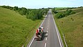 The A590 Dalton bypass - geograph.org.uk - 1954364.jpg 2,522 × 1,436; 2.73 MB
-
 The Farmer's Arms, Newton - geograph.org.uk - 6893693.jpg 1,024 × 768; 122 KB
-
 The Farmers Arms, Newton - geograph.org.uk - 6895393.jpg 1,024 × 768; 120 KB
-
 The Village Inn, Newton - geograph.org.uk - 6893683.jpg 1,024 × 815; 129 KB
-

-
 Tithe Barn Cottages - geograph.org.uk - 6893933.jpg 1,024 × 768; 165 KB
-
 Track to Killerwick Grange - geograph.org.uk - 6890645.jpg 800 × 600; 60 KB
-
 Ulverston 5 Miles - geograph.org.uk - 6890652.jpg 800 × 600; 110 KB
-
 Ulverston Road, Dalton-in-Furness - geograph.org.uk - 5853573.jpg 800 × 600; 119 KB
-
 Woodland beside the A590 - geograph.org.uk - 6890664.jpg 1,024 × 768; 240 KB


_-_geograph.org.uk_-_6297427.jpg)


