Category:DEM maps of France
Jump to navigation
Jump to search
Media in category "DEM maps of France"
The following 10 files are in this category, out of 10 total.
-
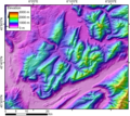
669px DEMBauges titrage.png 631 × 571; 675 KB
-
DEMBauges.png 1,858 × 1,664; 1.34 MB
-
DEMBornes.png 2,435 × 2,219; 1.81 MB
-
DEMChablais.png 2,876 × 1,805; 1.92 MB
-
DEMChartreuse.png 2,042 × 1,843; 1.08 MB
-
DEMValensole.png 2,081 × 2,826; 3.65 MB
-
DEMVercors.png 1,958 × 2,154; 1.91 MB
-
DEMVosges.png 1,876 × 2,234; 5.86 MB
-
Monts du Cantal Relief Map, SRTM-1.jpg 2,000 × 2,000; 3 MB
-
Plateau Grand-Ratz localisation.svg 960 × 860; 1.46 MB


