Category:DEM maps of Asia
Jump to navigation
Jump to search
Media in category "DEM maps of Asia"
The following 14 files are in this category, out of 14 total.
-
1944 map of Mindanao.jpg 14,350 × 11,204; 26.32 MB
-
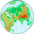
Afreurasia ortho 5layers.svg 903 × 903; 4.14 MB
-
Asia Elevation Zones (5485512129).jpg 2,390 × 3,174; 1,007 KB
-
DEM Baikal lake.png 3,337 × 2,385; 4.49 MB
-
DEM Mongolia.png 3,337 × 1,442; 7.82 MB
-
DEMTibet annotated.png 3,145 × 1,763; 6.77 MB
-
DEMTibet.png 3,145 × 1,763; 8.73 MB
-
Elevation Zones, Asia (7242987510).jpg 2,375 × 3,168; 1.38 MB
-
Jsc2000e02749 Lake Kuttara.jpg 3,000 × 3,000; 1.8 MB
-
Pakistan Khairabad digital elevation model by TanDEM-X (DLR).jpg 2,268 × 2,526; 2.28 MB
-
Yug-Color hillshades.jpg 1,980 × 773; 492 KB
-
Yug-Shadedrelief.tmp.tif 1,980 × 773; 1.46 MB
-
Yug-Trans.png 1,980 × 773; 1.6 MB
-
Yug-White hillsades.jpg 1,980 × 773; 505 KB


